Safety Score: 3,0 of 5.0 based on data from 9 authorites. Meaning we advice caution when travelling to United Kingdom.
Travel warnings are updated daily. Source: Travel Warning United Kingdom. Last Update: 2024-04-29 08:03:39
Explore Belaugh Village
Belaugh Village in Norfolk (England) is located in United Kingdom about 105 mi (or 169 km) north-east of London, the country's capital.
Local time in Belaugh Village is now 09:56 AM (Monday). The local timezone is named Europe / London with an UTC offset of one hour. We know of 9 airports in the wider vicinity of Belaugh Village, of which 3 are larger airports. The closest airport in United Kingdom is Norwich International Airport in a distance of 5 mi (or 8 km), South-West. Besides the airports, there are other travel options available (check left side).
There are several Unesco world heritage sites nearby. The closest heritage site in United Kingdom is Royal Botanic Gardens, Kew in a distance of 97 mi (or 156 km), South-West. Also, if you like golfing, there is an option about 7 mi (or 11 km). away. If you need a place to sleep, we compiled a list of available hotels close to the map centre further down the page.
Depending on your travel schedule, you might want to pay a visit to some of the following locations: Brundall, Surlingham, East Ruston, Norwich and Rockland Saint Mary. To further explore this place, just scroll down and browse the available info.
Local weather forecast
Todays Local Weather Conditions & Forecast: 14°C / 57 °F
| Morning Temperature | 4°C / 40 °F |
| Evening Temperature | 13°C / 55 °F |
| Night Temperature | 7°C / 45 °F |
| Chance of rainfall | 0% |
| Air Humidity | 60% |
| Air Pressure | 1015 hPa |
| Wind Speed | Fresh Breeze with 14 km/h (8 mph) from North |
| Cloud Conditions | Broken clouds, covering 72% of sky |
| General Conditions | Broken clouds |
Tuesday, 30th of April 2024
16°C (61 °F)
10°C (49 °F)
Light rain, moderate breeze, overcast clouds.
Wednesday, 1st of May 2024
15°C (59 °F)
10°C (50 °F)
Light rain, gentle breeze, overcast clouds.
Thursday, 2nd of May 2024
16°C (61 °F)
10°C (51 °F)
Light rain, moderate breeze, overcast clouds.
Hotels and Places to Stay
Norfolk Mead
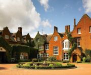
Sprowston Manor Marriott Hotel & Country Club
The William IV
Videos from this area
These are videos related to the place based on their proximity to this place.
TheCanoeMan on BBC Country Tracks - v4
TheCanoeMan - http://www.TheCanoeMan.com BBC Country Tracks - http://www.bbc.co.uk/programmes/b00ss1tp TheCanoeMan & Mr Darcy welcome Joe Crowley from BBC Country Tracks, canoeing ...
Coltishall April 1988
Ruth Church - Christopher Chris Church - Jill Larkman Church - Sinead Taylor - Suzanne Allsopp - Diane Freezer - Marie Shingfield - Jessica Chaney.
TheCanoeMan on BBC Country Tracks - v2
TheCanoeMan - http://www.TheCanoeMan.com BBC Country Tracks - http://www.bbc.co.uk/programmes/b00ss1tp TheCanoeMan & Mr Darcy welcome Joe Crowley from BBC Country Tracks, canoeing ...
Norfolk Broads
A four day boat trip around the Norfolk Broads. http://web.me.com/darrenrye/BroadlandAdventure/Blog/Blog.html.
How to & How not to pass Wroxham bridge.
Bank Holiday Monday 5th May 2014 The first two large boats, Fair Majesty is one, pass beautifully under Wroxham bridge, the third large one @0:49 Tropical Gem makes a big old mess and has to...
Barton House Railway.mp4
Barton House Railway, a great day for all the family. Little Steam, Diesel and Electric trains with authentic signalling and tablet working. The nerve centre is the original Honing signal box...
Heron at Daisy Broad Lodges in Wroxham, Norfolk
The setting of "Heron" - a holiday cottage at Daisy Broad Lodges in Wroxham, Norfolk. http://bit.ly/HeronDaisyBroadLodges.
Royalls Boatyard in Wroxham
Royalls Boatyard in Wroxham. Your starting point when taking a Norfolk Broads boating holiday with Royalls. http://bit.ly/RoyallsBoatyard.
Pilot takes a risk at Wroxham bridge!
The water level was really quite high as you'll see towards the end of the clip, the boat just about makes it through. Sitting in Wroxham watching the boats pass under the bridge, every now...
1 Intro to the Broads
General introduction to the Broads and boating holidays, including some traffic aerial video photography of the wonderful place which is the Broads.
Videos provided by Youtube are under the copyright of their owners.
Attractions and noteworthy things
Distances are based on the centre of the city/town and sightseeing location. This list contains brief abstracts about monuments, holiday activities, national parcs, museums, organisations and more from the area as well as interesting facts about the region itself. Where available, you'll find the corresponding homepage. Otherwise the related wikipedia article.
Wroxham Broad
Wroxham Broad is on the River Bure near the village of Wroxham in Norfolk, England within The Broads National Park. The broad has an area of 34.4 hectares and a mean depth of 1.3 metres. It lies to the west of the Bure, with two navigable openings between river and broad. The village and broad lie in an area of fairly intensive agriculture, with areas of wet woodland adjoining the broad and river. The broad is home to the Norfolk Broads Yacht Club.
Bure Valley Railway
The Bure Valley Railway is a 15 minimum gauge heritage railway in Norfolk, within The Broads National Park. The railway runs from Wroxham to Aylsham and is Norfolk's longest railway of less than standard gauge. It uses both steam and diesel locomotives. There are intermediate halts at Brampton, Buxton and Coltishall. There are 17 bridges, including a 105 ft long girder bridge over the River Bure in Buxton with Lammas as well as Aylsham Bypass Tunnel under the A140 at Aylsham.
Hoveton and Wroxham railway station
Hoveton and Wroxham is a railway station serving the town of Wroxham in the English county of Norfolk. The station is technically situated in the adjacent village of Hoveton, but the two settlements are usually regarded as one. The station is served by local services operated by Greater Anglia on the Bittern Line from Norwich to Cromer and Sheringham.
Wroxham F.C
Wroxham Football Club is an English football club based in the town of Wroxham, about four miles north-east of Norwich, in Norfolk. The club are currently members of the Isthmian League Division One North. They joined the league from the Anglian Combination in 1988 when it added a second division and were promoted to the Premier Division at the first attempt. Since then they have won the Premier Division on eight occasions and reached the FA Vase final, losing 6–1 to Whitley Bay in 2009–10.
Coltishall railway station
Coltishall railway station serves the town of Coltishall in Norfolk and is served by the
RAF Rackheath
Royal Air Force Station Rackheath or more simply RAF Rackheath is a former Royal Air Force station located 5 miles north east of Norwich, Norfolk, England.
Horstead with Stanninghall
Horstead with Stanninghall is a civil parish in the English county of Norfolk, consisting of the former parishes of Horstead and Stanninghall. It covers an area of 11.54 km and had a population of 1007 in 435 households as of the 2001 census. For the purposes of local government, it falls within the district of Broadland. There is a history of the parish, written by Percy Millican, bearing the descriptive title 'The History of Horstead and Stanninghall'.
Roys of Wroxham
Roys of Wroxham is a family owned group of general stores based in Hoveton, Norfolk in an area generally known as Wroxham. The store after winning a competition in the early 1930s uses the motto "The World's Largest Village Store" in all its advertising and literature


