Safety Score: 3,0 of 5.0 based on data from 9 authorites. Meaning we advice caution when travelling to United Kingdom.
Travel warnings are updated daily. Source: Travel Warning United Kingdom. Last Update: 2024-04-28 08:22:10
Touring Dilham
Dilham in Norfolk (England) is a town located in United Kingdom about 110 mi (or 177 km) north-east of London, the country's capital place.
Time in Dilham is now 04:51 PM (Sunday). The local timezone is named Europe / London with an UTC offset of one hour. We know of 9 airports nearby Dilham, of which 3 are larger airports. The closest airport in United Kingdom is Norwich International Airport in a distance of 10 mi (or 16 km), South-West. Besides the airports, there are other travel options available (check left side).
There are several Unesco world heritage sites nearby. The closest heritage site in United Kingdom is Saltaire in a distance of 101 mi (or 162 km), North-West. Also, if you like the game of golf, there is an option about 6 mi (or 9 km). away. Need some hints on where to stay? We compiled a list of available hotels close to the map centre further down the page.
Being here already, you might want to pay a visit to some of the following locations: East Ruston, Brundall, Surlingham, Rockland Saint Mary and Hellington. To further explore this place, just scroll down and browse the available info.
Local weather forecast
Todays Local Weather Conditions & Forecast: 10°C / 49 °F
| Morning Temperature | 10°C / 51 °F |
| Evening Temperature | 6°C / 43 °F |
| Night Temperature | 7°C / 44 °F |
| Chance of rainfall | 7% |
| Air Humidity | 86% |
| Air Pressure | 999 hPa |
| Wind Speed | Strong breeze with 20 km/h (13 mph) from North-East |
| Cloud Conditions | Overcast clouds, covering 99% of sky |
| General Conditions | Moderate rain |
Monday, 29th of April 2024
13°C (55 °F)
8°C (46 °F)
Broken clouds, fresh breeze.
Tuesday, 30th of April 2024
12°C (53 °F)
11°C (52 °F)
Light rain, fresh breeze, overcast clouds.
Wednesday, 1st of May 2024
14°C (56 °F)
11°C (51 °F)
Light rain, gentle breeze, overcast clouds.
Hotels and Places to Stay
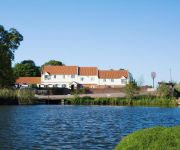
Wayford Bridge Hotel
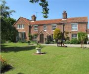
May Cottage B&B
Olde Hall
Beechwood Hotel & Restaurant
Videos from this area
These are videos related to the place based on their proximity to this place.
Round towered church of Beeston St. Lawrence, Norfolk
SEE MY TRAVEL PAGE ON FACEBOOK : https://www.facebook.com/motorhomefulltime According to the Round Tower Churches Society, there are 185 round tower churches in East Anglia : 126 in ...
Wroxham Barns United 2
For you #Archers fans, @bbcradio4 our pigs are looking to play "Tom Archers" pigs! Bring it on Bridge Farm, "Let's be havin you" Junior Farm All Stars!
A piglet wearing socks and a runaway pony?
So I'm filming a piglet that looks like it's wearing socks and an escaped pony speeds past, followed by a slightly concerned keeper... Junior Farm Wroxham Barns.
Let's play! The Dark Secret - Part13. The Hospital
Download: http://www.moddb.com/members/the-dark-secret-mods/downloads/the-dark-secret-part-one Tds 1 Time / Date: 2002 (Half Life 1 mod) Thank you for watching...
Let's play! The Dark Secret - Part15. Underneath
Download: http://www.moddb.com/members/the-dark-secret-mods/downloads/the-dark-secret-part-one Tds 1 Time / Date: 2002 (Half Life 1 mod) Thank you for watching...
Let's play! The Dark Secret - Part11. Mountain Hallways
And to not get stuck in the floor. Download this SAVE file. http://www.moddb.com/mods/the-dark-secret-1-2-3/downloads/load-ds30bsp Sorry for the delay. Download: ...
Let's play! The Dark Secret II - Part8. Room D AL 101
Part8 of The Dark Secret 2. Download: http://www.moddb.com/members/the-dark-secret-mods/downloads/the-dark-secret-part-2 Tds 2 Time / Date: 2003 (Half Life 1 mod) Thank you for watching...
Let's play! The Dark Secret - Part2. Tesley House
Download: http://www.moddb.com/members/the-dark-secret-mods/downloads/the-dark-secret-part-one Tds 1 Time / Date: 2002 (Half Life 1 mod) Thank you for watching...
Videos provided by Youtube are under the copyright of their owners.
Attractions and noteworthy things
Distances are based on the centre of the city/town and sightseeing location. This list contains brief abstracts about monuments, holiday activities, national parcs, museums, organisations and more from the area as well as interesting facts about the region itself. Where available, you'll find the corresponding homepage. Otherwise the related wikipedia article.
Barton Broad
Barton Broad lies within The Broads in Norfolk, the United Kingdom. The broad is situated to the south and east of the village of Barton Turf, and is within the parish of Barton Turf. It is, after Hickling Broad, the second largest broad, and a nature reserve in the care of the Norfolk Wildlife Trust. It is reputed that Horatio Nelson learnt to sail here. Among other users are the Sailing Club of Gresham's School.
Ant Broads & Marshes NNR
Ant Broads & Marshes NNR is a National Nature Reserve in Norfolk, England established by English Nature. It is named after the River Ant. It is part of the "Ant Broads and Marshes" Site of Special Scientific Interest and is within The Broads National Park. The NNR includes: Barton Broad and Catfield Fen, owned and managed by Norfolk Wildlife Trust Catfield Fen Reserve, owned and managed by the British Butterfly Conservation Society.
North Walsham & Dilham Canal
The North Walsham and Dilham Canal is a waterway in the English county of Norfolk. It is accepted officially that this waterway is the only canal in Norfolk although it is the canalization of the upper reaches of the River Ant. This navigation was constructed with locks a little wider than most canals in the UK to accommodate the use of the Norfolk wherries. It is 8.7 miles long and runs from Swafield Bridge to a junction with the River Ant at Smallburgh.
Honing railway station
Honing railway station was a station in Norfolk, England, serving the small village of Honing. It was on the Midland and Great Northern Joint Railway between Melton Constable and Great Yarmouth. It closed along with the rest of the line in 1959. Today, the two platforms and remains of the waiting room and its cellar, complete with two fireplaces, are covered in overgrowth. There are also remains of the station building foundations, the signal box, and a hand water pump inside a small shed.


