Safety Score: 3,0 of 5.0 based on data from 9 authorites. Meaning we advice caution when travelling to United Kingdom.
Travel warnings are updated daily. Source: Travel Warning United Kingdom. Last Update: 2024-04-30 08:30:35
Discover Tuttington
Tuttington in Norfolk (England) is a city in United Kingdom about 108 mi (or 173 km) north-east of London, the country's capital city.
Local time in Tuttington is now 08:40 PM (Tuesday). The local timezone is named Europe / London with an UTC offset of one hour. We know of 10 airports in the vicinity of Tuttington, of which 4 are larger airports. The closest airport in United Kingdom is Norwich International Airport in a distance of 8 mi (or 14 km), South. Besides the airports, there are other travel options available (check left side).
There are several Unesco world heritage sites nearby. The closest heritage site in United Kingdom is Saltaire in a distance of 95 mi (or 153 km), North-West. Also, if you like golfing, there is an option about 12 mi (or 19 km). away. Looking for a place to stay? we compiled a list of available hotels close to the map centre further down the page.
When in this area, you might want to pay a visit to some of the following locations: Norwich, East Ruston, Brundall, Surlingham and Rockland Saint Mary. To further explore this place, just scroll down and browse the available info.
Local weather forecast
Todays Local Weather Conditions & Forecast: 17°C / 63 °F
| Morning Temperature | 9°C / 48 °F |
| Evening Temperature | 12°C / 54 °F |
| Night Temperature | 11°C / 52 °F |
| Chance of rainfall | 0% |
| Air Humidity | 69% |
| Air Pressure | 1013 hPa |
| Wind Speed | Moderate breeze with 11 km/h (7 mph) from North-West |
| Cloud Conditions | Overcast clouds, covering 87% of sky |
| General Conditions | Light rain |
Wednesday, 1st of May 2024
11°C (52 °F)
9°C (49 °F)
Moderate rain, moderate breeze, overcast clouds.
Thursday, 2nd of May 2024
11°C (51 °F)
10°C (51 °F)
Light rain, fresh breeze, overcast clouds.
Friday, 3rd of May 2024
12°C (53 °F)
11°C (51 °F)
Light rain, moderate breeze, overcast clouds.
Hotels and Places to Stay
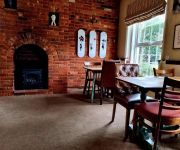
The Plough Inn
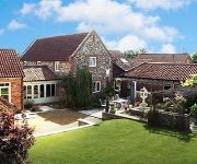
Woodman's Farm
Norfolk Mead
The Marsham Arms Inn
Beechwood Hotel & Restaurant
Videos from this area
These are videos related to the place based on their proximity to this place.
SEPECAT Jaguar Flight from RAF Coltishall
I was lucky enough to have a go in the back of a Jaguar T4. Footage covers taxi, take off, some low level and above cloud flying before I had to put the camera away to have a fly!
Wroxham Bridge West to East 2009
Starting the return journey from Wroxham on my second tour out. First was through Great Yarmouth to Norwich, second to Horning and Wroxham.
Cllr Michael Baker at UKIP's Clean up North Norfolk day in North Walsham
Services are under pressure in North Norfolk and the Pro-Euro Lib Dems insist that they want to continue to pay £106000 every minute of every day - the cost of UK membership of the European...
vintage and classic motorcycles museum walk through
a look around unrestored motorcycles vintage and classic in north walsham museum...lighting was not good and the bikes were crammed in tight ...but it was interesting.
Food industry
Brays Cottage are based in North Norfolk and make pork pies in a converted flint barn, over looking the sea premium. See why they love Kashflow for managing their business.
Bure Valley Railway - A Trip On BEVER 3
went to the Bure Valley Railway recently and managed to get a footplate ride on BEVER 3 the desil hydrolic. Sorry for the bad video qulity it was taken on my iphone rather than my camera.
Cab view of the Bure Valley
See the journey from Wroxham to Aylsham as seen from "Spitfire", locomotive No.7.
Videos provided by Youtube are under the copyright of their owners.
Attractions and noteworthy things
Distances are based on the centre of the city/town and sightseeing location. This list contains brief abstracts about monuments, holiday activities, national parcs, museums, organisations and more from the area as well as interesting facts about the region itself. Where available, you'll find the corresponding homepage. Otherwise the related wikipedia article.
Bure Valley Path
The Bure Valley Path is a 9-mile long walking trail and cycling trail in Norfolk, England. It runs alongside the Bure Valley Railway, a heritage railway from Wroxham to Aylsham.
Aylsham Bypass Tunnel
The Aylsham Bypass Tunnel is the only railway tunnel in Norfolk, England currently open to trains. It carries the narrow gauge Bure Valley Railway under the Aylsham Bypass. The former Norfolk & Suffolk Joint Railway's Cromer Tunnel at Cromer is disused. The original East Norfolk Railway crossed the road by means of a level crossing but the combination of heavy traffic and small steam trains is not encouraged in modern transport policies.
Buxton railway station, Norfolk
Buxton railway station serves the village of Buxton in Norfolk and is served by the Bure Valley Railway. It is remarkable because it is one of the first stations on the Bure Valley Railway to have wireless internet access.
Aylsham North railway station
This article is about the former Midland and Great Northern Joint Railway station. For the Bure Valley Railway station see Aylsham South railway station. Aylsham North railway station was a station in Aylsham, Norfolk on the Midland and Great Northern Joint Railway line from the Midlands to the Norfolk Coast. It was closed in 1959 along with the rest of the line. It was demolished following the closure, and is now a car park for the Weavers Way footpath.
Felmingham railway station
Felmingham railway station is a former railway station in Norfolk, England. It was closed in 1959. It served the village of Felmingham. Former Services Preceding station Disused railways Following station Aylsham North Midland and Great Northern North Walsham Town
Buxton Lamas railway station
Buxton Lamas was a railway station in Buxton with Lammas, Norfolk. It was located near the Bure Valley Railway's present Buxton station. Preceding station Disused railways Following station Aylsham South Great Eastern Railway Coltishall
Oxnead
Oxnead is a lost settlement in Norfolk, England, roughly three miles south-east of Aylsham. It now consists mostly of St Michael’s Church and Oxnead Hall. It was the principal residence of the Paston family from 1597 until the death of William Paston, 2nd Earl of Yarmouth in 1732. Under Sir William Paston (1610–1663), Oxnead was the site of several works by the architect and sculptor, Nicholas Stone, master-mason to Kings James I and Charles I.
List of United Kingdom locations: Dr


