Safety Score: 3,0 of 5.0 based on data from 9 authorites. Meaning we advice caution when travelling to United Kingdom.
Travel warnings are updated daily. Source: Travel Warning United Kingdom. Last Update: 2024-05-10 08:04:54
Delve into Braceborough
Braceborough in Lincolnshire (England) is a town located in United Kingdom about 84 mi (or 135 km) north of London, the country's capital town.
Time in Braceborough is now 04:18 AM (Saturday). The local timezone is named Europe / London with an UTC offset of one hour. We know of 13 airports closer to Braceborough, of which 5 are larger airports. The closest airport in United Kingdom is RAF Cottesmore in a distance of 10 mi (or 17 km), West. Besides the airports, there are other travel options available (check left side).
There are several Unesco world heritage sites nearby. The closest heritage site in United Kingdom is Derwent Valley Mills in a distance of 23 mi (or 37 km), North. Also, if you like the game of golf, there are some options within driving distance. In need of a room? We compiled a list of available hotels close to the map centre further down the page.
Since you are here already, you might want to pay a visit to some of the following locations: Essendine, Ryhall, Barnack, Ufford and Helpston. To further explore this place, just scroll down and browse the available info.
Local weather forecast
Todays Local Weather Conditions & Forecast: 18°C / 65 °F
| Morning Temperature | 10°C / 50 °F |
| Evening Temperature | 19°C / 66 °F |
| Night Temperature | 11°C / 52 °F |
| Chance of rainfall | 0% |
| Air Humidity | 72% |
| Air Pressure | 1022 hPa |
| Wind Speed | Gentle Breeze with 7 km/h (4 mph) from North-West |
| Cloud Conditions | Overcast clouds, covering 97% of sky |
| General Conditions | Light rain |
Sunday, 12th of May 2024
20°C (69 °F)
15°C (59 °F)
Light rain, moderate breeze, overcast clouds.
Monday, 13th of May 2024
17°C (63 °F)
12°C (54 °F)
Light rain, moderate breeze, broken clouds.
Tuesday, 14th of May 2024
13°C (55 °F)
10°C (50 °F)
Light rain, moderate breeze, broken clouds.
Hotels and Places to Stay
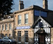
William Cecil
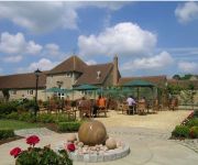
Toft Country House Hotel
Videos from this area
These are videos related to the place based on their proximity to this place.
Radian Pro over Thurlby Lincs UK
Flying the Radian Pro over the lovely village of Thurlby UK. On the ground is me, my bro, my mate Ceri and my lil nephew Samuel. Peace and Love xxx p.s spelling correction in title - Lawrance Park.
Toft Golf club2011 PEARS CHAMPIONSHIP
Toft Hotel Golf and Country Club Winners of the annual matchplay summerpears with their wonderful Trophy The Trophy was given to the Club by Mrs Clare Farrel...
Eddie Stobarts Georgia Grace. Good Overtake A15 Thurlby.wmv
Driver of Georgia Grace showing how the driver of my last video how it should be done. Emailed Stobarts to say thanks! Credit where it is due!
Time-lapse sunset
A time-lapse of the sun setting over fields near Wood Lane, Thurlby. Filmed on a mobile phone using software from: http://www.andysoftware.co.uk A still imag...
MG PA struggling up Toft Hill
MG PA originally had 36 hp at max rpm. Quite a few have escaped over the years and with no fan or water pump going over 4000rpm for any time leads to a very hot engine so getting up this hill...
Time-lapse driving, Thurlby to Stamford
Driving from Thurlby to Stamford filmed using time-lapse software I wrote for mobile phones. Available to download and use for free from http://www.andysoftware.co.uk.
Hauck Malibu All-in-One Travel System - Demonstration | BabySecurity
http://www.babysecurity.co.uk http://www.babysecurity.co.uk/hauck-malibu-all-in-one-travel-system.html Hauck Malibu All in One -- Pushchair, Carrycot and Car Seat Travel System is the perfect...
Hauck Baby Center Travel Cot - How To Fold and Build | BabySecurity
http://www.babysecurity.co.uk http://www.babysecurity.co.uk/hauck-babycentre-classic-mickey.html The Baby Centre is the perfect companion for any parent whilst travelling on holiday or simply...
Liquid Force Super Trip Wakeboard Review 2013
Liquid Force Super Trip Wakeboard Review 2013 http://www.tallingtonlakesproshop.com/liquid-force-super-trip-grind-wakeboard-2013.ir?
Hauck Dream and Play Travel Cot - How To Fold | BabySecurity
http://www.babysecurity.co.uk http://www.babysecurity.co.uk/strollers-travel/travel-cots-carry-cots/where/manufacturer/hauck-for-kids.html Off to visit friends with your baby or just a bit...
Videos provided by Youtube are under the copyright of their owners.
Attractions and noteworthy things
Distances are based on the centre of the city/town and sightseeing location. This list contains brief abstracts about monuments, holiday activities, national parcs, museums, organisations and more from the area as well as interesting facts about the region itself. Where available, you'll find the corresponding homepage. Otherwise the related wikipedia article.
King Street (Roman road)
King Street is the name of a modern road on the line of a Roman road. It runs on a straight course in eastern England, between the City of Peterborough and South Kesteven in Lincolnshire. This English name has long been applied to the part which is still in use and which lies between Ailsworth Heath, in the south and Kate's Bridge, in the north. The old road continued to Bourne thence north-westwards to join Ermine Street south of Ancaster. This part of Ermine Street is called High Dike.
Barholm and Stowe
Barholm and Stowe is a civil parish in the South Kesteven district of Lincolnshire, England. According to the 2001 census it had a population of 87. The parish covers the village of Barholm and the Stowe hamlet.
Uffington Rural District
Uffington was a rural district in Lincolnshire, Parts of Kesteven from 1894 to 1931. It was created in 1894 from that part of the Stamford rural sanitary district which was in Kesteven. It covered the following parishes Barholm Braceborough Greatford Stowe Tallington Uffington West Deeping Wilsthorpe It was abolished by a County Review Order in 1931, and went to form part of the South Kesteven Rural District.
Bowthorpe Oak
The Bowthorpe Oak in Bourne, Lincolnshire, England is perhaps England's oldest oak tree with an estimated age of over 1,000 years. The hollow interior has been fitted with seats and has apparently been used as a dining room for 20 people in the past, although it is now home to sheep and chickens. The tree can be found on Bowthorpe Park Farm and visitors are welcome throughout the year.
Thurlby railway station
Thurlby railway station was a station in Thurlby by Bourne, Lincolnshire on the Great Northern Railway between Essendine and Bourne. It was closed in 1951.
Braceborough Spa Halt railway station
Braceborough Spa railway station was a station in Braceborough Spa, Lincolnshire on the Great Northern Railway between Essendine and Bourne. It was closed in 1951, along with the rest of the line.
Tallington railway station
Tallington railway station was a station in Tallington, Lincolnshire on the Great Northern Railway between Grantham and Peterborough. It was closed in 1959, however the former goods yard is still open and is used by the Dow-Mac works at Tallington for delivery of concrete beams, bridge supports, sleepers, etc. by rail. Preceding station Historical railways Following station Peterborough North Great Northern Railway Essendine


