Safety Score: 3,0 of 5.0 based on data from 9 authorites. Meaning we advice caution when travelling to United Kingdom.
Travel warnings are updated daily. Source: Travel Warning United Kingdom. Last Update: 2024-04-28 08:22:10
Discover Carlby
Carlby in Lincolnshire (England) with it's 542 citizens is a town in United Kingdom about 84 mi (or 136 km) north of London, the country's capital city.
Current time in Carlby is now 09:27 PM (Sunday). The local timezone is named Europe / London with an UTC offset of one hour. We know of 13 airports near Carlby, of which 5 are larger airports. The closest airport in United Kingdom is RAF Cottesmore in a distance of 9 mi (or 14 km), West. Besides the airports, there are other travel options available (check left side).
There are several Unesco world heritage sites nearby. The closest heritage site in United Kingdom is Derwent Valley Mills in a distance of 22 mi (or 35 km), North. Also, if you like playing golf, there are a few options in driving distance. Looking for a place to stay? we compiled a list of available hotels close to the map centre further down the page.
When in this area, you might want to pay a visit to some of the following locations: Essendine, Ryhall, Pickworth, Barnack and Tinwell. To further explore this place, just scroll down and browse the available info.
Local weather forecast
Todays Local Weather Conditions & Forecast: 6°C / 43 °F
| Morning Temperature | 6°C / 43 °F |
| Evening Temperature | 9°C / 49 °F |
| Night Temperature | 4°C / 39 °F |
| Chance of rainfall | 21% |
| Air Humidity | 92% |
| Air Pressure | 1002 hPa |
| Wind Speed | Fresh Breeze with 16 km/h (10 mph) from South-East |
| Cloud Conditions | Overcast clouds, covering 100% of sky |
| General Conditions | Moderate rain |
Monday, 29th of April 2024
12°C (54 °F)
9°C (48 °F)
Overcast clouds, fresh breeze.
Tuesday, 30th of April 2024
13°C (55 °F)
8°C (47 °F)
Light rain, moderate breeze, broken clouds.
Wednesday, 1st of May 2024
16°C (60 °F)
11°C (51 °F)
Light rain, gentle breeze, overcast clouds.
Hotels and Places to Stay
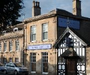
William Cecil
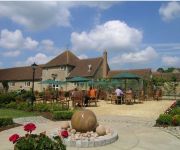
Toft Country House Hotel
Videos from this area
These are videos related to the place based on their proximity to this place.
Totrax of Boston badger an old couple
Totrax truck reg FP07ZRD ruining an old couples day and gives White Van Man a bad name. Imagine this, a beautiful sunny day, an old fella and his wife, could be your mum and dad or mine; decide...
Toft Golf club2011 PEARS CHAMPIONSHIP
Toft Hotel Golf and Country Club Winners of the annual matchplay summerpears with their wonderful Trophy The Trophy was given to the Club by Mrs Clare Farrel...
Time-lapse sunset
A time-lapse of the sun setting over fields near Wood Lane, Thurlby. Filmed on a mobile phone using software from: http://www.andysoftware.co.uk A still imag...
MG PA struggling up Toft Hill
MG PA originally had 36 hp at max rpm. Quite a few have escaped over the years and with no fan or water pump going over 4000rpm for any time leads to a very hot engine so getting up this hill...
BOXING DAY MEET circa 1958
BOXING DAY MEET Stamford, Lincolnshire, UK. Circa 1958 Large crowds turn out to watch as the Burghley Hunt meet outside the Central Cinema and ride off towar...
Caterpillar Fifty Ploughing & Allis Chalmers with Discs at Little Casterton
Caterpillar Fifty ploughing and Allis Chalmers Discing at Little Casterton Working Weekend 20/9/09.
Case DC4 & Case Binder at Little Casterton
Case DC4 & Case Binder at Little Casterton Working Weekend 20/9/09.
Moline Universal Model D at Little Casterton
Moline Universal Model D at Little Casterton Working Weekend 20/9/09.
Videos provided by Youtube are under the copyright of their owners.
Attractions and noteworthy things
Distances are based on the centre of the city/town and sightseeing location. This list contains brief abstracts about monuments, holiday activities, national parcs, museums, organisations and more from the area as well as interesting facts about the region itself. Where available, you'll find the corresponding homepage. Otherwise the related wikipedia article.
Bourne Rural District
Bourne was a rural district in Lincolnshire, Parts of Kesteven from 1894 to 1931. It was created by the Local Government Act 1894 based on the Bourne rural sanitary district. In 1931, under a County Review Order, it was abolished, with its area going to form part of the new South Kesteven Rural District.
Carlby
Carlby is a small village/parish in the district of South Kesteven in Lincolnshire, England. It is located four miles south of Bourne on the A6121 near the Lincolnshire/Rutland boundary, which is partly the River West Glen. The ecclesiastical parish is Ryhall with Essendine and Carlby, part of the Rutland Deanery of the Diocese of Peterborough. The incumbent is The Revd Patrick McKee. The parish church is dedicated to St. Stephen. The current building dates to 1734.
Bowthorpe Oak
The Bowthorpe Oak in Bourne, Lincolnshire, England is perhaps England's oldest oak tree with an estimated age of over 1,000 years. The hollow interior has been fitted with seats and has apparently been used as a dining room for 20 people in the past, although it is now home to sheep and chickens. The tree can be found on Bowthorpe Park Farm and visitors are welcome throughout the year.
Careby Aunby and Holywell
Careby Aunby and Holywell is a civil parish in the district of South Kesteven, south-west Lincolnshire, in England. It stretches from the county border with Rutland in the west to the River West Glen in the east. The B1176 road from Corby Glen passes through Careby and on past Aunby toward Stamford. The centre of the parish is near grid reference TF017157 The total population in the 2001 census was 146. The population in 1801 was 65, and had risen to 133 by 1911
Braceborough Spa Halt railway station
Braceborough Spa railway station was a station in Braceborough Spa, Lincolnshire on the Great Northern Railway between Essendine and Bourne. It was closed in 1951, along with the rest of the line.
Careby
Careby is the principal village in the a civil parish of Careby Aunby and Holywell in the South Kesteven district of South Kesteven, Lincolnshire, England. The River West Glen flows through the parish, near Careby, forming part of the parish boundary. The name derives from the Old Scandinavian Kariby or "village of a man named Kari," and first appears in 1199 as Careby. The placename suffix, "by", is immensely common in this part of the country, being part of the Danelaw.
Ryhall railway station
Ryhall & Belmesthorpe railway station (originally Ryhall & Belmisthorpe) was a station in Belmesthorpe and about half a mile from Ryhall, both in Rutland. It was the only intermediate station on the Great Northern Railway single track line between Stamford and Essendine. It was sited south of a level crossing at the west end of the village. The goods yard was to the north of the level crossing.
Essendine railway station
Essendine railway station was a station in Essendine, Rutland. It was situated on the East Coast Main Line of the Great Northern Railway.


