Safety Score: 3,0 of 5.0 based on data from 9 authorites. Meaning we advice caution when travelling to United Kingdom.
Travel warnings are updated daily. Source: Travel Warning United Kingdom. Last Update: 2024-04-27 08:23:39
Explore Westcliffe
Westcliffe in Kent (England) is located in United Kingdom about 69 mi (or 110 km) east of London, the country's capital.
Local time in Westcliffe is now 10:09 PM (Saturday). The local timezone is named Europe / London with an UTC offset of one hour. We know of 11 airports in the wider vicinity of Westcliffe, of which 3 are larger airports. The closest airport in United Kingdom is Kent International Airport in a distance of 13 mi (or 21 km), North. Besides the airports, there are other travel options available (check left side).
There are several Unesco world heritage sites nearby. The closest heritage site in United Kingdom is Canterbury Cathedral, St Augustine's Abbey, and St Martin's Church in a distance of 15 mi (or 24 km), North-West. Also, if you like golfing, there are multiple options in driving distance. If you need a place to sleep, we compiled a list of available hotels close to the map centre further down the page.
Depending on your travel schedule, you might want to pay a visit to some of the following locations: Ashford, Boulogne-sur-Mer, Calais, Southend-on-Sea and Upper Stoke. To further explore this place, just scroll down and browse the available info.
Local weather forecast
Todays Local Weather Conditions & Forecast: 13°C / 55 °F
| Morning Temperature | 8°C / 47 °F |
| Evening Temperature | 11°C / 52 °F |
| Night Temperature | 11°C / 51 °F |
| Chance of rainfall | 15% |
| Air Humidity | 92% |
| Air Pressure | 1004 hPa |
| Wind Speed | Moderate breeze with 11 km/h (7 mph) from West |
| Cloud Conditions | Overcast clouds, covering 98% of sky |
| General Conditions | Moderate rain |
Sunday, 28th of April 2024
10°C (50 °F)
8°C (46 °F)
Light rain, strong breeze, overcast clouds.
Monday, 29th of April 2024
11°C (52 °F)
9°C (49 °F)
Sky is clear, moderate breeze, clear sky.
Tuesday, 30th of April 2024
13°C (56 °F)
10°C (50 °F)
Light rain, moderate breeze, overcast clouds.
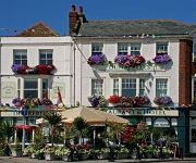
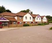
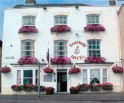
Hotels and Places to Stay
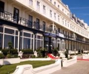
Best Western Plus Dover Marina Hotel & Spa
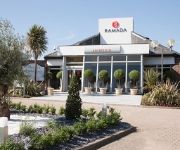
Ramada Dover
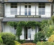
Loddington House Hotel
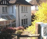
Heathers Woodlands
Crabble Hill House
The Kings Head & Channel View
Dunkerley's Restaurant and Hotel
Dover East
Waterfront Hotel
Dover (Eastern Ferry Terminal)
Videos from this area
These are videos related to the place based on their proximity to this place.
Tour of the lifts at Dover Eastern Docks
Nova lifts at dover eastern docks http://benobve.110mb.com.
Last Trains Out of Dover Marine
In July 1993 the last trains to use the Marine Station at Dover were video'd. The station was for the use of foot passengers, including the prestigious "Golden Arrow" boat train passengers,...
111 - United Kingdom. England. Dover - Ferry Exit [HD]
Wielka Brytania. Dover. Zjazd z promu P&O i wyjazd z portu /// GPS - http://gdziejestem.pl/user/SZWAGIER.
A Drive From Canterbury Along The A2 To Dover Docks Kent England
A drive from Canterbury along the A2 finishing at Dover Eastern Docks.
Tour of the Pride of dover boat
Tour of the lifts and rest of the boat on the "Pride of Dover" P&O ferry. (dover - calais) This boat has 2 wonderfull old Lutz lifts. This boat is going to be scrapped soon. http://benobve.11...
Dover Flight with the DJI inspire one
Dji inspire one flight over the white cliffs of dover. Wind 25/30mph Clowdy after a nice suny day. Location close to the Light house.
Wyjazd z Promu P&O w Dover - Exit from the P&O Ferry in Dover
Dla wszystkich pasjonatów ciężarówek, pokazany wyjazd z promu po angielskiej stronie. Wybaczcie za słabą jakość filmu, kręcone telefonem z ręki.
Driving on Norfolk Line ferry, Dover
Driving on the Norfolkline ferry in Dover and driving off in Dunkerque.
Videos provided by Youtube are under the copyright of their owners.
Attractions and noteworthy things
Distances are based on the centre of the city/town and sightseeing location. This list contains brief abstracts about monuments, holiday activities, national parcs, museums, organisations and more from the area as well as interesting facts about the region itself. Where available, you'll find the corresponding homepage. Otherwise the related wikipedia article.
White Cliffs of Dover
The White Cliffs of Dover are cliffs which form part of the English coastline facing the Strait of Dover and France. The cliffs are part of the North Downs formation. The cliff face, which reaches up to 350 feet, owes its striking façade to its composition of chalk accentuated by streaks of black flint. The cliffs spread east and west from the town of Dover in the county of Kent, an ancient and still important English port.
Martin Mill railway station
Martin Mill railway station serves Martin Mill in Kent. The station and all trains serving it are operated by Southeastern.
South Foreland
South Foreland is a chalk headland on the Kent coast of southeast England. It presents a bold cliff to the sea, and commands views over the Strait of Dover. It is 3 miles northeast of Dover and 15 miles south of North Foreland. It is the closest point on the British mainland to the European continent at a distance of only 21 miles . This proximity gives it military significance and during World War II a coastal battery was sited on the headland along with a radar station.
South Foreland Lighthouse
South Foreland Lighthouse is a Victorian lighthouse on the South Foreland in St. Margaret's Bay, Dover, Kent, England, used to warn ships approaching the nearby Goodwin Sands. It went out of service in 1988 and is currently owned by the National Trust. A lighthouse had previously stood on the site since at least 1730 and during most of this time it was manned by the Knott family (lighthouse keepers). South Foreland was the first lighthouse to use an electric light.
Preußen (ship)
The Preußen (usually Preussen in English) was a German steel-hulled five-masted ship-rigged windjammer built in 1902 for the F. Laeisz shipping company and named after the German state and kingdom of Prussia. It was the only ship of this class with five masts carrying six sails on each mast within the world merchant fleet. Until the 2000 launch of the Royal Clipper, a sail cruise liner, she was the only five-masted full-rigged ship ever built.
Langdon Bay, Kent
Langdon Bay is a bay in east Kent, England. It is two miles east of the town of Dover, and is named after the nearby villages of Langdon, East Langdon and West Langdon. The cliffs around it are known as the Langdon Cliffs, there is a prominent zig-zag path that leads from the cliff top to the beach, this is visible from the sea.
Swingate Mill, Guston
Swingate Mill is a Grade II listed tower mill in Guston, Kent, England that was built in 1849.
St Margaret's Bay Windmill
St Margarets Bay Windmill is a Grade II listed Smock mill on South Foreland, the southeasternmost point of England. It was built in 1929 to generate electricity for the attached house, high on the White Cliffs of Dover.






!['111 - United Kingdom. England. Dover - Ferry Exit [HD]' preview picture of video '111 - United Kingdom. England. Dover - Ferry Exit [HD]'](https://img.youtube.com/vi/fOUzvbeHM-I/mqdefault.jpg)


