Safety Score: 3,0 of 5.0 based on data from 9 authorites. Meaning we advice caution when travelling to United Kingdom.
Travel warnings are updated daily. Source: Travel Warning United Kingdom. Last Update: 2024-04-27 08:23:39
Delve into Swingate
Swingate in Kent (England) is located in United Kingdom about 68 mi (or 110 km) east of London, the country's capital town.
Current time in Swingate is now 05:32 AM (Sunday). The local timezone is named Europe / London with an UTC offset of one hour. We know of 12 airports close to Swingate, of which 4 are larger airports. The closest airport in United Kingdom is Kent International Airport in a distance of 14 mi (or 22 km), North. Besides the airports, there are other travel options available (check left side).
There are several Unesco world heritage sites nearby. The closest heritage site in United Kingdom is Canterbury Cathedral, St Augustine's Abbey, and St Martin's Church in a distance of 14 mi (or 23 km), North-West. Also, if you like playing golf, there are some options within driving distance. If you need a hotel, we compiled a list of available hotels close to the map centre further down the page.
While being here, you might want to pay a visit to some of the following locations: Ashford, Boulogne-sur-Mer, Calais, Southend-on-Sea and Upper Stoke. To further explore this place, just scroll down and browse the available info.
Local weather forecast
Todays Local Weather Conditions & Forecast: 10°C / 50 °F
| Morning Temperature | 10°C / 49 °F |
| Evening Temperature | 9°C / 47 °F |
| Night Temperature | 8°C / 46 °F |
| Chance of rainfall | 0% |
| Air Humidity | 80% |
| Air Pressure | 1005 hPa |
| Wind Speed | Strong breeze with 22 km/h (14 mph) from North-East |
| Cloud Conditions | Overcast clouds, covering 89% of sky |
| General Conditions | Light rain |
Monday, 29th of April 2024
11°C (52 °F)
9°C (49 °F)
Sky is clear, moderate breeze, clear sky.
Tuesday, 30th of April 2024
13°C (56 °F)
10°C (50 °F)
Light rain, moderate breeze, overcast clouds.
Wednesday, 1st of May 2024
14°C (57 °F)
12°C (53 °F)
Overcast clouds, gentle breeze.
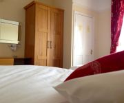
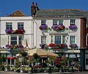
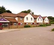
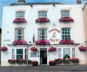
Hotels and Places to Stay
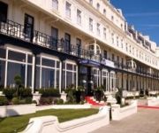
Best Western Plus Dover Marina Hotel & Spa
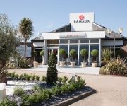
Ramada Dover
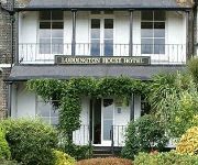
Loddington House Hotel
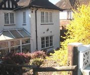
Heathers Woodlands
Crabble Hill House
The Kings Head & Channel View
Dunkerley's Restaurant and Hotel
Dover East
Dover (A20)
Waterfront Hotel
Videos from this area
These are videos related to the place based on their proximity to this place.
Tour of the lifts at Dover Eastern Docks
Nova lifts at dover eastern docks http://benobve.110mb.com.
Last Trains Out of Dover Marine
In July 1993 the last trains to use the Marine Station at Dover were video'd. The station was for the use of foot passengers, including the prestigious "Golden Arrow" boat train passengers,...
111 - United Kingdom. England. Dover - Ferry Exit [HD]
Wielka Brytania. Dover. Zjazd z promu P&O i wyjazd z portu /// GPS - http://gdziejestem.pl/user/SZWAGIER.
Embarquement sur le Ferry à Dover
Arrivée au port de Dover, passages des douanes et embarquement en voiture sur le ferry DFDS au terminal de Dover Arriving at Dover Ferry Terminal, driving trough customs and boarding in the...
A Drive From Canterbury Along The A2 To Dover Docks Kent England
A drive from Canterbury along the A2 finishing at Dover Eastern Docks.
Tour of the Pride of dover boat
Tour of the lifts and rest of the boat on the "Pride of Dover" P&O ferry. (dover - calais) This boat has 2 wonderfull old Lutz lifts. This boat is going to be scrapped soon. http://benobve.11...
Dover Flight with the DJI inspire one
Dji inspire one flight over the white cliffs of dover. Wind 25/30mph Clowdy after a nice suny day. Location close to the Light house.
Videos provided by Youtube are under the copyright of their owners.
Attractions and noteworthy things
Distances are based on the centre of the city/town and sightseeing location. This list contains brief abstracts about monuments, holiday activities, national parcs, museums, organisations and more from the area as well as interesting facts about the region itself. Where available, you'll find the corresponding homepage. Otherwise the related wikipedia article.
Louis Blériot
Louis Charles Joseph Blériot (1 July 1872 – 1 August 1936) was a French aviator, inventor and engineer. He developed the first practical headlamp for cars and established a profitable business manufacturing them, using much of the money he made to finance his attempts to build a successful aircraft. In 1909 he became world famous for making the first flight across the English Channel in a heavier than air aircraft, winning the prize of £1,000 offered by the Daily Mail newspaper.
Duke of York's Royal Military School
The Duke of York’s Royal Military School, more commonly called the Duke of York’s, is a co-educational Academy with military traditions in Dover, Kent, open to pupils whose parents are serving or have served in any branch of the United Kingdom armed forces for a minimum of 4 years. The school was until September 2010 a military boarding secondary school and an executive agency of the Ministry of Defence (MOD).
Fort Burgoyne
Fort Burgoyne, originally known as Castle Hill Fort, was built in the 1860s as one of the Palmerston forts around Dover in southeast England. It was built to a polygonal system with detached eastern and western redoubts, to guard the high ground northeast of the strategic port of Dover, just north of Dover Castle. The fort is named after the 19th century General John Fox Burgoyne, Inspector-General of Fortifications and son of the John Burgoyne who fought in the American Revolutionary War.
Swingate transmitting station
The Swingate transmitting station is a facility for FM-transmission in the village of Swingate, near Dover, Kent. For many years there were three lattice towers with a height of 111 metres . This station was one of the first 5 Chain Home Radar stations completed in 1936 and was originally designated AMES 04 Dover. The FM transmitting antennas are attached to what was the middle tower; microwave link dishes and mobile telephone antennas were spread across all three towers.
St Mary in Castro, Dover
St Mary in Castro, or St Mary de Castro, is a church in the grounds of Dover Castle, Kent, south-east England. It is a heavily restored Saxon structure, built next to a Roman lighthouse which became the church bell-tower. St Mary serves the local population and the army, and is the church of the Dover Garrison.
Langdon Bay, Kent
Langdon Bay is a bay in east Kent, England. It is two miles east of the town of Dover, and is named after the nearby villages of Langdon, East Langdon and West Langdon. The cliffs around it are known as the Langdon Cliffs, there is a prominent zig-zag path that leads from the cliff top to the beach, this is visible from the sea.
HMS Codrington (D65)
HMS Codrington was an A-class destroyer of the Royal Navy. She served as the flotilla leader during the Second World War in Home waters and off the Norwegian coast, before being bombed and sunk on 27 July 1940 whilst in dock at Dover.
Swingate Mill, Guston
Swingate Mill is a Grade II listed tower mill in Guston, Kent, England that was built in 1849.






!['111 - United Kingdom. England. Dover - Ferry Exit [HD]' preview picture of video '111 - United Kingdom. England. Dover - Ferry Exit [HD]'](https://img.youtube.com/vi/fOUzvbeHM-I/mqdefault.jpg)


