Safety Score: 3,0 of 5.0 based on data from 9 authorites. Meaning we advice caution when travelling to United Kingdom.
Travel warnings are updated daily. Source: Travel Warning United Kingdom. Last Update: 2024-04-26 08:02:42
Delve into Chorleywood
Chorleywood in Hertfordshire (England) with it's 11,917 habitants is located in United Kingdom about 19 mi (or 31 km) north-west of London, the country's capital town.
Current time in Chorleywood is now 01:44 AM (Saturday). The local timezone is named Europe / London with an UTC offset of one hour. We know of 10 airports close to Chorleywood, of which 5 are larger airports. The closest airport in United Kingdom is RAF Northolt in a distance of 8 mi (or 13 km), South-East. Besides the airports, there are other travel options available (check left side).
There are several Unesco world heritage sites nearby. The closest heritage site in United Kingdom is Blenheim Palace in a distance of 14 mi (or 23 km), North-West. Also, if you like playing golf, there are some options within driving distance. We encountered 2 points of interest near this location. If you need a hotel, we compiled a list of available hotels close to the map centre further down the page.
While being here, you might want to pay a visit to some of the following locations: Uxbridge, Slough, Datchet, Horton and Harrow. To further explore this place, just scroll down and browse the available info.
Local weather forecast
Todays Local Weather Conditions & Forecast: 6°C / 42 °F
| Morning Temperature | 4°C / 40 °F |
| Evening Temperature | 8°C / 46 °F |
| Night Temperature | 7°C / 45 °F |
| Chance of rainfall | 2% |
| Air Humidity | 93% |
| Air Pressure | 1004 hPa |
| Wind Speed | Moderate breeze with 10 km/h (6 mph) from South-West |
| Cloud Conditions | Overcast clouds, covering 100% of sky |
| General Conditions | Light rain |
Sunday, 28th of April 2024
12°C (53 °F)
7°C (45 °F)
Moderate rain, moderate breeze, overcast clouds.
Monday, 29th of April 2024
13°C (56 °F)
8°C (47 °F)
Few clouds, moderate breeze.
Tuesday, 30th of April 2024
17°C (62 °F)
11°C (52 °F)
Light rain, moderate breeze, few clouds.
Hotels and Places to Stay
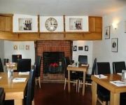
Falcon Inn
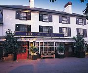
Bull Hotel & Conference Centre
Crowne Plaza GERRARDS CROSS
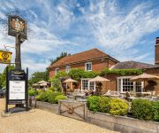
Bedford Arms
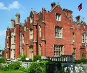
De Vere Latimer Estate
The Ivy House
Denham Grove
Holiday Inn Express HEMEL HEMPSTEAD
Kings Langley
London Ruislip
Videos from this area
These are videos related to the place based on their proximity to this place.
NEW Nuffield Health Fitness club, at RMS Rickmansworth
Register now for opening offer at www.nuffieldhealthoffer.co.uk. Introducing the New Nuffield Health & Wellbeing club, at RMS in Rickmansworth. 100 founder memberships will be available upon ...
New build semi-detached family home in Central Rickmansworth
New Homes Manager Emily Walton walks us through the show home at Gilliat Row, Ebury Road, Central Rickmansworth as the last 6 properties are launched to the public.
The Met reaches Rickmansworth and extends to Chesham
Philip Greenslade talks of the Metropolitain Railway at Rickmansworth. Produced by Barry Coward Photography Andrew Kennedy Director Ted Eggs Archive film courtesy of Alan Willmott 1992 A FAME.
GR8Drive-RICKMANSWORTH/MILL END WD3 DUAL CONTROL DRIVING LESSONS-CALL 07791 674 839
At GR8Drive near Rickmansworth WD3 we pride ourselves in offering professional Driving Lessons at affordable prices in Rickmansworth by DSA qualified Driving Instructors starting from as little...
Last Metropolitan Line 'A' Stock arrives into Rickmansworth Southbound, 26/09/12
Last Ever Southbound Working at Rickmansworth for Vintage London Underground Craven's 'A' Stock Units 5034 & 5063 working the last all stations Amersham - Aldgate Service on the 26/09/12. ...
Battle of Britain Memorial Flypast 2012 - Rickmansworth
This was the Battle of Britain Memorial Flight, as it flew over the Rickmansworth Canal Festival at 12:31 on Saturday 19th May, 2012. It consisted of a Lancaster Bomber, a Hurricane and three...
Jack & the Beanstalk, Watersmeet, Rickmansworth 2010
Join the lovely Linda Robson as she waves the wand of Fairy Organic and sprinkles magic over everyone in pantoland! Simon Howe as Dame Trott will be sharing his cutting edge fashion style as...
1938 tube train & Sarah Siddons on London Underground Metropolitan line
On 22 May 2011 the London Transport Museum organised some vintage vehicles to run on London Underground's Metropolitan line between Amersham and Watford (direct) and in Rickmansworth ...
Today In Chorleywood
Don't know what was in the box, but it left Andrew Flemming and headed off to traumatise people in the deli.
SWC Free Walk 81, Chorleywood to Chesham. 21/1/13
What a winter-wonderland of a walk this 10 miler turned out to be! A whole day walking in the snow...wonderful! When snow fall in London seems to stop all those trains running south of the...
Videos provided by Youtube are under the copyright of their owners.
Attractions and noteworthy things
Distances are based on the centre of the city/town and sightseeing location. This list contains brief abstracts about monuments, holiday activities, national parcs, museums, organisations and more from the area as well as interesting facts about the region itself. Where available, you'll find the corresponding homepage. Otherwise the related wikipedia article.
Chalfont Common
Chalfont Common is a hamlet in Buckinghamshire, England. It is located in the Chiltern Hills, to the north of Chalfont St Peter. It is also the home of the Epilepsy Society.
Chenies Manor House
Chenies Manor House, at Chenies, Buckinghamshire, southern England, a Grade I Listed Building, known formerly as Chenies Palace, was owned by the Cheyne family who were granted the manorial rights in 1180. The current house was built around 1460 by Sir John Cheyne. His widow, Lady Agnes Cheyne, left the manor house in a contested will to her niece, Anne Semark, wife of Sir David Phelip in 1494.
Chiltern Open Air Museum
Chiltern Open Air Museum is a museum of vernacular buildings and a tourist attraction located near Chalfont St Peter and Chalfont St. Giles in the Chiltern Hills, Buckinghamshire, England. The museum was founded in 1976 and aims to rescue and restore common English buildings from the Chilterns, which might otherwise have been destroyed or demolished. The buildings have been relocated to the museum's 45-acre site, which includes woodland and parkland.
Royal Masonic School
The Royal Masonic School for Girls is an independent school in Rickmansworth, England, with both day and boarding pupils. The school was instituted in 1788, with the aim of maintaining the daughters of indigent Freemasons, unable through death, illness, or incapacitation to support their families. Today, the school accepts the children of both masons and non-masons. It began in 1789 with fifteen pupils and a Matron in Somers Town, St Pancras, Middlesex.
A404 road
The A404 is a road in the United Kingdom that starts at Paddington in London and terminates near Maidenhead in Berkshire. The road initially follows a course through north-west London via Harlesden, Wembley, Harrow, Northwood and Rickmansworth. The M25 Junction 18 is at Chorleywood. The A404 crosses into Buckinghamshire and continues towards Little Chalfont and Amersham.
Maple Cross and Mill End
Maple Cross and Mill End is a ward in Three Rivers, in England, the United Kingdom. It is located in the far south-west Hertfordshire, in the East of England region. The ward includes the eponymous villages of Maple Cross and Mill End, lying between Chorleywood West to the north; Penn, Rickmansworth, and Harefield to the east; and Chalfont St. Giles and Chalfont Common to the west.
Heronsgate
Heronsgate (or formerly Herringsgate) is a settlement on the outskirts of Chorleywood, Hertfordshire founded by Feargus O'Connor and the Chartist Cooperative Land Company (later the National Land Company) as O'Connorsville or O'Connorville in 1846.
National Land Company
The National Land Company was founded as the Chartist Cooperative Land Company in 1845 by the chartist Feargus O'Connor to help working-class people satisfy the landholding requirement to gain a vote in county seats in Great Britain. It was wound up by Act of Parliament by 1851.


