Safety Score: 3,0 of 5.0 based on data from 9 authorites. Meaning we advice caution when travelling to United Kingdom.
Travel warnings are updated daily. Source: Travel Warning United Kingdom. Last Update: 2024-04-24 08:14:40
Delve into Bourne End
Bourne End in Hertfordshire (England) with it's 233 habitants is located in United Kingdom about 24 mi (or 38 km) north-west of London, the country's capital town.
Current time in Bourne End is now 03:10 AM (Thursday). The local timezone is named Europe / London with an UTC offset of one hour. We know of 8 airports close to Bourne End, of which 5 are larger airports. The closest airport in United Kingdom is London Luton Airport in a distance of 11 mi (or 18 km), North-East. Besides the airports, there are other travel options available (check left side).
There are several Unesco world heritage sites nearby. The closest heritage site in United Kingdom is Blenheim Palace in a distance of 8 mi (or 13 km), North-West. Also, if you like playing golf, there are some options within driving distance. We encountered 3 points of interest near this location. If you need a hotel, we compiled a list of available hotels close to the map centre further down the page.
While being here, you might want to pay a visit to some of the following locations: Caddington, Dunstable, Totternhoe, Houghton Regis and Luton. To further explore this place, just scroll down and browse the available info.
Local weather forecast
Todays Local Weather Conditions & Forecast: 6°C / 43 °F
| Morning Temperature | 4°C / 39 °F |
| Evening Temperature | 8°C / 46 °F |
| Night Temperature | 5°C / 41 °F |
| Chance of rainfall | 1% |
| Air Humidity | 91% |
| Air Pressure | 1005 hPa |
| Wind Speed | Moderate breeze with 10 km/h (6 mph) from East |
| Cloud Conditions | Overcast clouds, covering 100% of sky |
| General Conditions | Light rain |
Friday, 26th of April 2024
9°C (48 °F)
3°C (38 °F)
Broken clouds, gentle breeze.
Saturday, 27th of April 2024
6°C (43 °F)
9°C (48 °F)
Moderate rain, moderate breeze, overcast clouds.
Sunday, 28th of April 2024
12°C (53 °F)
9°C (47 °F)
Moderate rain, fresh breeze, overcast clouds.
Hotels and Places to Stay
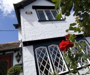
Boxmoor Lodge Hotel & Restaurant
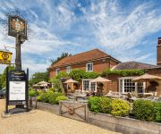
The Kings Arms
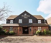
The Pennyfarthing Hotel
The Olde Kings Arms
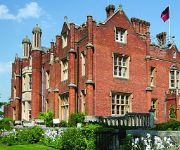
De Vere Latimer Estate
Bedford Arms
TRAVELODGE HEMEL HEMPSTEAD GATEWAY
JCT.9 Holiday Inn LUTON-SOUTH M1
The Chequers
Hemel Hempstead West
Videos from this area
These are videos related to the place based on their proximity to this place.
WIN A TRIP TO PAPUA NEW GUINEA
The PNG Tourism Promotion Authority (PNGTPA) and Wanderlust are offering a handful of travel bloggers the chance to win an iPad Mini or GoPro camera – and a trip to Papua New Guinea. To...
Morris Dancers
Here we see one of England's finest traditions - men dressing up as freemasons, and dancing about for beer money. I love it!
Fat Cows Eating on an English Summer Day - farm near Bourne End Marina (animals)
Fat Cows eating in a farm near Bourne End Marina with other cattle. An English Summer Day video.
Stunt crazy caravan stunt
Filmed in 1990 when cars were made out of steel so thin, this stunt just shows us how easy it is to smash through a caravan.
Ariel Atom & Subaru Impreza Experience (Driftlimits)
One of the presents from my 21st Birthday was this Ariel Atom experience that took place at DriftLimits in Hemel Hempstead. The whole driving experience was great and I would definitely recommend...
BSA R10 Walnut stock oil finish
Just a video diary this one really just trying out an oil finish I learned from reading an online article.
Videos provided by Youtube are under the copyright of their owners.
Attractions and noteworthy things
Distances are based on the centre of the city/town and sightseeing location. This list contains brief abstracts about monuments, holiday activities, national parcs, museums, organisations and more from the area as well as interesting facts about the region itself. Where available, you'll find the corresponding homepage. Otherwise the related wikipedia article.
Dacorum
The Borough of Dacorum is a local government district in Hertfordshire, England that includes the towns of Hemel Hempstead, Berkhamsted, Tring and the western part of Kings Langley. The district, which was formed in 1974, had a population of 137,799 in 2001. Its name was taken from the old hundred of Dacorum which covered approximately the same area.
South West Hertfordshire (UK Parliament constituency)
South West Hertfordshire is a constituency represented in the House of Commons of the UK Parliament since 2005 by David Gauke, a Conservative.
RAF Bovingdon
RAF Bovingdon was a Royal Air Force station, located to the west of Bovingdon, two and a half miles (4 kilometres) south of Hemel Hempstead (its principal neighbour) and two and a half miles south east of Berkhamsted, in Hertfordshire, UK. During World War II, the airfield was used by the Royal Air Force (RAF) and the United States Army Air Forces (USAAF) Eighth Air Force. It was assigned USAAF designation Station 112, station code "BV", later changed to "BZ".
Bourne End rail crash
The Bourne End rail crash occurred on 30 September 1945 when an overnight sleeping-car express train from Scotland to London Euston derailed due to a driver's error. 43 people were killed, making it Britain's joint seventh worst rail disaster in terms of death toll.
HM Prison The Mount
HM Prison The Mount is a Category C men's prison, located on the outskirts of Bovingdon village in Hertfordshire, England. The Mount Prison is operated by Her Majesty's Prison Service.
Sparrows Herne Turnpike Road
Sparrows Herne Turnpike Road was an 18th century English turnpike road from London to Aylesbury. The route was approximately that of the later A41 trunk road, (excluding the modern bypass sections at Watford and Hemel Hempstead), and much of the original route is now numbered as the A4251. It followed the Edgware Road and ran through Watford, Kings Langley, Apsley, the Boxmoor area of Hemel Hempstead, Berkhamsted and Tring.
Chaulden
Chaulden is a residential district in Hemel Hempstead, Hertfordshire, England located west of the town centre and bordering on open countryside. It was an early development in the construction of Hemel Hempstead new town, commenced in 1953 and has its own neighbourhood shopping centre. The name Chaulden can be traced back to 1523 as a local field name and means a chalky valley. A country house and estate called Chaulden House occupied the area during the nineteenth century.
Westbrook Hay School
Westbrook Hay Prep School is a co-educational independent school which educates children from rising 3 –13 years. The school is primarily a day school but with flexi boarding. The school took on its present name at its present site in the 1960s, previously it had been a boarding school for boys called Gadebridge Park School in nearby Hemel Hempstead from 1914 until it was forced out of its premises, Gadebridge House by the Commission for New Towns as part of its development of the new town.


