Safety Score: 3,0 of 5.0 based on data from 9 authorites. Meaning we advice caution when travelling to United Kingdom.
Travel warnings are updated daily. Source: Travel Warning United Kingdom. Last Update: 2024-05-18 08:26:29
Discover Wallands Park
The district Wallands Park of in East Sussex (England) is a district in United Kingdom about 44 mi south of London, the country's capital city.
Looking for a place to stay? we compiled a list of available hotels close to the map centre further down the page.
When in this area, you might want to pay a visit to some of the following locations: Lewes, Rottingdean, Brighton, Fulking and Felbridge. To further explore this place, just scroll down and browse the available info.
Local weather forecast
Todays Local Weather Conditions & Forecast: 14°C / 56 °F
| Morning Temperature | 12°C / 54 °F |
| Evening Temperature | 17°C / 63 °F |
| Night Temperature | 13°C / 56 °F |
| Chance of rainfall | 4% |
| Air Humidity | 93% |
| Air Pressure | 1013 hPa |
| Wind Speed | Light breeze with 5 km/h (3 mph) from South |
| Cloud Conditions | Overcast clouds, covering 100% of sky |
| General Conditions | Light rain |
Sunday, 19th of May 2024
17°C (62 °F)
12°C (53 °F)
Light rain, gentle breeze, clear sky.
Monday, 20th of May 2024
16°C (61 °F)
11°C (51 °F)
Sky is clear, moderate breeze, clear sky.
Tuesday, 21st of May 2024
15°C (60 °F)
13°C (56 °F)
Light rain, light breeze, scattered clouds.
Hotels and Places to Stay
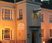
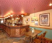
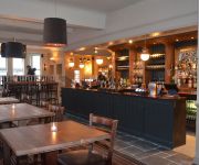
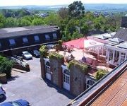
The Shelleys
The Newmarket Inn Relaxinnz
White Horse
White Hart
Lewes Town Centre
Newhaven
Videos from this area
These are videos related to the place based on their proximity to this place.
Lewes Bonfire Night 2010 - An effigy of The Pope is blown up
An effigy of The Pope is blown up at the Commercial Square fire site at Lewes Bonfire 2010.
SWC Free Walk 134, Lewes to Brighton. 29/1/12.
Another fine walk across The South Downs, albeit only 7 miles. A further 4.5 miles is added with a coastal walk into Brighton. Leaving Lewes, the walker is soon into the countryside and ascending...
Lorry stuck in Lewes nearly crashes into Porsche Cayenne
So just sitting at my desk and hear all these horns going off outside. To my surprise, another lorry had got stuck. However, this lorry was massive! So the recording began. The driver almost...
Podróże z Maciejem - South Downs National Park (Hassocks - Lewes)
Podróże z Maciejem - Południowa Anglia, Park Narodowy South Downs (Hassocks - Lewes) Travelling with Maciej - South Downs National Park (Hassocks - Lewes) W tym odcinku wybiorę się...
Shepherds Arise! Mummers Play 2014 - Lewes Saturday Folk Club
Traditional mummers play, as part of the "Shepherd's Arise" performance of Sussex Carols at the Lewes Saturday Folk Club. Based on a play collected from the Village of Ovingdean, near Brighton.
Locksmith Lewes, Plumpton BN7, Fit new upvc door mechanism - Page Security Locksmiths Lewes
https://page-security.com/sussex/lewes-2/ Page Security Locksmith Lewes attended Williams property in Plumpton Lewes BN7 after he called us regarding his faulty mechanism on his front door,...
Common Cause Co-operative , Lewes
Video showing a selection of current projects by Common Cause Co-operative, Lewes. Made for 21st anniversary of Common Cause.
Videos provided by Youtube are under the copyright of their owners.
Attractions and noteworthy things
Distances are based on the centre of the city/town and sightseeing location. This list contains brief abstracts about monuments, holiday activities, national parcs, museums, organisations and more from the area as well as interesting facts about the region itself. Where available, you'll find the corresponding homepage. Otherwise the related wikipedia article.
Battle of Lewes
The Battle of Lewes was one of two main battles of the conflict known as the Second Barons' War. It took place at Lewes in Sussex, on 14 May 1264. It marked the high point of the career of Simon de Montfort, 6th Earl of Leicester, and made him the "uncrowned King of England". The battle occurred because of the vacillation of King Henry III, who was refusing to honour the terms of the Provisions of Oxford, an agreement he had signed with his barons, led by Montfort, in 1258.
Lewes (district)
Lewes is a local government district in East Sussex in southern England covering an area of 113 sq mi, with 9 miles of coastline. It is named after its administrative centre, Lewes. Other towns in the district include Newhaven, Peacehaven, and Seaford. Plumpton racecourse is within the district. There are 28 parishes in the district.
Lewes Castle
Lewes Castle stands at the highest point of Lewes, East Sussex, England on an artificial mound constructed with chalk blocks. It was originally called Bray Castle.
Cliffe Hill
Cliffe Hill is a hill to the east of the town of Lewes in East Sussex, England. It is impressive on its western edge, where it looms over Lewes. Its summit is covered in a golf course. It is the lowest Marilyn in the British Isles. Also to be found on the hill is an obelisk known as Martyrs' Memorial commemorating the destruction of Lewes' monastery by Henry VIII and the burning of the 17 Protestant martyrs known as the Sussex Martyrs in 1555–1557.
Lewes railway station
Lewes railway station serves the town of Lewes in East Sussex, England. It has five platforms and is on the East Coastway Line. Train services are provided by Southern. The station has a café and a newsagent, and there is a taxi office on the main forecourt. There is a small taxi rank outside.
Southease railway station
Southease railway station is a railway station half a mile east of the village of Southease, East Sussex, England. It is on the Seaford Branch of the East Coastway Line. The station is surrounded by agricultural land. The South Downs Way crosses the Seaford Branch here.
Lewes (UK Parliament constituency)
Lewes is a constituency in East Sussex represented in the House of Commons of the UK Parliament since 1997 by Norman Baker, a Liberal Democrat.
Brighton Kemptown (UK Parliament constituency)
Brighton, Kemptown is a constituency covering the eastern portion of the city of Brighton and Hove including Kemptown and part of the Lewes District represented in the House of Commons of the UK Parliament since 2010 by Simon Kirby of the Conservative Party.
Mount Caburn
Mount Caburn is a 480-foot (146m) isolated peak, one of the highest landmarks in East Sussex, England, about one mile (1.6 km) east of Lewes overlooking the village of Glynde. It is an isolated part of the South Downs, separated by Glynde Reach, a tributary of the River Ouse.
Ringmer F.C
Ringmer F.C. is a football club based in Ringmer, near Lewes, East Sussex, England. For the 2012–13 season, they are members of Sussex County League Division One.
Lewes Crown Court
Lewes Crown Court is a Crown Court in Lewes, East Sussex, England. It is housed in the Lewes Combined Court Centre which it shares with Lewes County Court in the Lewes High Street. The Portland stone building, originally established as East Sussex County Hall, was designed by John Johnson and built between 1808 and 1812.
Lewes Priory
The Priory of St Pancras was the first Cluniac house in England and had one of the largest monastic churches in the country. It was set within an extensive walled and gated precinct laid out in a commanding location fronting the tidal shore-line at the head of the Ouse valley to the south of Lewes in the County of Sussex. The Priory had daughter houses, including Castle Acre Priory in Norfolk, and was endowed with churches and extensive holdings throughout England.
Anne of Cleves House
Anne of Cleves House is a 15th century timber-framed Wealden hall house on Southover High Street in Lewes, East Sussex, England. It formed part of Queen Anne's annulment settlement from King Henry VIII in 1541, although she never visited the property. It was restored by the architect Walter Godfrey. Owned and operated as a museum by the Sussex Archaeological Society under the operating name "Sussex Past", it is home to wide-ranging collections of furniture and artefacts of Sussex interest.
Monk's House
Monk's House is an 18th century weatherboarded cottage in the village of Rodmell, three miles (4.8km) south-east of Lewes, East Sussex, England. The writer Virginia Woolf and her husband, the political activist, journalist and editor Leonard Woolf, bought the house in 1919, and received there many important visitors connected to the Bloomsbury Group, including T. S. Eliot, E. M. Forster, Roger Fry and Lytton Strachey.
Barcombe railway station
Barcombe was a railway station serving the village of Barcombe in East Sussex. It was part of the East Grinstead to Lewes line, more popularly known as the Bluebell Railway. The station was originally opened as "New Barcombe" to distinguish it from the nearby station of Barcombe Mills (then called 'Barcombe'), and was changed to its more usual name on 1 January 1885. In 1897 goods sidings were installed at a cost of £1450.
The Dripping Pan
The Dripping Pan is a football stadium in Lewes, England. It has been home to Lewes F.C. since their incarnation in 1885. It had previously been used by Lewes Priory Cricket Club, though the ground itself had been used by the people of Lewes as a centre for recreation as far back as records exist, including athletics.
Barcombe Mills railway station
Barcombe Mills is a disused railway station in the hamlet of Barcombe Mills, on the closed section of the Wealden Line. The station was opened in 1858 and closed in 1969.
Sussex Greensand Way
The Sussex Greensand Way is a Roman road linking the London to Lewes Way at Barcombe Mills to Stane Street at Hardham. The road, which has almost entirely fallen out of use, follows the free draining ridge of greensand which lies north of the South Downs. It is a planned route rather than a Romanised iron age track, following a few straight alignments without any steep gradients, which linked various north-south roads and tracks.
HM Prison Lewes
HM Prison Lewes is a local men's prison, located in Lewes in East Sussex, England. The term 'local' means that the prison holds people on remand to the local courts, as well as sentenced prisoners. The prison is operated by Her Majesty's Prison Service.
Blackcap, East Sussex
Blackcap is a National Trust owned area of countryside on the peak of the South Downs, just south east of the village of Plumpton in East Sussex, England. It is also mainly part of the Clayton to Offham Escarpment SSSI. The reserve contains the hills of Blackcap 206 metres in the parish of East Chiltington, Mount Harry 196 metres in the parish of Hamsey and the wooded area of Ashcombe Bottom in the parish of St John Without.
Lewes Free Presbyterian Church
Lewes Free Presbyterian Church is one of seven Free Presbyterian Church of Ulster places of worship in England. It is based in a former Calvinistic Independent chapel in the Cliffe area of Lewes, the county town of East Sussex and the main town in the local government district of Lewes. Jireh Chapel is more than 200 years old and originally housed an independent Calvinistic congregation. It has been listed at Grade I by English Heritage for its architectural and historical importance.
Lewes Speed Trials
The Lewes Speed Trials were speed trials held on a defunct course in Lewes, Sussex, England, sometimes known as "The Motor Road."
Southover General Baptist Chapel
Southover General Baptist Chapel is a former Baptist place of worship in the ancient village of Southover, now part of the town and district of Lewes, one of six local government districts in the English county of East Sussex. Founded in 1741 as the first Baptist place of worship in the area, it attracted a congregation of General Baptists whose theological views gradually moved towards Unitarianism.
Lewes avalanche
The Lewes avalanche occurred on 27 December 1836 in Lewes, Sussex, when a huge build-up of snow on a chalk cliff overlooking the town collapsed into the settlement 100 metres below, destroying a row of cottages and killing eight people. It remains the deadliest avalanche on record in the United Kingdom.
Church of St John sub Castro, Lewes
The Church of St John sub Castro is an Anglican church in Lewes, the county town of East Sussex, England. It was built in 1839 on the site of an 11th-century Saxon church, and has been designated by English Heritage as a Grade II listed building. In the churchyard is a memorial to Finnish prisoners from the Crimean War who died while confined in Lewes Naval Prison; the memorial is also listed Grade II. The church continues to be active as a parish church in the diocese of Chichester.


