Safety Score: 3,0 of 5.0 based on data from 9 authorites. Meaning we advice caution when travelling to United Kingdom.
Travel warnings are updated daily. Source: Travel Warning United Kingdom. Last Update: 2024-04-18 08:12:24
Explore Chiltington
Chiltington in East Sussex (England) is a city in United Kingdom about 41 mi (or 66 km) south of London, the country's capital.
Local time in Chiltington is now 01:44 AM (Friday). The local timezone is named Europe / London with an UTC offset of one hour. We know of 10 airports in the vicinity of Chiltington, of which 5 are larger airports. The closest airport in United Kingdom is Shoreham Airport in a distance of 13 mi (or 21 km), South-West. Besides the airports, there are other travel options available (check left side).
There are several Unesco world heritage sites nearby. The closest heritage site in United Kingdom is Stonehenge, Avebury and Associated Sites in a distance of 19 mi (or 31 km), North. Also, if you like golfing, there are multiple options in driving distance. We found 3 points of interest in the vicinity of this place. If you need a place to sleep, we compiled a list of available hotels close to the map centre further down the page.
Depending on your travel schedule, you might want to pay a visit to some of the following locations: Lewes, Rottingdean, Brighton, Fulking and Felbridge. To further explore this place, just scroll down and browse the available info.
Local weather forecast
Todays Local Weather Conditions & Forecast: 10°C / 51 °F
| Morning Temperature | 9°C / 49 °F |
| Evening Temperature | 10°C / 51 °F |
| Night Temperature | 6°C / 43 °F |
| Chance of rainfall | 0% |
| Air Humidity | 76% |
| Air Pressure | 1017 hPa |
| Wind Speed | Fresh Breeze with 15 km/h (9 mph) from East |
| Cloud Conditions | Overcast clouds, covering 95% of sky |
| General Conditions | Light rain |
Saturday, 20th of April 2024
9°C (48 °F)
4°C (39 °F)
Scattered clouds, moderate breeze.
Sunday, 21st of April 2024
9°C (48 °F)
6°C (42 °F)
Broken clouds, fresh breeze.
Monday, 22nd of April 2024
8°C (46 °F)
5°C (40 °F)
Light rain, fresh breeze, broken clouds.
Hotels and Places to Stay
The Shelleys
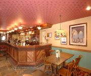
The Newmarket Inn Relaxinnz
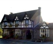
The Kings Head Inn
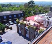
BEST WESTERN BIRCH HOTEL
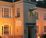
White Hart
Lewes Town Centre
Videos from this area
These are videos related to the place based on their proximity to this place.
Lewes Bonfire Night 2010 - An effigy of The Pope is blown up
An effigy of The Pope is blown up at the Commercial Square fire site at Lewes Bonfire 2010.
Lewes Bonfire Fireworks Time-Lapse 2014 - 4K
A time-lapse overlooking Lewes from Offham Hill during the 2014 Lewes Bonfire Celebration Fireworks Displays. Best Viewed in 1440p HD or 4K. Follow me On Facebook: ...
Cars causing gridlock on country lane
Traffic from both directions attempting to avoid a small queue end up causing complete gridlock on a narrow country lane in Offham. Cycle club had to use cyclocross tactics to squeeze through...
Shepherds Arise! Mummers Play 2014 - Lewes Saturday Folk Club
Traditional mummers play, as part of the "Shepherd's Arise" performance of Sussex Carols at the Lewes Saturday Folk Club. Based on a play collected from the Village of Ovingdean, near Brighton.
Lewes Bonfire Night 2010 - Commercial Square Fire site
Scenes from the 2010 Lewes Bonfire night at the Commercial Square fire site.
Lewes Guy Fawkes Massive Bonfire Fogata Night East Sussex England Fifth November
Lewes, East Sussex England: Guy Fawkes bonfire night on November 5, giant bonfire lit, at some point an effigy of either George Bush or Alistair Darling (who raised the beer tax in England)...
Lewes Bonfire Night Celebration Fireworks : Firework Display
Clips of fireworks from the firework display at Lewes Bonfire Night Celebration. Lewes Bonfire Night Celebration Website . . Click Below. http://www.lewesbonfirecelebrations.com/ Lewes Bonfire...
Videos provided by Youtube are under the copyright of their owners.
Attractions and noteworthy things
Distances are based on the centre of the city/town and sightseeing location. This list contains brief abstracts about monuments, holiday activities, national parcs, museums, organisations and more from the area as well as interesting facts about the region itself. Where available, you'll find the corresponding homepage. Otherwise the related wikipedia article.
Battle of Lewes
The Battle of Lewes was one of two main battles of the conflict known as the Second Barons' War. It took place at Lewes in Sussex, on 14 May 1264. It marked the high point of the career of Simon de Montfort, 6th Earl of Leicester, and made him the "uncrowned King of England". The battle occurred because of the vacillation of King Henry III, who was refusing to honour the terms of the Provisions of Oxford, an agreement he had signed with his barons, led by Montfort, in 1258.
Plumpton Racecourse
Plumpton Racecourse is a National Hunt (jumping) horse-racing course at the village of Plumpton, East Sussex near Lewes and Brighton. One of the smaller National Hunt race courses in Britain, it is rather hilly, a tightish left-handed circuit of just over a mile. The hurdle course is now situated on the outside of the chase course: both share the same uphill finish.
Barcombe railway station
Barcombe was a railway station serving the village of Barcombe in East Sussex. It was part of the East Grinstead to Lewes line, more popularly known as the Bluebell Railway. The station was originally opened as "New Barcombe" to distinguish it from the nearby station of Barcombe Mills (then called 'Barcombe'), and was changed to its more usual name on 1 January 1885. In 1897 goods sidings were installed at a cost of £1450.
Sussex Greensand Way
The Sussex Greensand Way is a Roman road linking the London to Lewes Way at Barcombe Mills to Stane Street at Hardham. The road, which has almost entirely fallen out of use, follows the free draining ridge of greensand which lies north of the South Downs. It is a planned route rather than a Romanised iron age track, following a few straight alignments without any steep gradients, which linked various north-south roads and tracks.
Plumpton Place
Plumpton Place is a Grade 2 listed Elizabethan manor house in Plumpton, East Sussex, England. The house is on the English Heritage register. Plumpton Place looks onto the nearby north-facing escarpment of the South Downs, with Plumpton College (formerly Plumpton Agricultural College) and the 11th century church of St. Michael's and All Angels immediately adjacent to the west and Plumpton village some 500m to the east.
Plumpton College
Plumpton College (Once known as Plumpton Agricultural College) is a Further and Higher education college in Plumpton, East Sussex, England, with courses in a variety of land based and related subjects. The college provides a range of full time and part time land-based courses, FE courses to Foundation Degree and BSc courses. The College degree courses are provided in association with the University of Brighton.
Blackcap, East Sussex
Blackcap is a National Trust owned area of countryside on the peak of the South Downs, just south east of the village of Plumpton in East Sussex, England. It is also mainly part of the Clayton to Offham Escarpment SSSI. The reserve contains the hills of Blackcap 206 metres in the parish of East Chiltington, Mount Harry 196 metres in the parish of Hamsey and the wooded area of Ashcombe Bottom in the parish of St John Without.
Lewes Speed Trials
The Lewes Speed Trials were speed trials held on a defunct course in Lewes, Sussex, England, sometimes known as "The Motor Road."


