Safety Score: 3,0 of 5.0 based on data from 9 authorites. Meaning we advice caution when travelling to United Kingdom.
Travel warnings are updated daily. Source: Travel Warning United Kingdom. Last Update: 2024-04-27 08:23:39
Discover Lindale
Lindale in Cumbria (England) with it's 579 citizens is a place in United Kingdom about 220 mi (or 354 km) north-west of London, the country's capital city.
Current time in Lindale is now 12:46 PM (Saturday). The local timezone is named Europe / London with an UTC offset of one hour. We know of 9 airports near Lindale, of which 4 are larger airports. The closest airport in United Kingdom is Barrow Walney Island Airport in a distance of 16 mi (or 26 km), West. Besides the airports, there are other travel options available (check left side).
There are several Unesco world heritage sites nearby. The closest heritage site is Frontiers of the Roman Empire in Germany at a distance of 80 mi (or 129 km). The closest in United Kingdom is Castles and Town Walls of King Edward in Gwynedd in a distance of 82 mi (or 129 km), North-East. Also, if you like playing golf, there are a few options in driving distance. If you need a hotel, we compiled a list of available hotels close to the map centre further down the page.
While being here, you might want to pay a visit to some of the following locations: Blackpool, Freckleton, Warton, Preston and Southport. To further explore this place, just scroll down and browse the available info.
Local weather forecast
Todays Local Weather Conditions & Forecast: 10°C / 49 °F
| Morning Temperature | 2°C / 35 °F |
| Evening Temperature | 8°C / 46 °F |
| Night Temperature | 3°C / 38 °F |
| Chance of rainfall | 0% |
| Air Humidity | 55% |
| Air Pressure | 1007 hPa |
| Wind Speed | Moderate breeze with 10 km/h (6 mph) from South-West |
| Cloud Conditions | Broken clouds, covering 69% of sky |
| General Conditions | Broken clouds |
Sunday, 28th of April 2024
8°C (46 °F)
5°C (41 °F)
Overcast clouds, moderate breeze.
Monday, 29th of April 2024
10°C (51 °F)
8°C (46 °F)
Light rain, moderate breeze, overcast clouds.
Tuesday, 30th of April 2024
14°C (56 °F)
9°C (48 °F)
Light rain, fresh breeze, overcast clouds.
Hotels and Places to Stay
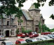
Cumbria Grand
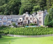
Netherwood
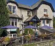
The Lymehurst Hotel
Newby Bridge Hotel
Videos from this area
These are videos related to the place based on their proximity to this place.
MUDSLIDE: How to wreck a campsite field!
Wet Bank Holiday Evening in Sunny England... What else is there to do?
Sailing Trip to Secret Corner of Morecambe Bay
How many people have experienced sailing in this secret corner of Morecambe Bay? These lucky guys must be amongst the very few! This is day 2 of their level 3 sailing course with Bay Sea School...
Class 185 Departs Grange-Over-Sands
Class 185 departs Grange-over-Sands with a Sunday First TransPennine Express service to Manchester Airport from Barrow-in-Furness.
Night Drive - M6 - M5 - Birmingham HD
m6 m5 drive at night in range rover sport with 28ft caravan on back.
Videos provided by Youtube are under the copyright of their owners.
Attractions and noteworthy things
Distances are based on the centre of the city/town and sightseeing location. This list contains brief abstracts about monuments, holiday activities, national parcs, museums, organisations and more from the area as well as interesting facts about the region itself. Where available, you'll find the corresponding homepage. Otherwise the related wikipedia article.
Castle Head Field Centre
Castle Head Field Centre, near to the seaside resort of Grange-over-Sands in Cumbria, England is a Georgian house built by the ironmaster John Wilkinson, surrounded by 20 acres of grounds. The centre is close to the coastal habitats and landforms of Morecambe Bay as well as the fells of the Lake District National Park. Activities include camping, building shelters, canoeing, making camp fires, mountain hiking, indoor climbing, toasting marshmallows.
High Newton
High Newton is a village in the South Lakeland District, in the county of Cumbria.
Low Newton, Cumbria
Low Newton is a hamlet in the South Lakeland District, in the county of Cumbria, England. It was on the A590 road until it was by-passed a few years ago, it was opeded on Tuesday 8th April 2008. Nearby settlements include the town of Grange-over-Sands, the villages of Lindale, High Newton and Newby Bridge and the hamlets of Barber Green and High Hampsfield. References:
Grange Fell Church, Grange-Over-Sands
Grange Fell Church DenominationChurch of EnglandChurchmanshipAnglicanWebsiteGrange Fell Church, Grange-over-SandsAdministrationDioceseDiocese of Carlisle ProvinceProvince of YorkClergyVicar(s)Revd. Canon Nicholas Ash Grange Fell Church commonly referred to by locals as the Fell Church is a Church of England church in the Grange Fell area of Grange-over-Sands, Cumbria, England. It was built in 1907.
St Paul Parish Church, Grange-over-Sands
St Paul's Church, Grange-over-Sands, is located in Crown Hill, Grange-Over-Sands, Cumbria, England. It is an active parish church in the deanery of Windermere, the archdeaconry of Westmorland and Furness, and the diocese of Carlisle. Its benefice is united with those of St Mary, Allithwiate, St Mary and St Michael, Cartmel, St Peter, Field Broughton, St John the Baptist, Flookburgh, Grange Fell Church, Grange-over-Sands, and St Paul, Lindale, to form the benefice of Cartmel Peninsula.
Newton Fell
Newton Fell is a hill in the English Lake District near High Newton, south east of Newby Bridge, Cumbria. It lies to the north east of the A590 road. It is the subject of a chapter of Wainwright's book The Outlying Fells of Lakeland. Wainwright describes two walks, to the summits he calls Newton Fell (north) at 780 feet and Newton Fell (south) or Dixon Heights at 585 feet .
Hampsfield House
Hampsfield House is a country house located to the west of the village of Lindale, Cumbria, England. It was built between 1880 and 1882, and designed by the Lancaster architects Paley and Austin. The house cost about £7,000 (£ as of 2013). It was built for Sir John Tomlinson Hibbert, Member of Parliament for Oldham, who was Parliamentary Secretary to the Local Government Board under Gladstone in 1871–74, and again in 1880–83.
Meathop Moss
Meathop Moss is a raised bog in Cumbria, England near the village of Meathop. Moss is a dialect word meaning bog. The site was identified by the entomologist Charles Rothschild (1877 – 1923) as being of ecological importance and needing protection. In 1919 it was leased for use as a nature reserve. In 1998 it was purchased by the Cumbria Wildlife Trust with help from the Heritage Lottery Fund.


