Safety Score: 3,0 of 5.0 based on data from 9 authorites. Meaning we advice caution when travelling to Slovakia.
Travel warnings are updated daily. Source: Travel Warning Slovakia. Last Update: 2024-05-18 08:26:29
Delve into Opatovský Sokolec
The district Opatovský Sokolec of Okoč in Trnava is a subburb in Slovakia about 37 mi south-east of Bratislava, the country's capital town.
If you need a hotel, we compiled a list of available hotels close to the map centre further down the page.
While being here, you might want to pay a visit to some of the following locations: Sellye, Gyor, Komarom, Pannonhalma and Kisber. To further explore this place, just scroll down and browse the available info.
Local weather forecast
Todays Local Weather Conditions & Forecast: 21°C / 70 °F
| Morning Temperature | 12°C / 54 °F |
| Evening Temperature | 22°C / 72 °F |
| Night Temperature | 16°C / 60 °F |
| Chance of rainfall | 1% |
| Air Humidity | 62% |
| Air Pressure | 1012 hPa |
| Wind Speed | Gentle Breeze with 6 km/h (4 mph) from West |
| Cloud Conditions | Scattered clouds, covering 28% of sky |
| General Conditions | Light rain |
Monday, 20th of May 2024
23°C (74 °F)
16°C (61 °F)
Moderate rain, gentle breeze, overcast clouds.
Tuesday, 21st of May 2024
20°C (68 °F)
16°C (62 °F)
Light rain, moderate breeze, overcast clouds.
Wednesday, 22nd of May 2024
16°C (61 °F)
14°C (57 °F)
Light rain, gentle breeze, overcast clouds.
Hotels and Places to Stay
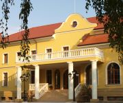
Hotel*** Plauter Kuria
Videos from this area
These are videos related to the place based on their proximity to this place.
Topoľníky (Nyárasd) - Veľký Meder (Nagymegyer)
Topoľníky (Nyárasd) - Okoč (Ekecs) - Veľký Meder (Nagymegyer) Aprilia Sportcity Cube 250.
Red Ring tobogan - Termalpark Velky Meder
All - year tobogan with color effects Red Ring in Veľký Meder length: 66,7 m.
Aquakarneval - GASTROFEST Veľký Meder 2015
AQUAKARNEVAL - GASTROFEST Veľký Meder 28.03.2015, pred termálnym kúpaliskom Veľký Meder, Thermal Corvinus.
Black Led tobogan - Termalpark Velky Meder
All - year tobogan with color effects Black Led in Veľký Meder length: 67,5 m.
[Velky Meder] 2. Den | Yellow Submarine :) (Jsem ponorka)
Moje druhé video z Veľkého Medera... ---------------------------ODKAZY------------------------------------ YouTube: http://youtube.com/user/cergacuvminecraft Ask.fm: http://ask.fm/vovicek...
Videos provided by Youtube are under the copyright of their owners.
Attractions and noteworthy things
Distances are based on the centre of the city/town and sightseeing location. This list contains brief abstracts about monuments, holiday activities, national parcs, museums, organisations and more from the area as well as interesting facts about the region itself. Where available, you'll find the corresponding homepage. Otherwise the related wikipedia article.
Žitný ostrov
Žitný ostrov, also called Veľký Žitný ostrov (Great Rye Island) (German: Große Schüttinsel or Great Schütt Island, Hungarian: Csallóköz) to differentiate it from Malý Žitný ostrov (Small Rye Island) (German: Kleine Schüttinsel or Little Schütt Island, Hungarian: Szigetköz), is a river island in southwestern Slovakia, extending from Bratislava to Komárno. It lies between the Danube, its tributary Little Danube and Váh. The island is a major part of the Danubian Flat.
Danubian Flat
The Danubian Flat, also translated as Danubian Plain, is the south-western, more flat, part of the Danubian Lowland in Slovakia. The border with the Danubian Hills runs approx. along the line Bratislava – Senec – Sereď – Nové Zámky – Patince. It has been formed by the arms of the Danube and by the southern Váh, Nitra and Žitava rivers. It is filled with huge layers of gravel from the Danube and other rivers of the area. These Danubian gravels are covered with loess and other very fertile soils.
Malé Kosihy
Malé Kosihy is a village and municipality in the Nové Zámky District in the Nitra Region of south-west Slovakia.
Dudváh
Dudváh (Hungarian: Dudvág) is a lowland river in western Slovakia. It is 97 km long, with a basin of 1,507 km², and with a flow of 1.3 m³/s near the village of Siladice. Its source is located in the Čachtice Little Carpathians, and it mostly runs in parallel to the Váh river. Dudváh flows into the old branch of the Čierna Voda river, which in turn flows into the Little Danube river.
Gönyű
Gönyű is a village in Győr-Moson-Sopron county, Hungary. The village is known for its bizarre soccer field.


!['[Velky Meder] 2. Den | Yellow Submarine :) (Jsem ponorka)' preview picture of video '[Velky Meder] 2. Den | Yellow Submarine :) (Jsem ponorka)'](https://img.youtube.com/vi/oRDQJAxHsOA/mqdefault.jpg)


