Safety Score: 2,7 of 5.0 based on data from 9 authorites. Meaning we advice caution when travelling to United States.
Travel warnings are updated daily. Source: Travel Warning United States. Last Update: 2024-05-06 08:04:52
Delve into Willoughby Beach
Willoughby Beach in City of Norfolk (Virginia) is a town located in United States about 139 mi (or 224 km) south of Washington DC, the country's capital town.
Time in Willoughby Beach is now 11:32 AM (Monday). The local timezone is named America / New York with an UTC offset of -4 hours. We know of 8 airports closer to Willoughby Beach, of which 4 are larger airports. The closest airport in United States is Norfolk International Airport in a distance of 7 mi (or 11 km), South-East. Besides the airports, there are other travel options available (check left side).
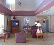
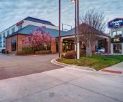
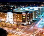
There is one Unesco world heritage site nearby. It's Monticello and the University of Virginia in Charlottesville in a distance of 99 mi (or 159 km), North-West. Also, if you like the game of golf, there are some options within driving distance. We saw 6 points of interest near this location. In need of a room? We compiled a list of available hotels close to the map centre further down the page.
Since you are here already, you might want to pay a visit to some of the following locations: Hampton, Norfolk, Portsmouth, Chesapeake and Poquoson. To further explore this place, just scroll down and browse the available info.
Local weather forecast
Todays Local Weather Conditions & Forecast: 23°C / 73 °F
| Morning Temperature | 20°C / 68 °F |
| Evening Temperature | 23°C / 74 °F |
| Night Temperature | 21°C / 70 °F |
| Chance of rainfall | 6% |
| Air Humidity | 77% |
| Air Pressure | 1015 hPa |
| Wind Speed | Gentle Breeze with 9 km/h (5 mph) from North-East |
| Cloud Conditions | Overcast clouds, covering 100% of sky |
| General Conditions | Moderate rain |
Monday, 6th of May 2024
23°C (73 °F)
20°C (67 °F)
Light rain, moderate breeze, broken clouds.
Tuesday, 7th of May 2024
27°C (80 °F)
24°C (75 °F)
Light rain, fresh breeze, overcast clouds.
Wednesday, 8th of May 2024
26°C (79 °F)
22°C (72 °F)
Moderate rain, fresh breeze, overcast clouds.
Hotels and Places to Stay
HOWARD JOHNSON INN NORFOLK
Hampton Inn Norfolk-Naval Base
Quality Inn Norfolk Naval Base
Crowne Plaza HAMPTON-MARINA
SpringHill Suites Norfolk Old Dominion University
Motel 6 Norfolk - Oceanview
The Bay Inn
Ocean View Inn
BW PLUS HOLIDAY SANDS INN STS
SUPER 8 NORFOLK CHESAPEAKE BAY
Videos from this area
These are videos related to the place based on their proximity to this place.
late summer beach sunrise hd
Nature Share - Late summer beach sunrise on a breezy morning, with seaoats, sunflowers, beach grass, waves and the sun! Oh, and a seagull flying by. Enjoy, relax, have a Good Morning!
Few Moments of Early March Evening on Dune of Willoughby Spit
At sunset of a warm day, sea gulls munching seaweed on the beach, sea oats and the moon. Relax...
Ocean View Waterslide Makes a Splash
At Community Beach in Norfolk, VA Norfolk Perspectives with Bob Batcher.
Formal 01/13/15 Session - Norfolk City Council
02:25 PH-1 PUBLIC HEARING to hear comments on a Lease Agreement with Ocean View Little League for the use of certain property known as “Ocean View Little League Ball Fields” 03:00 PH-2...
FY2013 Budget Public Hearing - City of Norfolk Virginia
Recorded May 2, 2012 at Granby High More budget information available at http://www.norfolk.gov.
Work 01/13/15 Session pt. 1 - Norfolk City Council
00:02 SLOVER OVERVIEW - Presenters: Mayor Paul Fraim, Harry T. Lester 09:50 SLOVER LIBRARY PROGRAMMING - Presenter: Sonal Rastogi, Director of Libraries 17:02 SLOVER LIBRARY ...
Work 01/13/15 Session pt. 2 - Norfolk City Council
00:02 WASTE MGMT TRUCKS 03:11 COUNCIL INTERESTS AND ISSUES 27:08 ELECTED SCHOOL BOARD - Council Discussion.
Work 11/26/13 Session pt. 2 - Norfolk City Council
00:01 TREE DONATION - Presenters: Darrell Crittendon, Director of RPOS & Michael Nentwich, City Forester 16:18 ORANGE AREA IMPROVEMENTS - Presenter: John Keifer, Director of Public Works ...
Regular 03/26/13 Session - Norfolk City Council
01:00 HAMPTON ROADS CDC Presenter: Dr. Deborah DiCroce, President & CEO of Hampton Roads Community Foundation 18:20 CLOSED SESSION - LEGALMATTER 19:08 COUNCIL INTERESTS ...
Videos provided by Youtube are under the copyright of their owners.
Attractions and noteworthy things
Distances are based on the centre of the city/town and sightseeing location. This list contains brief abstracts about monuments, holiday activities, national parcs, museums, organisations and more from the area as well as interesting facts about the region itself. Where available, you'll find the corresponding homepage. Otherwise the related wikipedia article.
Jamestown Exposition
The Jamestown Exposition was one of the many world's fairs and expositions that were popular in the United States in the early part of the 20th century. Commemorating the 300th anniversary of the founding of Jamestown in the Virginia Colony, it was held from April 26 to December 1, 1907, at Sewell's Point on Hampton Roads, in Norfolk, Virginia. It celebrated the first permanent English settlement in the present United States.
Battle of Hampton Roads
The Battle of Hampton Roads, often referred to as either the Battle of the Monitor and Merrimack (or Virginia) or the Battle of Ironclads, was the most noted and arguably most important naval battle of the American Civil War from the standpoint of the development of navies. It was fought over two days, March 8–9, 1862, in Hampton Roads, a roadstead in Virginia where the Elizabeth and Nansemond Rivers meet the James River just before it enters Chesapeake Bay.
Fort Wool
Fort Wool was a seacoast fortification designed by Brigadier General of engineers Simon Bernard, an expatriated Frenchman who had served under Napoleon as his chief engineer, was one of more than forty forts started after the War of 1812 when the British boldly sailed up the Chesapeake Bay to burn the Capital.
Naval Station Norfolk
Naval Station Norfolk, in Norfolk, Virginia, is a base of the United States Navy, supporting naval forces in the United States Fleet Forces Command, those operating in the Atlantic Ocean, Mediterranean Sea, and Indian Ocean. NS Norfolk, also known as the Norfolk Naval Base, occupies about four miles (6 km) of waterfront space and seven miles (11 km) of pier and wharf space of the Hampton Roads peninsula known as Sewell's Point.
Hampton Roads Bridge–Tunnel
The Hampton Roads Bridge–Tunnel (HRBT) is the 3.5-mile -long Hampton Roads crossing for Interstate 64 and U.S. Route 60. It is a four-lane facility comprising bridges, trestles, man-made islands, and tunnels under the main shipping channels for Hampton Roads harbor in the southeastern portion of Virginia in the United States.
Willoughby Spit
Willoughby Spit is a peninsula of land in the independent city of Norfolk, Virginia in the United States. It is bordered by water on three sides: the Chesapeake Bay to the north, Hampton Roads to the west, and Willoughby Bay to the south.
Rip Raps
Rip Raps is a small 15 acre (60,000 m²) artificial island at the mouth of the harbor area known as Hampton Roads in the independent city of Hampton in southeastern Virginia in the United States. Its name is derived from the Rip Rap Shoals in Hampton Roads, which also gave their name to a 19th century criminal gang (see below)/
Commodore Levy Chapel
The Commodore Levy Chapel, established in 1942 and renamed in 1959 in honor of Uriah P. Levy, is the United States Navy's oldest Jewish chapel, located at Naval Station Norfolk, in Norfolk, Virginia. It is part of a chapel complex in the Naval Station's Frazier Hall that also includes Catholic, Protestant, and Muslim Chapels. Commodore Levy Chapel is one of two Navy chapels named for the same person, the other located being the Commodore Uriah P.


