Safety Score: 2,7 of 5.0 based on data from 9 authorites. Meaning we advice caution when travelling to United States.
Travel warnings are updated daily. Source: Travel Warning United States. Last Update: 2024-04-26 08:02:42
Discover S.W. Ctr Cty
The district S.W. Ctr Cty of Philadelphia in Philadelphia County (Pennsylvania) is a subburb in United States about 123 mi north-east of Washington DC, the country's capital city.
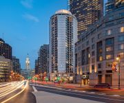
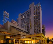
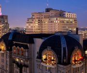
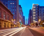
If you need a hotel, we compiled a list of available hotels close to the map centre further down the page.
While being here, you might want to pay a visit to some of the following locations: Camden, Woodbury, Media, Norristown and Doylestown. To further explore this place, just scroll down and browse the available info.
Local weather forecast
Todays Local Weather Conditions & Forecast: 16°C / 61 °F
| Morning Temperature | 7°C / 45 °F |
| Evening Temperature | 12°C / 54 °F |
| Night Temperature | 10°C / 50 °F |
| Chance of rainfall | 2% |
| Air Humidity | 28% |
| Air Pressure | 1032 hPa |
| Wind Speed | Gentle Breeze with 8 km/h (5 mph) from North-East |
| Cloud Conditions | Overcast clouds, covering 100% of sky |
| General Conditions | Light rain |
Sunday, 28th of April 2024
18°C (65 °F)
18°C (64 °F)
Moderate rain, gentle breeze, broken clouds.
Monday, 29th of April 2024
24°C (76 °F)
20°C (68 °F)
Moderate rain, light breeze, scattered clouds.
Tuesday, 30th of April 2024
17°C (62 °F)
18°C (65 °F)
Light rain, light breeze, overcast clouds.
Hotels and Places to Stay
The Ritz-Carlton Philadelphia
The Rittenhouse
Embassy Suites by Hilton Philadelphia Center City
Sheraton Philadelphia Downtown Hotel
Sheraton Philadelphia University City Hotel
Hyatt At The Bellevue
DoubleTree by Hilton Philadelphia Center City
ROOST Midtown
The Westin Philadelphia
Club Quarters in Philadelphia
Videos from this area
These are videos related to the place based on their proximity to this place.
DANCING AT ODUNDE AFRIKAN FESTIVAL
Filmed on location in Philadelphia, PA at Odunde Afrikan Festival June 9th, 2013.
Cat's & Squirrel on a Treadmill 09/19/2010.
Milo, Minnie & Squirrel balance on a tread mill 09/19/2010.
Videos provided by Youtube are under the copyright of their owners.
Attractions and noteworthy things
Distances are based on the centre of the city/town and sightseeing location. This list contains brief abstracts about monuments, holiday activities, national parcs, museums, organisations and more from the area as well as interesting facts about the region itself. Where available, you'll find the corresponding homepage. Otherwise the related wikipedia article.
Southwest Center City, Philadelphia
Southwest Center City (SWCC) is a neighborhood in South Philadelphia bordering Center City, Philadelphia, Pennsylvania. The neighborhood is bordered on the north by South Street, on the south by Washington Avenue, on the west by the Schuylkill River, and by Broad Street on the east. It is an area adjacent to the Fitler Square and Rittenhouse Square neighborhoods to the North and Point Breeze to the South.
Fitler Square, Philadelphia
Fitler Square is a city park in Philadelphia, Pennsylvania, bounded on the east by 23rd Street, on the west by 24th Street, on the north by Panama Street, and on the south by Pine Street. It is in the southwestern part of Philadelphia's Center City district. Fitler Square was named for late 19th century Philadelphia mayor Edwin Henry Fitler.
Rosenbach Museum & Library
The Rosenbach Museum & Library is located within two 19th-century townhouses at 2008 and 2010 Delancey Place in Philadelphia. The historic houses contain the collections and treasures of Philip Rosenbach and his younger brother Dr. A. S. W. Rosenbach. The brothers owned the Rosenbach Company which became the preeminent dealer of rare books, manuscripts and decorative arts during the first half of the 20th century. Dr.
University City (SEPTA station)
University City is a railway station in Philadelphia, Pennsylvania, along the SEPTA Main Line. The station serves the area around the University of Pennsylvania, and is located at South Street & Convention Avenue. It serves the Airport, Wilmington/Newark, and Media/Elwyn Regional Rail Lines. The station is less than a block from the University of Pennsylvania's Franklin Field and the Palestra.
Schuylkill, Philadelphia
Schuylkill is a neighborhood in the South Philadelphia region of Philadelphia, Pennsylvania. It has many different names and has also been called Graduate Hospital and Southwest Center City. Schuylkill is part of the 19146 postal code, which lies on the west side of Broad Street as far as 25th Street, where the Point Breeze neighborhood starts, and from the north side of Washington Avenue up to South Street.
Point Breeze, Philadelphia
Point Breeze is a neighborhood in the South Philadelphia section of Philadelphia, Pennsylvania, United States. It is generally bound by 25th Street to the west, Washington Avenue to the north, Broad Street to the east, and Mifflin Street to the south, although the sections between 18th Street and Broad Street are coming into their own neighborhood as Newbold. Southwest Center City lies to its north, and Passyunk Square lies to its east.
Civil War Museum of Philadelphia
The Civil War Museum of Philadelphia (formerly the Civil War and Underground Railroad Museum of Philadelphia and previously the Civil War Library and Museum) in Philadelphia, Pennsylvania, claims to be the oldest chartered American Civil War institution in the United States. The museum was founded in 1888 by veteran officers of the Union Army, Navy and Marine Corps.
West Philadelphia Borough, Pennsylvania
West Philadelphia Borough, also known as West Philadelphia District, is a defunct borough that was located west of the Schuylkill River in Blockley Township, Philadelphia County, Pennsylvania. The borough ceased to exist and was incorporated into the City of Philadelphia following the passage of the Act of Consolidation, 1854.
24th Street Station (Philadelphia)
24th St. Station was an intercity railroad station built for the Baltimore and Ohio Railroad, designed by architect Frank Furness. It stood at 24th and Chestnut Streets in Philadelphia, Pennsylvania, and opened in 1888. The station was essentially built on stilts, with the main entrance from the Chestnut Street Bridge, 30 feet above ground level. The B&O trains ran under the bridge along the east bank of the Schuylkill River.
Chestnut Street Bridge
The Chestnut Street Bridge is a bridge across the Schuylkill River that carries Chestnut Street in Philadelphia, USA. The original 1861 bridge was "a bridge whose scale and use of cast iron made it singular in the United States and throughout the world". The 1957 bridge, now one way, carries PA Route 3 eastbound and continues to help connect West Philadelphia with the rest of the city.
Devil's Pocket, Philadelphia
Devil's Pocket is a neighborhood in the South Philadelphia section of Philadelphia, Pennsylvania. It is south of Lombard Street, east of 27th Street and north of Washington Avenue, on the western edge of Southwest Center City. Devil's Pocket is a very small neighborhood of rowhouses tucked near an industrial landscape along the banks of the river. It has historically been heavily Irish-American.
Walnut Street (Philadelphia)
Walnut Street is located in downtown Philadelphia and extends from the city's Delaware River waterfront through Center City and West Philadelphia. Walnut Street has been characterized as "the city's premier shopping district". A portion of the street was ranked 12th in 2005 by Women's Wear Daily among its list of the most expensive retail streets in North America, with rents of $90 per square foot and is home to several "upscale dining, retail and cultural" establishments.
Graduate Hospital
Graduate Hospital was a hospital in the Southwest Center City neighborhood of Philadelphia, founded in 1916 and repurposed in 2007. Medical care began on the site in 1889 under the name Philadelphia Polyclinic. Currently, the site is a rehabilitation and long-term acute-care facility known as Penn Medicine at Rittenhouse.
Chestnut Street (Philadelphia)
Chestnut Street is a major historic street in Philadelphia, Pennsylvania. Originally named Wynne Street because Thomas Wynne's home was there. William Penn renamed it Chestnut Street in 1684. It runs east–west from the Delaware River waterfront in downtown Philadelphia through Center City and West Philadelphia. The road crosses the Schuylkill River on the Chestnut Street Bridge. It serves as eastbound Pennsylvania Route 3 between 63rd and 38th Streets.
Class of 1923 Arena
The Class of 1923 Arena is the skating rink of the University of Pennsylvania. In 1968, alumni from the Class of 1923 formed the group "Friends of Pennsylvania Hockey," led by Howard Butcher, III. Butcher donated over 3 million dollars for the creation of the facility, along with John Cleveland and Bill R. Wise, Butcher organized the largest class donation in the history of the university. Thus, the arena was aptly named after the class to commemorate its generosity.
Walnut Street Bridge (Philadelphia)
The Walnut Street Bridge in Philadelphia, Pennsylvania crosses the Schuylkill River between Center City and West Philadelphia, and carries Walnut Street, a westbound street. Completed in 1991 after several years of construction, this modern highway-type bridge replaced a span completed in 1893. The 1893 bridge was a 60-foot-wide concrete structure with three steel Pratt trusses mounted on four heavy oblong concrete abutments and piers.
Gallery 339
Gallery 339 is a photographic art gallery located in Philadelphia, USA. The gallery promotes the work of distinguished and emerging photographers from around the world. The gallery's focus is thoughtful, carefully made work, extending across the spectrum of contemporary photography from antique processes used to explore current issues, to digital processes used to consider timeless questions in art.
Church of the New Jerusalem (Philadelphia)
The Church of the New Jerusalem was a former nineteenth-century Swedenborgian church located in downtown Philadelphia, Pennsylvania at 22nd and Chestnut Streets. The church was erected in 1881 to designs by Theophilus Parsons Chandler. When the congregation diminished, the church closed in the mid-1980s, and the structure was reused in 1989 as office space.
Schuylkill River Park
Schuylkill River Park is a swath of land owned by Fairmount Park in Philadelphia, Pennsylvania. It encompasses most of the area bordered by 25th Street and the Schuylkill River (more exactly the CSX Tracks) between Manning and Delancey Streets and the area bordered by the Schuylkill River and 26th Street between Delancey and Pine Streets.
Schuylkill Arsenal Railroad Bridge
Schuylkill Arsenal Railroad Bridge was built in 1885–86 by the Pennsylvania Railroad as a formerly electrified, wrought iron, two-track, deck truss, (fixed shut) swing bridge across the Schuylkill River in the University City neighborhood in Philadelphia, Pennsylvania. The name comes from the Schuylkill Arsenal, which functioned from 1799 to 1926, located near the eastern approaches to this bridge. The University of Pennsylvania's Meiklejohn Stadium is next to the western approach to the bridge.
Weave Bridge
The Weave Bridge is a 145 ft bridge at The University of Pennsylvania, USA which was conceptualized by Cecil Balmond and engineered by Ammann & Whitney. It was commissioned by the University in 2007, and opened in June 2009. The bridge creates a pedestrian passage over the Amtrak train tracks that currently separate the main campus from athletic fields along the Schuylkill River. The design features a "braided rope" structure consisting of six steel strands.
Philadelphia Free School
The Philadelphia Free School is a school in South Philadelphia, Pennsylvania that operates on the democratic education or Sudbury school model. The school, which opened in fall 2011, is open to students from Pre-K to 12th grade. Citing low graduation rates of Philadelphia public school students and studies that show Pennsylvania has one of the largest achievement gaps between students above and below the poverty line, the school emphasizes results rather than standardization and hierarchy.
Duck Girl (Manship)
Duck Girl is a bronze sculpture, by Paul Manship. It is located at Rittenhouse Square, near 18th street and Walnut Street, Philadelphia. It was installed in Cloverly Park, in 1916, and moved to storage in 1956, but relocated to Rittenhouse Square. The sculpture won the Widener Gold Medal, from the Pennsylvania Academy of the Fine Arts, in 1914.
Penn Park
Penn Park is a 24-acre park on the campus of the University of Pennsylvania in Philadelphia, Pennsylvania. The park features two athletic fields, a multipurpose stadium with 470 seats, a tennis center, a seasonal air structure, and picnic areas.
First Presbyterian Church (Philadelphia)
The First Presbyterian Church in Philadelphia is located on 21st and Walnut. It boasts an array of architectural styles of leading Philadelphia architects.


