Safety Score: 2,7 of 5.0 based on data from 9 authorites. Meaning we advice caution when travelling to United States.
Travel warnings are updated daily. Source: Travel Warning United States. Last Update: 2024-04-25 08:17:04
Explore Point Breeze
The district Point Breeze of Philadelphia in Philadelphia County (Pennsylvania) is located in United States about 122 mi north-east of Washington DC, the country's capital.
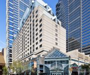
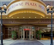
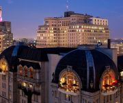
If you need a place to sleep, we compiled a list of available hotels close to the map centre further down the page.
Depending on your travel schedule, you might want to pay a visit to some of the following locations: Camden, Woodbury, Media, Norristown and Doylestown. To further explore this place, just scroll down and browse the available info.
Local weather forecast
Todays Local Weather Conditions & Forecast: 12°C / 53 °F
| Morning Temperature | 9°C / 48 °F |
| Evening Temperature | 14°C / 58 °F |
| Night Temperature | 9°C / 48 °F |
| Chance of rainfall | 0% |
| Air Humidity | 37% |
| Air Pressure | 1027 hPa |
| Wind Speed | Gentle Breeze with 8 km/h (5 mph) from South |
| Cloud Conditions | Overcast clouds, covering 88% of sky |
| General Conditions | Overcast clouds |
Friday, 26th of April 2024
15°C (59 °F)
9°C (48 °F)
Sky is clear, gentle breeze, clear sky.
Saturday, 27th of April 2024
16°C (62 °F)
12°C (54 °F)
Overcast clouds, gentle breeze.
Sunday, 28th of April 2024
19°C (66 °F)
18°C (64 °F)
Light rain, light breeze, broken clouds.
Hotels and Places to Stay
UrHip @ Rittenhouse
Kimpton Hotel Palomar Philadelphia
ROOST Midtown
The Westin Philadelphia
Sonesta Philadelphia Downtown
Hyatt At The Bellevue
Club Quarters in Philadelphia
A Boutique Hotel Rittenhouse 1715
DoubleTree by Hilton Philadelphia Center City
ROOST RITTENHOUSE
Videos from this area
These are videos related to the place based on their proximity to this place.
Point Breeze Marches for People-First Development
On the 50th anniversary of MLK's March on Washington, residents of the Point Breeze section of South Philadelphia gathered to remember his legacy and stand up for justice. Long term residents...
1.1 Point Breeze 4.12.2009: Lessons in the Aqeedah of Ahlus Sunnah wal Jamaa'ah
Beneficial Ash'ari Ahlus Sunnah Playlists by Abdur Rahman As Sondalaani: The Articles of Faith: from The Daughters of the Deen Show http://www.youtube.com/playlist?list=PLD66562E2B42CE03E...
Videos provided by Youtube are under the copyright of their owners.
Attractions and noteworthy things
Distances are based on the centre of the city/town and sightseeing location. This list contains brief abstracts about monuments, holiday activities, national parcs, museums, organisations and more from the area as well as interesting facts about the region itself. Where available, you'll find the corresponding homepage. Otherwise the related wikipedia article.
South Philadelphia
South Philadelphia, nicknamed South Philly, is the section of Philadelphia bounded by South Street to the north, the Delaware River to the east and south, and the Schuylkill River to the west.
Southwest Center City, Philadelphia
Southwest Center City (SWCC) is a neighborhood in South Philadelphia bordering Center City, Philadelphia, Pennsylvania. The neighborhood is bordered on the north by South Street, on the south by Washington Avenue, on the west by the Schuylkill River, and by Broad Street on the east. It is an area adjacent to the Fitler Square and Rittenhouse Square neighborhoods to the North and Point Breeze to the South.
Fitler Square, Philadelphia
Fitler Square is a city park in Philadelphia, Pennsylvania, bounded on the east by 23rd Street, on the west by 24th Street, on the north by Panama Street, and on the south by Pine Street. It is in the southwestern part of Philadelphia's Center City district. Fitler Square was named for late 19th century Philadelphia mayor Edwin Henry Fitler.
Rosenbach Museum & Library
The Rosenbach Museum & Library is located within two 19th-century townhouses at 2008 and 2010 Delancey Place in Philadelphia. The historic houses contain the collections and treasures of Philip Rosenbach and his younger brother Dr. A. S. W. Rosenbach. The brothers owned the Rosenbach Company which became the preeminent dealer of rare books, manuscripts and decorative arts during the first half of the 20th century. Dr.
Point Breeze, Philadelphia
Point Breeze is a neighborhood in the South Philadelphia section of Philadelphia, Pennsylvania, United States. It is generally bound by 25th Street to the west, Washington Avenue to the north, Broad Street to the east, and Mifflin Street to the south, although the sections between 18th Street and Broad Street are coming into their own neighborhood as Newbold. Southwest Center City lies to its north, and Passyunk Square lies to its east.
Girard Estate, Philadelphia
Girard Estate, also known as Girard Estates, is part of South Philadelphia. Its boundaries stretch from South 22nd Street on the west to South 17th Street on the east.
Hawthorne, Philadelphia
Hawthorne is a neighborhood in the South Philadelphia section of Philadelphia, Pennsylvania. It is located between Broad Street and 11th Street, and extends from South Street to Washington Avenue.
Girard Academic Music Program
The Girard Academic Music Program (GAMP) is a magnet secondary school in Philadelphia, Pennsylvania. The school is operated by the School District of Philadelphia. GAMP covers grades five through twelve, and offers many extracurricular activities including: concert band, orchestra, chamber strings, jazz band, concert choir, high school and middle school choirs, middle school band, theatre productions, instrumental lessons for beginners.
Civil War Museum of Philadelphia
The Civil War Museum of Philadelphia (formerly the Civil War and Underground Railroad Museum of Philadelphia and previously the Civil War Library and Museum) in Philadelphia, Pennsylvania, claims to be the oldest chartered American Civil War institution in the United States. The museum was founded in 1888 by veteran officers of the Union Army, Navy and Marine Corps.
Devil's Pocket, Philadelphia
Devil's Pocket is a neighborhood in the South Philadelphia section of Philadelphia, Pennsylvania. It is south of Lombard Street, east of 27th Street and north of Washington Avenue, on the western edge of Southwest Center City. Devil's Pocket is a very small neighborhood of rowhouses tucked near an industrial landscape along the banks of the river. It has historically been heavily Irish-American.
Philadelphia High School for the Creative and Performing Arts
The Philadelphia High School for Creative and Performing Arts is a magnet school in South Philadelphia, Philadelphia, Pennsylvania. It is a part of the School District of Philadelphia. Students major in one of six areas: Creative Writing, Instrumental Music, Visual Arts, Theater, Dance, and Vocal Music. The school, commonly referred to as CAPA, is currently located on South Broad Street, in the old Ridgeway Library.
Ellsworth–Federal (SEPTA station)
Ellsworth–Federal is a subway station on SEPTA's Broad Street Line in Philadelphia, Pennsylvania. The station opened on September 18, 1938, and is located at the eastern edge of the Italian Market on Broad Street, between Ellsworth and Federal Streets. It is served by Broad Street Line local trains only, with one platform.
South Philadelphia High School
South Philadelphia High School also known as Southern High is a public secondary high school located in the south section of Philadelphia, Pennsylvania, at the intersection of Broad Street and Snyder Avenue, just north of the South Philadelphia Sports Complex residential neighborhood, Marconi Plaza, Franklin Delano Roosevelt Park, Philadelphia Naval Shipyard and near the Passyunk Avenue urban corridor of shops and restaurants.
Lombard Street (Philadelphia)
Lombard Street is an east-west street in Center City, Philadelphia, Pennsylvania. It runs from Front Street, near the Delaware River, on the east, to 27th St. , near the Schuylkill River, on the west. Unlike many east-west street names in Philadelphia, the "Lombard" name is not continued in West Philadelphia. Historically, the eastern end of Lombard St. was home to one of the oldest free black neighborhoods in the United States, which was displaced during urban redevelopment since the 1950s.
Stephen Girard Park
Stephen Girard Park is a 4-acre park in Philadelphia, Pennsylvania, in the South Philadelphia neighborhood at 21st and Shunk Streets. It is maintained by the City of Philadelphia's Fairmount Park Commission. The park was established in 1953 on land donated by Stephen Girard, and includes a house formerly owned by the Girard family. The house was named Gentilehommiere. {{#invoke:Coordinates|coord}}{{#coordinates:39.920339|-75.183145||||||| |primary |name= }}
Graduate Hospital
Graduate Hospital was a hospital in the Southwest Center City neighborhood of Philadelphia, founded in 1916 and repurposed in 2007. Medical care began on the site in 1889 under the name Philadelphia Polyclinic. Currently, the site is a rehabilitation and long-term acute-care facility known as Penn Medicine at Rittenhouse.
Tasker–Morris (SEPTA station)
Tasker-Morris is a rapid transit passenger rail station on SEPTA's Broad Street Line. It is located at 1600 South Broad Street in Philadelphia, Pennsylvania and serves only local trains. The station is named for the nearby Tasker Street to the north and Morris Street to the south. In between the two streets is a customer service office for the Philadelphia Gas Works. The song "Tasker-Morris Station" by The Menzingers is about the station.
Snyder (SEPTA station)
Snyder is a rapid transit passenger rail station on SEPTA's Broad Street Line in South Philadelphia, Pennsylvania. It is located at 2100 South Broad Street, and is named for Snyder Avenue. The station provides access to a Greyhound Bus stop named "Fairfax Bus and Bagel. " Originally built in 1938, Snyder station was the southern terminus of the Broad Street Line until 1973, when it was extended to Pattison Station (now known as AT&T station).
Passyunk Square, Philadelphia
Passyunk Square is a neighborhood in South Philadelphia bounded by Broad Street to the west, 6th Street to the east, Tasker Street to the south and Washington Avenue to the north. Passyunk Square is bordered by the Bella Vista, Hawthorne, Central South Philadelphia, Wharton and Point Breeze neighborhoods. The park bounded by 12th, 13th, Wharton and Reed Streets in this neighborhood now known as Columbus Square was formerly known as "Passyunk Square".
Wharton, Philadelphia
Wharton is a neighborhood in South Philadelphia. Its boundaries are difficult to ascertain; the City of Philadelphia states it is along Wharton Street, west of Pennsport, and east of Point Breeze. According to this description, the neighborhood runs from about 4th Street to Broad, with no clear north to south boundaries. By other descriptions, the neighborhood runs from 8th to 13th Streets (east to west) and Wolf to Tasker Streets (south to north).
Moyamensing Prison
Moyamensing Prison was a prison in Philadelphia, Pennsylvania, designed by Thomas U. Walter and completed in 1835.
Gallery 339
Gallery 339 is a photographic art gallery located in Philadelphia, USA. The gallery promotes the work of distinguished and emerging photographers from around the world. The gallery's focus is thoughtful, carefully made work, extending across the spectrum of contemporary photography from antique processes used to explore current issues, to digital processes used to consider timeless questions in art.
Philadelphia Free School
The Philadelphia Free School is a school in South Philadelphia, Pennsylvania that operates on the democratic education or Sudbury school model. The school, which opened in fall 2011, is open to students from Pre-K to 12th grade. Citing low graduation rates of Philadelphia public school students and studies that show Pennsylvania has one of the largest achievement gaps between students above and below the poverty line, the school emphasizes results rather than standardization and hierarchy.
West Passyunk
West Passyunk is a neighborhood in South Philadelphia. It is bound by Mifflin Street to the North, West Passyunk Avenue to the South, South 18th Street to East, and South 25th Street to the West. It is served by the 1st Police District, located at 24th and Wolf Streets.
Dickinson Narrows, Philadelphia
Dickinson Narrows is now called "Dickinson Square West, it is a neighborhood in South Philadelphia and is partially a sector of larger existing areas, Pennsport and Passyunk Square. It is bound by Washington Avenue to the North, Mifflin Street to the South, 4th Street to the East, and 6th Street to the West.


