Safety Score: 2,7 of 5.0 based on data from 9 authorites. Meaning we advice caution when travelling to United States.
Travel warnings are updated daily. Source: Travel Warning United States. Last Update: 2024-05-20 08:01:38
Discover Cobbs Creek
The district Cobbs Creek of Angora in Philadelphia County (Pennsylvania) is a subburb in United States about 120 mi north-east of Washington DC, the country's capital city.
If you need a hotel, we compiled a list of available hotels close to the map centre further down the page.
While being here, you might want to pay a visit to some of the following locations: Philadelphia, Camden, Woodbury, Media and Norristown. To further explore this place, just scroll down and browse the available info.
Local weather forecast
Todays Local Weather Conditions & Forecast: 25°C / 77 °F
| Morning Temperature | 13°C / 56 °F |
| Evening Temperature | 24°C / 75 °F |
| Night Temperature | 17°C / 63 °F |
| Chance of rainfall | 0% |
| Air Humidity | 52% |
| Air Pressure | 1017 hPa |
| Wind Speed | Gentle Breeze with 6 km/h (4 mph) from North |
| Cloud Conditions | Few clouds, covering 12% of sky |
| General Conditions | Few clouds |
Tuesday, 21st of May 2024
26°C (78 °F)
18°C (65 °F)
Few clouds, gentle breeze.
Wednesday, 22nd of May 2024
28°C (83 °F)
23°C (73 °F)
Light rain, gentle breeze, clear sky.
Thursday, 23rd of May 2024
26°C (79 °F)
19°C (66 °F)
Moderate rain, gentle breeze, overcast clouds.
Hotels and Places to Stay
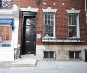
UrHip @ Rittenhouse
Hilton Philadelphia City Avenue
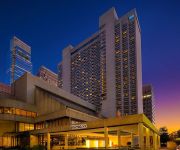
Sheraton Philadelphia Downtown Hotel
Sheraton Philadelphia University City Hotel
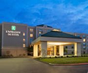
Embassy Suites by Hilton Philadelphia Airport
Four Points by Sheraton Philadelphia Airport
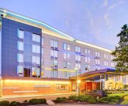
Aloft Philadelphia Airport
Sheraton Suites Philadelphia Airport
DoubleTree by Hilton Philadelphia Airport
The Inn at Penn a Hilton Hotel
Videos from this area
These are videos related to the place based on their proximity to this place.
UDFD Tower responding from Station 36
Here is Upper Darby Fire Department's Tower 74 (Primos-Secane-Westbrook Park Fire Co) leaving Station 36 (Cardington-Stonehurst) as they, as well as Co. 20 (Garrettford-Drexel Hill), respond...
4944 Walton Ave - University CIty, West Philadelphia real estate
A quintessential West Philly house in a great location off Baltimore Ave, this perfect-sized home has all the right upgrades—new kitchen, bath, roof and windows—along with charming original...
Jim Zaspel Rent to Own 6401 Catharine St., Philadelphia, PA 19143
Schedule a showing to see our newly rehabbed modern home for sale in Philadelphia. Buy this home with bad credit with our rent to own program. Our rent to own program will work even if you...
Jim Zaspel Rent to Own 5234 Irving St., Philadelphia, PA 19139
Schedule a showing to see our newly rehabbed modern home for sale in Philadelphia. Buy this home with bad credit with our rent to own program. Our rent to own program will work even if you...
Damone Jones Basketball #1
Class of 2015 point guard Damone Jones of The Christian Academy has the great assist to class of 2015 shooting guard Sianni Martin Of Neumann-Goretti.
Palm Warbler Tail Pumping, Spring 2012, Cobbs Creek Park, Philadelphia
Palm Warbler, in Cobbs Creek Park, Philadelphia, April 15th, 2012. Just south of the EEC (Environmental Education Center) at the end of Catharine street. Note the characteristic, incessant...
621 S Conestoga St - West Philadelphia real estate
West Philly's most popular builder does it again, bringing his trademark quality renovations and respect for original details to a nice Cobb's Creek block. This classic porchfront rowhome was...
5459 WEBSTER ST, PHILADELPHIA, PA Presented by Joshua McKnight.
Click to see more: http://www.searchallproperties.com/listings/2035263/5459-WEBSTER-ST-PHILADELPHIA-PA/auto?reqpage=video 5459 WEBSTER ST PHILADELPHIA, PA 19...
Videos provided by Youtube are under the copyright of their owners.
Attractions and noteworthy things
Distances are based on the centre of the city/town and sightseeing location. This list contains brief abstracts about monuments, holiday activities, national parcs, museums, organisations and more from the area as well as interesting facts about the region itself. Where available, you'll find the corresponding homepage. Otherwise the related wikipedia article.
MOVE
MOVE or the MOVE Organization is a Philadelphia-based black liberation group founded by John Africa. MOVE was described by CNN as "a loose-knit, mostly black group whose members all adopted the surname Africa, advocated a "back-to-nature" lifestyle and preached against technology. " In addition, MOVE members were vegans and passionate supporters of animal rights. The group lived communally and frequently engaged in public demonstrations related to issues they deemed important.
East Lansdowne, Pennsylvania
East Lansdowne is a borough in Delaware County, Pennsylvania, United States. The population was 2,668 at the 2010 census.
Millbourne, Pennsylvania
Millbourne is a borough in Delaware County, Pennsylvania, United States. The population was 1159 at the 2010 census. Millbourne borders Philadelphia along Cobbs Creek. Some people believe, incorrectly, the Borough is part of neighboring Upper Darby, as Millbourne students attend Upper Darby School District schools.
Yeadon, Pennsylvania
Yeadon is a borough in Delaware County, Pennsylvania, United States. It borders the City of Philadelphia. The population was 11,762 at the 2000 census.
Kingsessing, Philadelphia
Kingsessing is a neighborhood in the Southwest section of Philadelphia, Pennsylvania, United States, located adjacent to the neighborhoods of Cedar Park, Southwest Schuykill, and Mount Moriah, as well as Yeadon in Delaware County. It is roughly bounded by Cobbs Creek and 60th Street to the southwest, Woodland Avenue to the southeast, 53rd Street to the northeast, and Baltimore Avenue to the northwest.
Cobbs Creek, Philadelphia
Cobbs Creek is a predominantly African American neighborhood located in the West Philadelphia section of Philadelphia, Pennsylvania, United States . Cobbs Creek is generally bound by Market Street to the north, Baltimore Avenue to the south, 52nd Street to the east, and Cobbs Creek Parkway to the west.
Angora (SEPTA station)
Angora is a railway station in Philadelphia, Pennsylvania along the Media/Elwyn Line. It is officially located at 58th Street near Baltimore Avenue in West Philadelphia's Angora neighborhood, however the actual location is south of Baltimore Avenue. Part of Cobbs Creek Parkway runs along 58th Street between Baltimore Avenue, over the railroad bridge, to nearby Hoffman Avenue.
Fernwood–Yeadon (SEPTA station)
Fernwood-Yeadon is a United States railway station along the SEPTA West Chester Line. It is located at Church Lane and Penn Boulevard. It serves the Media/Elwyn Line. The station originally had a wooden pedestrian bridge and a grade crossing. Fernwood-Yeadon Station is east of the terminus of the former Newtown Square Branch of the Pennsylvania Railroad. South of the station is the Yeadon Loop, which is a terminus for the SEPTA Route 13 trolley for the SEPTA Subway-Surface Trolley Lines.
WPEB
WPEB is a variety formatted broadcast radio station licensed to Philadelphia, Pennsylvania. Due to WPEB's low wattage, the station only serves West Philadelphia and the University City Neighborhood. WPEB is owned and operated by Scribe Video Center, Inc.
Angora Loop (SEPTA station)
The Angora Loop is the western terminus of the SEPTA Subway-Surface trolley Route 34 in the Angora neighborhood of Southwest Philadelphia. It is near where Baltimore Avenue crosses Cobbs Creek into Delaware County. Trolleys run from here to Center City Philadelphia. The Angora Loop lies just west of Angora Regional Railroad Station, which serves the SEPTA Media/Elwyn Line.
Mount Moriah (SEPTA station)
Mt. Moriah is a trolley stop on the SEPTA Subway Surface 13 trolley in Southwest Philadelphia. Located at Kingsessing Ave & Cemetery Ave, there is a loop there for trolleys that do not go on the full route to Yeadon or Darby to turn around and go back to Center City Philadelphia. The stop is named for the Mount Moriah Cemetery next to the stop. The cemetery is named after Mount Moriah in Jerusalem, Israel and the Biblical Book of Genesis.
Yeadon (SEPTA station)
Yeadon is a trolley stop on the SEPTA Subway Surface 13 trolley in Yeadon, Pennsylvania. Trolleys arrive at this station from Center City Philadelphia and most of them end their routes there at the Yeadon Loop. Some trolleys continue from there to nearby Darby, Pennsylvania.
Angora, Philadelphia
Angora is a neighborhood in the Southwest section of Philadelphia, Pennsylvania, United States. Although its boundaries are not precise, West Philadelphia is to its north, Kingsessing is to the south, Cedar Park is to the east, and Cobbs Creek is to the west. The Angora Commuter Rail Station on the Media/Elwyn Line, two bus lines (routes 46 and "G"), and a trolley line all intersect around Baltimore Avenue and 58th Street, which is unofficially the nexus of the neighborhood.
Millbourne (SEPTA station)
Millbourne Station is a ground-level stop on the Market-Frankford Line, near the intersection of Millbourne Avenue and Market Street in Millbourne, Pennsylvania. The station was formerly called 66th Street, as it is half way in between 63rd Street in Philadelphia and 69th Street in Upper Darby. It was reopened on June 16, 2008 following a total reconstruction. Before reconstruction, only "B" trains stopped at Millbourne.
63rd Street (SEPTA station)
63rd Street Station is an elevated stop on the Market-Frankford Line, above the intersection of 63rd St and Market St in Philadelphia, Pennsylvania, in the Haddington neighborhood. It is the westernmost stop on the Market-Frankford Line that is located within the Philadelphia city limits. The station was opened on March 4, 1907 by the Philadelphia Rapid Transit Company. It was closed on June 13, 2008 for total reconstruction and reopened on May 4, 2009.
60th Street (SEPTA station)
60th St Station is an elevated stop on the Market-Frankford Line, above the intersection of 60th Street and Market Street in Philadelphia, Pennsylvania. The Haddington neighborhood lies to the north of the station, while the area to the south is considered to be part of Cobbs Creek. SEPTA bus route 46 serves 60th Street Station. The station was opened on March 4, 1907 by the Philadelphia Rapid Transit Company, and after a renovation project was reopened on Monday, June 18, 2007.
56th Street (SEPTA station)
56th Street Station is an elevated stop on the Market-Frankford Line, above the intersection of 56th Street and Market Street in Philadelphia, Pennsylvania. The Haddington neighborhood lies to the north, and the Cobbs Creek neighborhood to the south. SEPTA bus route at 56th Street is route G. 56th Street Station was built in 1907 by the Philadelphia Rapid Transit Company and reconstructed in 2005 as part of SEPTA's reconstruction of the Market Street Elevated line.
52nd Street (SEPTA station)
52nd Street Station is an elevated stop on the Market-Frankford Line, above the intersection of 52nd Street and Market Street in Philadelphia, Pennsylvania. The station lies at the junction of four neighborhoods. Haddington is to the northwest, Dunlap to the northeast, Walnut Hill lies to the southeast, and Cobbs Creek to the southwest. SEPTA bus route at 52nd Street include route 52. 52nd Street is a major shopping corridor.
Mount Moriah Cemetery (Philadelphia)
Mount Moriah Cemetery is a historic cemetery in southwest Philadelphia, Pennsylvania, along Cobbs Creek. It was incorporated on March 27, 1855 and established by an act of the Pennsylvania Legislature. The cemetery, which originally occupied 54 acres, was among a number of cemeteries established along the "rural ideal" popular at that time. An ornate Romanesque entrance and gatehouse were built of brownstone on Islington Lane, today known as Kingsessing Avenue.
City of Conquerors, Philadelphia
City of Conquerors is a church started by We Are More Than Conquerors Deliverance Ministries. The current building is a former synagogue as evidenced by the Jewish symbols on the exterior of the building. The street address is 11 South 63rd Street, Philadelphia, PA.
Calvary United Methodist Church, Philadelphia
Calvary United Methodist Church is located on the southeast corner of 48th St. & Baltimore Ave. at 801 48th St. St. Philadelphia, PA 19143. Rev. John Pritchard is the pastor. The church was founded in 1896 as Calvary Methodist Episcopal and the current structure was completed in 1906. Calvary United Methodist Church rents space in its building to a number of churches and community groups, including the West Philadelphia Mennonite Fellowship, Crossroads Music, and the Prometheus Radio Project.
St. Cyprian Roman Catholic Church (Philadelphia)
St. Cyprian Catholic Church is located on the southwest corner of 63rd St. (Cobbs Creek Pkwy) and Hazel Ave. at 525 Cobbs Creek Parkway in Philadelphia, Pennsylvania. Reverend Msgr. Federico A Britto is the pastor. The church was founded in 2000 although the building was built in 1924. The campus also includes a parish, rectory, and school.
Boys' Latin of Philadelphia Charter School
Boys' Latin of Philadelphia Charter School is a Pennsylvania approved secondary charter school located in Philadelphia, Pennsylvania. Boys' Latin was created by David P. Hardy (CEO) and Janine Yass (founder). It was formerly known as Southwest Philadelphia Academy for Boys but was changed to Boys' Latin of Philadelphia prior to receiving its charter.
Mount Moriah, Philadelphia
Mount Moriah is a neighborhood in Southwest Philadelphia, east of Cobbs Creek in the vicinity of Kingsessing Avenue. The neighborhood shares it name with the Mount Moriah Cemetery which was founded next to Cobs Creek in 1855. The Joseph W. Catharine School was added to the National Register of Historic Places in 1988.
Callowhill Depot
Callowhill Depot is a bus and trolley barn operated by the Southeastern Pennsylvania Transportation Authority, located in West Philadelphia, near the Delaware County border. It was built in 1913 by the Philadelphia Rapid Transit Company (PRT) and was later operated by the Philadelphia Transportation Company (PTC) before being taken over by SEPTA. The depot was constructed as part of the Thomas E. Mitten modernization program.


