Safety Score: 3,0 of 5.0 based on data from 9 authorites. Meaning we advice caution when travelling to United Kingdom.
Travel warnings are updated daily. Source: Travel Warning United Kingdom. Last Update: 2024-05-05 08:24:42
Delve into Bow Street
Bow Street in Ceredigion (Wales) with it's 1,572 habitants is a city located in United Kingdom about 178 mi (or 287 km) west of London, the country's capital town.
Current time in Bow Street is now 12:35 AM (Monday). The local timezone is named Europe / London with an UTC offset of one hour. We know of 11 airports closer to Bow Street, of which 5 are larger airports. The closest airport in United Kingdom is Swansea Airport in a distance of 58 mi (or 93 km), South. Besides the airports, there are other travel options available (check left side).
There are several Unesco world heritage sites nearby. The closest heritage site in United Kingdom is Castles and Town Walls of King Edward in Gwynedd in a distance of 50 mi (or 80 km), North. Also, if you like playing golf, there is an option about 7 mi (or 11 km). away. We saw 1 points of interest near this location. In need of a room? We compiled a list of available hotels close to the map centre further down the page.
Since you are here already, you might want to pay a visit to some of the following locations: Aberystwyth, Lledrod, Tywyn, Corris and Llangybi. To further explore this place, just scroll down and browse the available info.
Local weather forecast
Todays Local Weather Conditions & Forecast: 16°C / 60 °F
| Morning Temperature | 9°C / 49 °F |
| Evening Temperature | 13°C / 56 °F |
| Night Temperature | 11°C / 52 °F |
| Chance of rainfall | 0% |
| Air Humidity | 70% |
| Air Pressure | 1005 hPa |
| Wind Speed | Gentle Breeze with 8 km/h (5 mph) from North-West |
| Cloud Conditions | Broken clouds, covering 79% of sky |
| General Conditions | Light rain |
Monday, 6th of May 2024
13°C (56 °F)
10°C (50 °F)
Moderate rain, moderate breeze, overcast clouds.
Tuesday, 7th of May 2024
12°C (54 °F)
9°C (48 °F)
Overcast clouds, gentle breeze.
Wednesday, 8th of May 2024
14°C (57 °F)
11°C (53 °F)
Overcast clouds, light breeze.
Hotels and Places to Stay
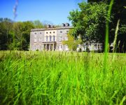
Nanteos Mansion Country House Hotel
Harry's
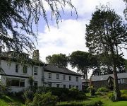
Conrah Country House
Four Seasons
Aberystwyth
Videos from this area
These are videos related to the place based on their proximity to this place.
Vale of Rheidol Railway Aberystwyth to Devils Bridge Short Version
RIDING ON THE VALE OF RHEIDOL RAILWAY FROM ABERYSTWYTH TO DEVILS BRIDGE.. VIEWS OF VALE OF RHEIDOL AND DEVILS BRIDGE.
Beth sy’n gwneud Aberystwyth yn le arbennig?
Am fwy o wybodaeth, ewch i: http://www.aber.ac.uk/cy/ Dilynwch ni ar: Facebook: http://www.aber.ac.uk/cy/social-media/fb-community/ Twitter: http://www.aber.ac.uk/cy/social-media/twitter/
Geraint Lewis Cymrawd, Prifysgol Aberystwyth
Am fwy o wybodaeth, ewch i: http://www.aber.ac.uk/cy/ Dilynwch ni ar: Facebook: http://www.aber.ac.uk/cy/social-media/fb-community/ Twitter: http://www.aber.ac.uk/cy/social-media/twitter/
Large Aberystwyth cottage - ideal for friends, family or University reunion | Llety Cambrian
Ideal for a group of friends, family gathering or a University reunion it is located only 1 mile from the Victorian seaside town of Aberystwyth and is set on a quiet private complex with a...
Prifysgol Aberystwyth TAR: Tudur Lloyd Evans (Cymraeg)
Am fwy o wybodaeth, ewch i: http://bit.ly/YI4drN Cerddoriaeth: 'Berceusounette' gan Popof (http://www.jamendo.com/en/track/11845/berceusounette)
Cynllun Iaith Prifysgol Aberystwyth
Am fwy o wybodaeth, ewch i: http://www.aber.ac.uk/cy/ Dilynwch ni ar: Facebook: http://www.aber.ac.uk/cy/social-media/fb-community/ Twitter: http://www.aber.ac.uk/cy/social-media/twitter/
UK storm
Stormy seas and strong winds batter UK Sunday 27th October 2013 Location : Borth, Wales, UK Storm name : St Jude.
Videos provided by Youtube are under the copyright of their owners.
Attractions and noteworthy things
Distances are based on the centre of the city/town and sightseeing location. This list contains brief abstracts about monuments, holiday activities, national parcs, museums, organisations and more from the area as well as interesting facts about the region itself. Where available, you'll find the corresponding homepage. Otherwise the related wikipedia article.
Llanbadarn railway station
Llanbadarn railway station is a railway station serving the ancient villages of Llanbadarn Fawr and Pwllhobi near Aberystwyth in Ceredigion in Mid-Wales. It is an intermediate station on the Vale of Rheidol Railway. Alighting passengers are required to step down onto the grass as there is no platform. The Journey time is to Aberystwyth is five minutes, fifteen minutes to Capel Bangor, thirty five minutes to Aberffrwd and fifty five minutes to Devil's Bridge.
Glanyrafon railway station
Glanyrafon railway station (formerly Glanrafon) is a railway station serving Glanyrafon in Ceredigion in Mid-Wales. It is a request stop on the preserved Vale of Rheidol Railway. It is 2 miles 26 chains from Aberystwyth, and there is one platform. In 2012, an RETB signalling mast which was part of the Cambrian Line infrastructure was removed from the station, having been in place since the 1980s.
Penglais School
Penglais School is a comprehensive school situated in the town of Aberystwyth, Ceredigion, West Wales. It offers education to over 1,550 pupils aged 11 to 19. The school was established in 1973 and teaches mainly through the medium of English.
Coleg Ceredigion
Coleg Ceredigion is a bilingual further education college in Ceredigion. It has two campuses in the two largest towns in Ceredigion, namely Aberystwyth and Cardigan . The college's principal is Jacqui Weatherburn. The college's logo is a blue man with an orange scarf. It was founded in 1967. Coleg Ceredigion’s Mission is to contribute to the educational, social and economic development of the community through the provision of a wide range of high quality learning opportunities.
Castell Gwallter
Castell Gwallter is the remains of a Norman motte-and-bailey castle situated on a large hill above the old village of Llandre (Llanfihangel Genau'r Glyn) in northern Ceredigion, Wales. It was built around 1120 by Walter de Bec.
Rachel's Organic
Rachel's is an organic dairy products company based in Aberystwyth, Wales. Founded by local farmers but now a subsidiary of French company Lactalis, it was United Kingdom's first certified organic dairy.
Thomas Parry Library
The Thomas Parry Library at Aberystwyth is part of the library of the University of Wales Aberystwyth, and serves the Department of Information and Library Studies. The University Library joined the University's Computing and Audio-visual Units in 1995 to form the Information Service, University of Wales Aberystwyth.
Dôl-y-bont
Dol-y-Bont is a village in Cardiganshire, Wales lying near Borth, to the north of Llandre. Dôl is Welsh for "meadow". The village was the birthplace of Welsh bard and scholar Dewi Teifi and the retirement location of British physicist C. E. Wynn-Williams. The area experienced exensive flooding in June 2012.


