Safety Score: 3,0 of 5.0 based on data from 9 authorites. Meaning we advice caution when travelling to United Kingdom.
Travel warnings are updated daily. Source: Travel Warning United Kingdom. Last Update: 2024-04-27 08:23:39
Delve into Bodewryd
Bodewryd in Anglesey (Wales) is a town located in United Kingdom about 222 mi (or 358 km) north-west of London, the country's capital town.
Time in Bodewryd is now 04:22 PM (Saturday). The local timezone is named Europe / London with an UTC offset of one hour. We know of 12 airports closer to Bodewryd, of which 5 are larger airports. The closest airport in United Kingdom is Anglesey Airport in a distance of 11 mi (or 18 km), South-West. Besides the airports, there are other travel options available (check left side).
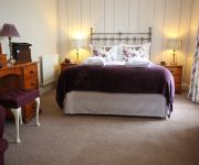
There are several Unesco world heritage sites nearby. The closest heritage site in United Kingdom is Castles and Town Walls of King Edward in Gwynedd in a distance of 33 mi (or 53 km), South-East. Also, if you like the game of golf, there are some options within driving distance. We saw 1 points of interest near this location. In need of a room? We compiled a list of available hotels close to the map centre further down the page.
Since you are here already, you might want to pay a visit to some of the following locations: Llanfaethlu, Llanfachraeth, Llangefni, Moelfre and Holyhead. To further explore this place, just scroll down and browse the available info.
Local weather forecast
Todays Local Weather Conditions & Forecast: 10°C / 50 °F
| Morning Temperature | 6°C / 42 °F |
| Evening Temperature | 9°C / 48 °F |
| Night Temperature | 8°C / 47 °F |
| Chance of rainfall | 0% |
| Air Humidity | 64% |
| Air Pressure | 1005 hPa |
| Wind Speed | Moderate breeze with 13 km/h (8 mph) from West |
| Cloud Conditions | Scattered clouds, covering 44% of sky |
| General Conditions | Scattered clouds |
Sunday, 28th of April 2024
8°C (46 °F)
10°C (49 °F)
Light rain, fresh breeze, overcast clouds.
Monday, 29th of April 2024
10°C (50 °F)
10°C (50 °F)
Moderate rain, high wind, near gale, overcast clouds.
Tuesday, 30th of April 2024
10°C (51 °F)
10°C (50 °F)
Moderate rain, strong breeze, overcast clouds.
Hotels and Places to Stay
Tre-Ysgawen Hall Country House Hotel
Lastra Farm Hotel
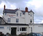
Trecastell Hotel
Videos from this area
These are videos related to the place based on their proximity to this place.
Estuary Cottage | Holiday Cottage in Dulas, near Moelfre, Anglesey
We are delighted to be able to offer Estuary Cottage to our guests. A converted barn, situated in the heart of the Lligwy estate, this really is an exquisite little house with the most delightful...
DJI Phantom FC40 - Parys Mountain - Cymru
Went to Parys Mountain this morning with the DJI Phantom, and finally got to use my cheap eBay gimbal along with some new batteries. The gimbal had...
AngleseyCottages - 5 star luxury self catering, pet friendly in 17 acres of unspoilt Anglesey,
http://www.anglesey-cottages.com/ doAnglesey.com Anglesey self catering 5 star luxury cottages Anglesey - Capel Coch Llanefni Anglesey dog friendly luxury holiday cottages Short breaks Anglesey...
Anglesey-Cottages
http://www.anglesey-cottages.com Anglesey Cottages - Luxury holiday cottages on Anglesey. Great for short break Anglesey dog friendly cottages. Anglesey self catering, holiday cottages on...
Llynon Lodge: Anglesey Holiday Cottage - Video Tour
Video tour of Llynon Lodge, a stunning 2 bedroomed holiday cottage to let in Llanddeusant, Anglesey. Romantic former gatehouse, recently refurbished to a very high standard. Video was taken...
Melin Llynnon - Lynnon Mill - Aerial Video
Filmed at Llynnon Mill on Anglesey using a Phantom 2 and GoPro Hero 3 Wedi'i ffilmio yn Melin Llynnon ar Ynys Môn gan ddefnyddio Phantom 2 a GoPro Hero 3 Purchase and DJI Phantom 2 from ...
How to collapse a static caravan
Scrapping a static caravan, Please see our facebook page for photos, http://www.facebook.com/pages/Pressure-Cleaning-Services/170863006311279.
Videos provided by Youtube are under the copyright of their owners.
Attractions and noteworthy things
Distances are based on the centre of the city/town and sightseeing location. This list contains brief abstracts about monuments, holiday activities, national parcs, museums, organisations and more from the area as well as interesting facts about the region itself. Where available, you'll find the corresponding homepage. Otherwise the related wikipedia article.
Llyn Alaw
Llyn Alaw is a man-made reservoir on Anglesey, North Wales managed by Dwr Cymru / Welsh Water. It is used to supply drinking water to the northern half of the island and does so at a rate of 35 million litres a day. Filling began in November 1965 flooding the existing marsh of Cors y Bol and was completed in January 1966. It was officially opened on October 21, 1966. The catchment is largely agricultural and few notable rivers feed into the lake.
Rhosgoch
Rhosgoch (Red Moor) is a small village in the north of the island of Anglesey, Wales. It is found 3.5 miles to the south-west of Amlwch. A short distance to the west of the village is the small lake Llyn Hafodol and a mile to the south is Anglesey's largest body of water the reservoir Llyn Alaw (Water Lily Lake). The village once was home to one of the stations on the Anglesey Central Railway. Although the tracks still exist no train has run on them since 1993.
Rhosgoch railway station
Rhosgoch railway station was situated on the Anglesey Central Railway line from Gaerwen to Amlwch. It had a small platform on the Down (west) side of the track, the original wooden building on which was replaced in 1882 by a brick building. To the north of the platform was a small goods yard. In the 1970s a private siding was constructed to connect the line to the Shell Oil Tank Farm nearby.
Cemais (Anglesey)
Cemais was one of the three medieval cantrefs on the island of Anglesey, north Wales, in the Kingdom of Gwynedd. It lay on the northern side of the island on the Irish Sea. The cantref consisted of the two cwmwds of Talybolion and Twrcelyn.
Carmel Head Thrust
Carmel Head Thrust is a geological fault on the northern part of the island of Anglesey in North Wales, where rocks of the Precambrian Mona Complex are thrust over Lower Paleozoic sedimentary rocks.
St Mary's Church, Bodewryd
St Mary's Church, Bodewryd is a small medieval church in the hamlet of Bodewryd, in Anglesey, north Wales. The date of construction is unknown, but there was a church on this site in 1254 and the earliest feature to which a date can be given is a doorway in a 15th-century style dating to around 1500.
St Peirio's Church, Rhosbeirio
St Peirio's Church, Rhosbeirio is a small disused medieval church, in Anglesey, north Wales. It is unclear when a church was first established on this site, although it has been said that this happened in about 605. The current structure, which may date from the 15th century, has been restored in the 18th and 19th centuries. It ceased being used for services some years ago and has been boarded up.
Llanfechell
Llanfechell is a village in Anglesey, North Wales, UK. It is the largest of several small villages and dispersed settlements that make up Mechell Community Council area. It is 11 miles east of Holyhead, and 5.6 miles west of Amlwch, on the north of the island. The Community (which also includes Mynydd Mechell and Carreglefn) has a 2001 population of 1,532. Village services include a church, a primary school, a pub and two chapels.


