Safety Score: 3,0 of 5.0 based on data from 9 authorites. Meaning we advice caution when travelling to United Kingdom.
Travel warnings are updated daily. Source: Travel Warning United Kingdom. Last Update: 2024-05-05 08:24:42
Explore Earlston
Earlston in The Scottish Borders (Scotland) with it's 1,780 inhabitants is a city in United Kingdom about 304 mi (or 489 km) north of London, the country's capital.
Local time in Earlston is now 08:39 AM (Monday). The local timezone is named Europe / London with an UTC offset of one hour. We know of 10 airports in the vicinity of Earlston, of which 5 are larger airports. The closest airport in United Kingdom is Edinburgh Airport in a distance of 35 mi (or 56 km), North-West. Besides the airports, there are other travel options available (check left side).
There are several Unesco world heritage sites nearby. The closest heritage site in United Kingdom is New Lanark in a distance of 18 mi (or 29 km), East. Also, if you like golfing, there are multiple options in driving distance. If you need a place to sleep, we compiled a list of available hotels close to the map centre further down the page.
Depending on your travel schedule, you might want to pay a visit to some of the following locations: Newtown St Boswells, Haddington, Dalkeith, Rochester and Kirknewton. To further explore this place, just scroll down and browse the available info.
Local weather forecast
Todays Local Weather Conditions & Forecast: 11°C / 52 °F
| Morning Temperature | 11°C / 52 °F |
| Evening Temperature | 12°C / 53 °F |
| Night Temperature | 10°C / 50 °F |
| Chance of rainfall | 5% |
| Air Humidity | 97% |
| Air Pressure | 1009 hPa |
| Wind Speed | Light breeze with 4 km/h (2 mph) from South |
| Cloud Conditions | Overcast clouds, covering 100% of sky |
| General Conditions | Light rain |
Tuesday, 7th of May 2024
10°C (49 °F)
8°C (46 °F)
Light rain, gentle breeze, overcast clouds.
Wednesday, 8th of May 2024
15°C (60 °F)
10°C (50 °F)
Light rain, moderate breeze, overcast clouds.
Thursday, 9th of May 2024
15°C (59 °F)
12°C (54 °F)
Light rain, moderate breeze, overcast clouds.
Hotels and Places to Stay
The Black Bull Hotel
Dryburgh Abbey Hotel
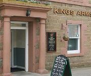
Kings Arms Hotel
Four Seasons Resort Anguilla
Videos from this area
These are videos related to the place based on their proximity to this place.
The Eildon Hills
A walk around the Eildon Hills near Melrose in the Scottish Borders. Starting on Eildon Hill North (the cairn) with views of the Leaderfoot Viaduct, Newton St Boswell and Melrose, then on to...
The Designer's House, Melrose, Scottish Borders - Self catering Accommodation Scotland
It is called the Designer's House for good reason, for the professional owner has invested all her skill in adorning this jewel of a cottage on the outskirts of the pretty town of Melrose in...
Burial Site Of Heart Of Robert The Bruce Melrose Abbey Scotland
Tour Scotland video of the burial site of the heart of King Robert the Bruce on visit to Melrose Abbey in the Scottish Borders. The embalmed heart of Robert the Bruce rests on the abbey's grounds,...
Amazing Abbey ruins Bandglittle's photos around Melrose and Jedburgh, United Kingdom (scotland)
Preview of Bandglittle's blog at TravelPod. Read the full blog here: http://www.travelpod.com/travel-blog-entries/bandglittle/uk2006/1164556680/tpod.html This blog preview was made by TravelPod...
Autumn Graveyard Melrose Abbey Borders Of Scotland
Tour Scotland Autumn video of the graveyard by Melrose Abbey on visit to the Scottish Borders.
Full Match - Edinburgh 10-11 Leicester Tigers
Full match of Edinburgh Rugby's pre-season friendly with Leicester Tigers from the Greenyards, Melrose. Stream provided in partnership with the Daily Record.
Leaderfoot Viaduct
Leaderfoot Railway Viaduct over the River Tweed to the east of Melrose in the Scottish Borders. Opened in 1863 and last used in 1965.
Videos provided by Youtube are under the copyright of their owners.
Attractions and noteworthy things
Distances are based on the centre of the city/town and sightseeing location. This list contains brief abstracts about monuments, holiday activities, national parcs, museums, organisations and more from the area as well as interesting facts about the region itself. Where available, you'll find the corresponding homepage. Otherwise the related wikipedia article.
Scott's View
Scott's View refers to a viewpoint in the Scottish Borders, overlooking the valley of the River Tweed, which is reputed to be one of the favourite views of Sir Walter Scott. The viewpoint can be located directly from a minor road leading south from Earlston just off the A68 and by travelling north from the village of St. Boswells up the slope of Bemersyde Hill. The view is around 3 miles east of Melrose. The view is to the west, and is dominated by the three peaks of Eildon Hill.
Earlston High School
Earlston High School is a secondary school in Earlston, Scottish Borders. It serves Earlston, as well as the surrounding area. It is in the middle of Earlston, off the A68 road. A new school building was completed in 2009.
Leaderfoot Viaduct
Leaderfoot Viaduct is a railway viaduct over the River Tweed in the Scottish Borders, Scotland. It is 2.5 km east of Melrose at grid reference NT574347. The viaduct was opened on 16 November 1863 to carry the Berwickshire Railway, which connected Reston with St Boswells (on the Edinburgh to Carlisle "Waverley Line"), via Duns and Greenlaw. The engineers of the railway were Charles Jopp and Wylie & Peddie.
River Leader
The River Leader, or Leader Water, is a small tributary of the River Tweed in Lauderdale in the Scottish Borders. It flows southwards from the Lammermuir Hills through the towns of Lauder and Earlston, joining the River Tweed at Leaderfoot.
Earlston railway station
Earlston railway station, in the Scottish Borders village of Earlston, was a station on the now disused Berwickshire Railway. There were two platforms (the location served as a passing loop) and two sidings, cattle dock and goods shed. The station closed to passenger traffic in 1948, and the last freight service operated on Friday 16 July 1965. The station closed completely, along with the line, on Monday 19 July 1965.
Legerwood Kirk
Legerwood Kirk is an ancient and historic Church of Scotland church in the former county of Berwickshire, Scotland. It is situated half a mile east of the hamlet of Legerwood and 6.5 miles south east of Lauder in the Scottish Borders, on an unclassified road east of the A68 highway at grid reference NT593433. The parish church at Legerwood serves a wholly agricultural community and there are barely any clusters of houses worthy of being known as a village.
Newstead Helmet
The Newstead Helmet is an iron Roman cavalry helmet dating to 80–100 AD that was discovered at the site of a Roman fort in Newstead, near Melrose in Roxburghshire, Scotland in 1905. It is now part of the Newstead Collection at the National Museum in Edinburgh. The helmet would have been worn by auxiliary cavalrymen in cavalry displays known as hippika gymnasia.
St Andrew's College, Drygrange
St Andrew's College, Drygrange, locate near Melrose, Scotland, was a Roman Catholic seminary founded in 1953 and closed in 1986.


