Safety Score: 3,0 of 5.0 based on data from 9 authorites. Meaning we advice caution when travelling to United Kingdom.
Travel warnings are updated daily. Source: Travel Warning United Kingdom. Last Update: 2024-04-26 08:02:42
Delve into Barnes
The district Barnes of Sunderland in Sunderland (England) is a district located in United Kingdom about 240 mi north of London, the country's capital town.
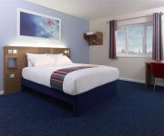
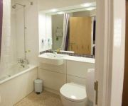
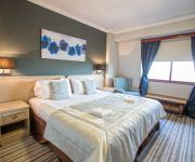
In need of a room? We compiled a list of available hotels close to the map centre further down the page.
Since you are here already, you might want to pay a visit to some of the following locations: Murton, South Shields, Haswell, Hawthorn and West Rainton. To further explore this place, just scroll down and browse the available info.
Local weather forecast
Todays Local Weather Conditions & Forecast: 8°C / 47 °F
| Morning Temperature | 4°C / 39 °F |
| Evening Temperature | 7°C / 44 °F |
| Night Temperature | 5°C / 41 °F |
| Chance of rainfall | 0% |
| Air Humidity | 65% |
| Air Pressure | 1006 hPa |
| Wind Speed | Gentle Breeze with 7 km/h (4 mph) from South |
| Cloud Conditions | Overcast clouds, covering 98% of sky |
| General Conditions | Overcast clouds |
Saturday, 27th of April 2024
8°C (46 °F)
6°C (43 °F)
Scattered clouds, gentle breeze.
Sunday, 28th of April 2024
8°C (46 °F)
6°C (43 °F)
Light rain, moderate breeze, overcast clouds.
Monday, 29th of April 2024
12°C (54 °F)
10°C (49 °F)
Scattered clouds, gentle breeze.
Hotels and Places to Stay
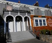
ROKER HOTEL
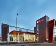
Hilton Garden Inn Sunderland
Sunderland Marriott Hotel
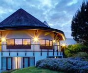
Seaham Hall
Quality Hotel Boldon
TRAVELODGE SUNDERLAND CENTRAL
TRAVELODGE SUNDERLAND HIGH STREET WEST
Sunderland A19/A1231
Highfield
Sunderland City Centre
Videos from this area
These are videos related to the place based on their proximity to this place.
London Campus - University of Sunderland video
www.sunderland.ac.uk/londoncampus See what students have to say about studying at the University of Sunderland London Campus, an exciting development based in Canary Wharf.
Engineering at the University of Sunderland
http://www.sunderland.ac.uk/ug/subjectareas/engineering/ Study an engineering degree in Sunderland. This video gives an overview of the course from staff and students.
Sunderland: a Life-Changing University
What does it mean to students who go to the University of Sunderland? "I absolutely love Sunderland - I don't want to leave." "I want another year" "Fantastic equipment" "The University...
University of Sunderland TV Advert 2014
Life changing, world changing, game changing. The inspirational new TV and cinema advert from the tomorrow makers and boundary breakers at the University of Sunderland.
What is Clearing? An animated guide, from the University of Sunderland
www.sunderland.ac.uk/clearing Didn't get the grades, and worried about going to university? This animation, by University of Sunderland graduate Catherine Salkeld explains what Clearing is,...
Indian students talk about the University of Sunderland London Campus
Experience a life-changing opportunity at the University of Sunderland, in the heart of London. www.sunderland.ac.uk/londoncampus.
Life-changing careers at the University of Sunderland
http://www.sunderland.ac.uk/jobs University of Sunderland staff talk about their experience working in Higher Education in a vibrant city by the sea.
British Dry Slope Ski Championships Dual Slalom 2012 at Sunderland
International Parallel Dual Slalom held after the British Dry Slope Ski Championships at the Silksworth Ski Centre, Sunderland on Saturday the 7th of July 2012. Teams from Scotland, Wales...
Design Degree Show 2014 - University of Sunderland
Students from the University of Sunderland's Arts, Design & Media faculty display their work for the eyes of the public, moderators and potential future employers. On display are striking examples...
Videos provided by Youtube are under the copyright of their owners.
Attractions and noteworthy things
Distances are based on the centre of the city/town and sightseeing location. This list contains brief abstracts about monuments, holiday activities, national parcs, museums, organisations and more from the area as well as interesting facts about the region itself. Where available, you'll find the corresponding homepage. Otherwise the related wikipedia article.
Stadium of Light
The Stadium of Light is an all-seater football stadium in Sunderland, England and home to Sunderland A.F.C. With space for 49,000 spectators, the Stadium of Light has the fifth-largest capacity of any English football stadium. The stadium primarily hosts Sunderland A.F.C. matches. The name Stadium of Light is a tribute to the traditional mining industry, which brought prosperity to the town; a Davy lamp monument stands at the entrance.
City of Sunderland
The City of Sunderland /ˈsʌndərlənd/ is a local government district of Tyne and Wear, in North East England, with the status of a city and metropolitan borough. It is named after its largest settlement, Sunderland, but covers a far larger area which includes the towns of Hetton-le-Hole, Houghton-le-Spring, Washington, and a range of suburban villages.
Sun FM
Sun FM is a radio station serving the City of Sunderland and also available in Tyne and Wear, northern parts of County Durham in England. It broadcasts on the frequency 103.4 MHz and plays a mix of contemporary and classic popular music alongside local news, travel and covered ground breaking dance music in the early 90's.
Wearside
Wearside is an area of North East England, centred on the continuous urban area formed by Sunderland, Seaham and other settlements by the River Wear. Mackems is a nickname used for the people of Wearside. The principal part of Wearside is the City of Sunderland, including Washington, Houghton-le-Spring, Shiney Row and in the south, Ryhope and Hetton-le-Hole. Additional settlements sometimes considered to be part of Wearside are Easington and Seaham.
A690 road
The A690 is a road in County Durham running from Sunderland in the east through Durham to Crook.
Millfield Metro station
Millfield is a suburb, a little to the west of the centre of Sunderland. This station dates from the opening of the Pelaw to Sunderland and South Hylton metro extension in 2002, but stands on the alignment of the former Sunderland to Durham mainline that fell to the Beeching Axe in the 1960s.
Barnes, Sunderland
Barnes is a suburb of the city of Sunderland, in northeast England, situated about a mile west of the city centre. The area is split into Barnes, which lies towards the east, and High Barnes, which lies around Barnes Park and the Bede Sixth Form Centre of City of Sunderland College. Barnes is bounded by Chester Road to the north, Durham Road on the south, Springwell Road to the west and the city centre to the east.
Park Lane Interchange
Park Lane 30px Park Lane Metro station was purpose-built for the Sunderland extension in 2002. Location Place Sunderland City Centre Local authority Sunderland Fare zone information Network One zone 4 Metro zone C Original (1979) zone 57 Station code PLI History Opened 2 May 1999 Park Lane Interchange is a busy transport interchange on the south-western fringe of the city centre of Sunderland, North East England.
University Metro station
University Metro Station on the Tyne and Wear Metro is located on the western fringe of Sunderland City Centre, and is the nearest station to the University of Sunderland's City Campus. It opened as part of the Sunderland extension in 2002 and is one of the three stations serving the city centre of Sunderland, the others being Park Lane and Sunderland (Central). The station can be accessed by footpaths from the A183 Chester Road and the A690 New Durham Road.
Sunderland Minster
Sunderland Minster Church of St Michaels and All Angels and St Benedict Biscop (commonly known as Sunderland Minster) is a church in Sunderland city centre, England. It was known as St Michael's Church, serving the parish of Bishopwearmouth, but was renamed on 11 January 1998 in recognition of Sunderland's city status. In May 2007 the Minster ceased to act as the parish church of Bishopwearmouth. It is one of the Greater Churches.
Sunderland Central (UK Parliament constituency)
Sunderland Central is a constituency represented in the House of Commons of the UK Parliament since its 2010 creation by Julie Elliott, a member of the Labour Party.
Sunderland High School
Sunderland High School is a coeducational independent day school in Sunderland, Tyne and Wear, England. Founded in 1883 as the oldest girls' senior school in Sunderland, it merged with a local boys' school to become the current coeducational school. A junior school was later added and is located on a separate site nearby. It is owned by the United Church Schools Trust.
Wearmouth Bridge
The Wearmouth Bridge is a through arch bridge across the River Wear in Sunderland. It is the final bridge over the river before its mouth with the North Sea. The current bridge is the third Wearmouth Bridge in its position. The first opened in 1796, and then was reconstructed in the 19th century.
Sunderland Art Gallery
The Sunderland Art Gallery is an art gallery based within the Sunderland Museum and Winter Gardens centre, in Sunderland City Centre. The collection of paintings includes works by the British artist, L.S. Lowry, many with local significance. For example, 'River Wear at Sunderland' (1961) and 'Girl in a Red Hat on a Promenade' (1972) - an enigmatic piece composed at Seaburn.
Mowbray Park
Mowbray Park is a municipal park in the centre of Sunderland, Tyne and Wear, England, located a few hundred yards from the busy throughfares of Holmeside and Fawcett Street and bordered by Sunderland Museum and Winter Gardens to the north, Burdon Road to the west, Toward Road to the east and Park Road to the south. The park was voted best in Britain in 2008.
Pallion Metro station
Pallion Metro Station is on the Green line of the Tyne and Wear Metro. The station opened as part of the Sunderland extension in 2002. The station is 150 metres north of the former Pallion mainline station, which closed in the 1960s. (The Metro route had to deviate from the original alignment due to road construction.
St Peter's Metro station
St Peter's Metro Station on the Tyne and Wear Metro is the nearest one to the University of Sunderland's St Peter's Campus. The station was built for the Sunderland extension in 2002. It is located at the northern approach viaducts of the Monkwearmouth railway bridge and a short distance south of Monkwearmouth Station Museum.
Monkwearmouth Railway Bridge
The Monkwearmouth railway bridge (also Sunderland railway bridge or Wearmouth railway bridge) is a rail bridge built 1879 crossing the River Wear at Sunderland and Monkwearmouth. The bridge lies adjacent to and upstream of the Wearmouth road bridge. Originally built as part of the Monwearmouth Junction line, it provided the first direct railway link between Newcastle and Sunderland. As of 2012 the bridge remains in use and is used by Tyne and Wear Metro and Durham Coast Line services.
Bishopwearmouth Cemetery
Bishopwearmouth Cemetery is a cemetery in Sunderland, Tyne and Wear, England. It lies between Hylton Road and Chester Road.
Plains Farm
Plains Farm (known locally as Plainsy) is a suburb of Sunderland, Tyne and Wear, England, and is a council-built housing estate, erected in the 1940s. Neighbouring areas include Silksworth, The Barnes, Thorney Close, Springwell and Farringdon. The housing in the area is run predominantly by Home Group and Gentoo Sunderland. Many houses are rented via the two companies; others have been purchased by home owners. The majority of housing is either Terraced or Semi Detached.
Monkwearmouth Colliery
Monkwearmouth Colliery (or Wearmouth Colliery) was a major North Sea coal mine located on the north bank of the River Wear, located in Sunderland. It was the largest mine in Sunderland and one of the most important in County Durham in northeast England. First opened in 1835 and in spite of the many accidents at the pit, the mine was the last to remain operating in the County Durham Coalfield.
St George's Church, Sunderland
St George's with Trinity and St James Church (abbreviated to St George's) is a United Reformed church in the Ashbrooke area of Sunderland, Tyne and Wear, England. Originally a Presbyterian church, it was constructed by John Bennie Wilson of Glasgow in 1888-90, to replace a former chapel on Villiers Street. Much of the funding was provided by a local shipowner, (later Sir) Robert Appleby Bartram, who laid the foundation stone on 7 February 1889.
North East England Mining Archive and Resource Centre
The North East England Mining Archive and Resource Centre (NEEMARC) is a major archive for mining related data and includes health and safety information, legal records, technical reports and trade union records. NEEMARC is situated within the Special Collections Room of the Murray Library at the University of Sunderland. The strong coal mining heritage of north-east England is still evident in annual events such as the Durham Miners' Gala.
Sunderland Wall
Sunderland Wall is an indoor climbing wall in Sunderland, Tyne and Wear, England, It is based in the Pallion area of sunderland. It is the largest and highest indoor climbing wall in United Kingdom, although it is thought it is also the highest in Europe. There are 32 lines with over 140 routes on the walls. It claims to have some of the best route setters in the United Kingdom. Sunderland Wall has a number of six metre, ten metre, sixteen metre and twenty-three metre walls.
Art Arena
ARTARENA is an "art film museum" planned for Sunderland in northeast England. It is intended to show items from the Roland Collection of Films on Art on 45 screens; visitors will wander between them wearing headphones that switch to the appropriate soundtrack. The original concept called for a futuristic €35m building in London. This gave way to a £2m reconstruction of the West Park United Reformed church on Stockton Road in Sunderland, which is planned to open in April 2012.


