Safety Score: 3,0 of 5.0 based on data from 9 authorites. Meaning we advice caution when travelling to United Kingdom.
Travel warnings are updated daily. Source: Travel Warning United Kingdom. Last Update: 2024-04-23 08:18:23
Delve into Monkwearmouth
The district Monkwearmouth of Sunderland in Sunderland (England) is a subburb in United Kingdom about 241 mi north of London, the country's capital town.
If you need a hotel, we compiled a list of available hotels close to the map centre further down the page.
While being here, you might want to pay a visit to some of the following locations: Murton, South Shields, Hawthorn, Shotton and Haswell. To further explore this place, just scroll down and browse the available info.
Local weather forecast
Todays Local Weather Conditions & Forecast: 7°C / 45 °F
| Morning Temperature | 6°C / 43 °F |
| Evening Temperature | 7°C / 44 °F |
| Night Temperature | 6°C / 42 °F |
| Chance of rainfall | 0% |
| Air Humidity | 70% |
| Air Pressure | 1025 hPa |
| Wind Speed | Moderate breeze with 13 km/h (8 mph) from South |
| Cloud Conditions | Overcast clouds, covering 100% of sky |
| General Conditions | Overcast clouds |
Wednesday, 24th of April 2024
7°C (44 °F)
5°C (40 °F)
Overcast clouds, moderate breeze.
Thursday, 25th of April 2024
10°C (50 °F)
8°C (46 °F)
Overcast clouds, light breeze.
Friday, 26th of April 2024
7°C (45 °F)
8°C (46 °F)
Light rain, gentle breeze, overcast clouds.
Hotels and Places to Stay
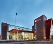
Hilton Garden Inn Sunderland
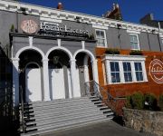
ROKER HOTEL
Sunderland Marriott Hotel
Seaham Hall
Quality Hotel Boldon
BEST WESTERN THE SEA HOTEL
Mill Dam Guest House
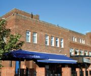
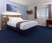
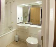
TRAVELODGE SUNDERLAND HIGH STREET WEST
TRAVELODGE SUNDERLAND CENTRAL
Sunderland A19/A1231
Videos from this area
These are videos related to the place based on their proximity to this place.
HAPPY -University of Sunderland Foundation Campus ver.
University of Sunderland Foundation Campus ver. For my assignment in Media class Thank you so much to the 67 participants and people who helped me shoot the video! by Yuno 5 March 2015.
Rising Sunderland: A tour of the Nissan Qashqai production line
A hastily captured iPhone video inside the Nissan Qashqai factory in Sunderland. Also home to the Juke, Note, Leaf and, in the future, the Invitation and Astra/Focus rival. Full review and...
Sunderland vs Arsenal 0-1 2012-13
"Sunderland vs Arsenal 0-1" "Arsenal" season ticket holder and UEFA qualified coach analysing "Sunderland vs Arsenal" from the game which finished "Sunderland vs Arsenal 0-1 2013" Follow me...
Privilege Derby Day 04/03/12 - 12.24pm, Penalty to Sunderland!
Wee Phillie in Privilege every matchday. Sunday 4th March 2012, Sunderland are away to The Mags and have a penalty. This is what happened when the ball hit the back of the Magpie's net...
RONNIE EVANS - Sunderland
Taken from Ronnie Evans of Sunderland - Simply The Best 2009 DVD. Ronnie Evans races with his Father, Ronnie Evans Senior, and help from Barry (his friend) with The High Southwick Homing ...
Quay West Business Village, Sunderland
Quay West Business Village offers 100000 sq. ft. of premium commercial space on the banks of the River Wear, only minutes from Sunderland city centre and major road and rail networks. Created...
Videos provided by Youtube are under the copyright of their owners.
Attractions and noteworthy things
Distances are based on the centre of the city/town and sightseeing location. This list contains brief abstracts about monuments, holiday activities, national parcs, museums, organisations and more from the area as well as interesting facts about the region itself. Where available, you'll find the corresponding homepage. Otherwise the related wikipedia article.
Stadium of Light
The Stadium of Light is an all-seater football stadium in Sunderland, England and home to Sunderland A.F.C. With space for 49,000 spectators, the Stadium of Light has the fifth-largest capacity of any English football stadium. The stadium primarily hosts Sunderland A.F.C. matches. The name Stadium of Light is a tribute to the traditional mining industry, which brought prosperity to the town; a Davy lamp monument stands at the entrance.
City of Sunderland
The City of Sunderland /ˈsʌndərlənd/ is a local government district of Tyne and Wear, in North East England, with the status of a city and metropolitan borough. It is named after its largest settlement, Sunderland, but covers a far larger area which includes the towns of Hetton-le-Hole, Houghton-le-Spring, Washington, and a range of suburban villages.
Wearside
Wearside is an area of North East England, centred on the continuous urban area formed by Sunderland, Seaham and other settlements by the River Wear. Mackems is a nickname used for the people of Wearside. The principal part of Wearside is the City of Sunderland, including Washington, Houghton-le-Spring, Shiney Row and in the south, Ryhope and Hetton-le-Hole. Additional settlements sometimes considered to be part of Wearside are Easington and Seaham.
Roker Park
Roker Park was an English football stadium situated in Roker, Sunderland. The stadium was the home of the English football club Sunderland A.F.C. from 1897 to 1997 before the club moved to the Stadium of Light. Near the end of the stadium's history, its capacity was around 22,500 with only a small part of the stadium being seated. The stadium's capacity had been higher in previous years, attracting a record crowd of 75,118.
Sunderland North (UK Parliament constituency)
Sunderland North was a borough constituency represented in the House of Commons of the Parliament of the United Kingdom. It elected one Member of Parliament (MP) by the first past the post system of election.
Sunderland Museum and Winter Gardens
Sunderland Museum and Winter Gardens is a municipal museum in Sunderland, England. It is part of the Tyne and Wear Museums group, and is sponsored by the Department for Culture, Media and Sport. It contains the only known British example of a gliding reptile, the oldest known vertebrate capable of gliding flight. The exhibit was discovered in Eppleton quarry.
Park Lane Interchange
Park Lane 30px Park Lane Metro station was purpose-built for the Sunderland extension in 2002. Location Place Sunderland City Centre Local authority Sunderland Fare zone information Network One zone 4 Metro zone C Original (1979) zone 57 Station code PLI History Opened 2 May 1999 Park Lane Interchange is a busy transport interchange on the south-western fringe of the city centre of Sunderland, North East England.
Sunderland Minster
Sunderland Minster Church of St Michaels and All Angels and St Benedict Biscop (commonly known as Sunderland Minster) is a church in Sunderland city centre, England. It was known as St Michael's Church, serving the parish of Bishopwearmouth, but was renamed on 11 January 1998 in recognition of Sunderland's city status. In May 2007 the Minster ceased to act as the parish church of Bishopwearmouth. It is one of the Greater Churches.
Sunderland Central (UK Parliament constituency)
Sunderland Central is a constituency represented in the House of Commons of the UK Parliament since its 2010 creation by Julie Elliott, a member of the Labour Party.
Stadium of Light Metro station
Stadium of Light Metro station is a station on the Tyne and Wear Metro, situated to the north of the centre of the city of Sunderland, England. The station opened in 2002, as part of the extension of the Metro system into the city. It is named after the nearby Stadium of Light, the home stadium of Sunderland A.F.C. , which is just a 10-minute walk away.
Wearmouth Bridge
The Wearmouth Bridge is a through arch bridge across the River Wear in Sunderland. It is the final bridge over the river before its mouth with the North Sea. The current bridge is the third Wearmouth Bridge in its position. The first opened in 1796, and then was reconstructed in the 19th century.
A1018 road
The A1018 is a road in North East England. It runs between South Shields, at the mouth of the River Tyne, and the A19 near Seaham, County Durham. Most of the route it follows is the old alignment of the A19, before it by-passed Sunderland to meet the Tyne Tunnel.
Sunderland Art Gallery
The Sunderland Art Gallery is an art gallery based within the Sunderland Museum and Winter Gardens centre, in Sunderland City Centre. The collection of paintings includes works by the British artist, L.S. Lowry, many with local significance. For example, 'River Wear at Sunderland' (1961) and 'Girl in a Red Hat on a Promenade' (1972) - an enigmatic piece composed at Seaburn.
Mowbray Park
Mowbray Park is a municipal park in the centre of Sunderland, Tyne and Wear, England, located a few hundred yards from the busy throughfares of Holmeside and Fawcett Street and bordered by Sunderland Museum and Winter Gardens to the north, Burdon Road to the west, Toward Road to the east and Park Road to the south. The park was voted best in Britain in 2008.
National Glass Centre
The National Glass Centre is a cultural venue and visitor attraction located in Sunderland, North East England.
St Peter's Metro station
St Peter's Metro Station on the Tyne and Wear Metro is the nearest one to the University of Sunderland's St Peter's Campus. The station was built for the Sunderland extension in 2002. It is located at the northern approach viaducts of the Monkwearmouth railway bridge and a short distance south of Monkwearmouth Station Museum.
Sunniside, Sunderland
Sunniside is a district of Sunderland, North East England, situated towards the eastern side of the city centre, bounded to the west by Fawcett Street, to the south by Borough Road, and to the north and east by Sunderland's Inner Ring road. A significant programme of urban development has established Sunniside as a centre of culture, film, dining, entertainment and art in the city.
Newcastle Road (stadium)
Newcastle Road was a football ground in Sunderland, England, and was the home ground of Sunderland A.F. C until 1898. It was the fifth ground at which the club had played and their first proper stadium. The ground was located between Newcastle Road, Eglinton Street North and Down Crozier Street. It is also the first ground at which Sunderland played as members of the Football League, their first game being a defeat against Burnley on 13 September 1890.
All Saints' Church, Monkwearmouth
All Saints’ Church is a church in Monkwearmouth, Sunderland, England. A parish of All Saints was formed in 1844 when it became clear that there was no longer enough room in the only parish church for Monkwearmouth, and a church for the new parish was completed and consecrated in 1849. One of its vicars was Alexander Boddy, and so All Saints' became known as the birthplace of modern British Pentecostalism. All Saints' is now again part of the parish of Monkwearmouth.
Parish of Monkwearmouth
The Parish of Monkwearmouth is a Church of England parish in Monkwearmouth, England, served by the churches of St Peter's, All Saints and St Andrew's.
Monkwearmouth Railway Bridge
The Monkwearmouth railway bridge (also Sunderland railway bridge or Wearmouth railway bridge) is a rail bridge built 1879 crossing the River Wear at Sunderland and Monkwearmouth. The bridge lies adjacent to and upstream of the Wearmouth road bridge. Originally built as part of the Monwearmouth Junction line, it provided the first direct railway link between Newcastle and Sunderland. As of 2012 the bridge remains in use and is used by Tyne and Wear Metro and Durham Coast Line services.
Monkwearmouth Colliery
Monkwearmouth Colliery (or Wearmouth Colliery) was a major North Sea coal mine located on the north bank of the River Wear, located in Sunderland. It was the largest mine in Sunderland and one of the most important in County Durham in northeast England. First opened in 1835 and in spite of the many accidents at the pit, the mine was the last to remain operating in the County Durham Coalfield.
St Peter's Church, Monkwearmouth
St Peter's Church is the parish church of Monkwearmouth in Sunderland, Tyne and Wear, England. It is one of three churches that make up the Parish of Monkwearmouth; the others being All Saints Church and St Andrew's Church, Roker. The first church on the site was built on instructions from Benedict Biscop in 674-75, of which only the west wall and porch survive. The tower was added before 1000 on top of the porch, and the rest of the church in the 14th century.
Art Arena
ARTARENA is an "art film museum" planned for Sunderland in northeast England. It is intended to show items from the Roland Collection of Films on Art on 45 screens; visitors will wander between them wearing headphones that switch to the appropriate soundtrack. The original concept called for a futuristic €35m building in London. This gave way to a £2m reconstruction of the West Park United Reformed church on Stockton Road in Sunderland, which is planned to open in April 2012.
Monkwearmouth-Jarrow Abbey
Monkwearmouth-Jarrow was a twin-foundation English monastery, located on the River Wear, at Monkwearmouth, and the River Tyne, at Jarrow, respectively, in the Kingdom of Northumbria. Its formal name is The Abbey Church of Saint Peter and Saint Paul, Monkwearmouth-Jarrow. Jarrow became the centre of Anglo-Saxon learning in the north of England, producing the greatest Anglo-Saxon scholar, Bede. The twin Anglo-Saxon monastery was the UK nomination for World Heritage Site status in 2011.


