Safety Score: 3,0 of 5.0 based on data from 9 authorites. Meaning we advice caution when travelling to United Kingdom.
Travel warnings are updated daily. Source: Travel Warning United Kingdom. Last Update: 2024-04-24 08:14:40
Discover Boldon Colliery
Boldon Colliery in South Tyneside (England) is a city in United Kingdom about 244 mi (or 393 km) north of London, the country's capital city.
Local time in Boldon Colliery is now 02:23 AM (Thursday). The local timezone is named Europe / London with an UTC offset of one hour. We know of 10 airports in the vicinity of Boldon Colliery, of which 5 are larger airports. The closest airport in United Kingdom is Newcastle Airport in a distance of 11 mi (or 17 km), North-West. Besides the airports, there are other travel options available (check left side).
There are several Unesco world heritage sites nearby. The closest heritage site is Frontiers of the Roman Empire in Germany at a distance of 4 mi (or 6 km). The closest in United Kingdom is Durham Castle and Cathedral in a distance of 43 mi (or 6 km), North-East. Also, if you like golfing, there are a few options in driving distance. We discovered 2 points of interest in the vicinity of this place. Looking for a place to stay? we compiled a list of available hotels close to the map centre further down the page.
When in this area, you might want to pay a visit to some of the following locations: South Shields, Wallsend, Sunderland, Gateshead and West Rainton. To further explore this place, just scroll down and browse the available info.
Local weather forecast
Todays Local Weather Conditions & Forecast: 8°C / 46 °F
| Morning Temperature | 4°C / 39 °F |
| Evening Temperature | 6°C / 44 °F |
| Night Temperature | 5°C / 40 °F |
| Chance of rainfall | 0% |
| Air Humidity | 59% |
| Air Pressure | 1004 hPa |
| Wind Speed | Moderate breeze with 10 km/h (6 mph) from South |
| Cloud Conditions | Broken clouds, covering 77% of sky |
| General Conditions | Light rain |
Friday, 26th of April 2024
9°C (47 °F)
5°C (41 °F)
Light rain, gentle breeze, scattered clouds.
Saturday, 27th of April 2024
9°C (49 °F)
6°C (44 °F)
Broken clouds, gentle breeze.
Sunday, 28th of April 2024
7°C (45 °F)
7°C (45 °F)
Moderate rain, gentle breeze, overcast clouds.
Hotels and Places to Stay
Mercure Newcastle George Washington Hotel Golf and Spa
Hilton Garden Inn Sunderland
Mill Dam Guest House
Quality Hotel Boldon
BEST WESTERN THE SEA HOTEL
Sunderland A19/A1231
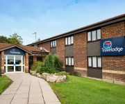
TRAVELODGE NEWCASTLE WHITEMARE POOL
TRAVELODGE NEWCASTLE SILVERLINK
TRAVELODGE SUNDERLAND CENTRAL
South Shields Port Of Tyne
Videos from this area
These are videos related to the place based on their proximity to this place.
Rock Licks Guitar Tuition South Shields
Rock Licks Guitar Tuition based in South Shields Full details on website http://www.rock-licks.com Beginner Intermediate Advanced Styles Rock Metal Blues both Electric and Acoustic https://www.f...
Flat surface pressure disc cleaning, block drive, paving patio cleaning South Shields Tyne & Wear
Driveway & patio cleaning flat surface high pressure disc cleaning, North East, Tyne and Wear. South Shields.
A trip around the Tyne Dock, only 5 hours before officially closing to shipping
I took a trip down the River Don in Jarrow then went down the Tyne and around Tyne Dock, this was on the 09/08/2009 this is the day before the closure of the dock as it is going to be filled...
NoEAA Div.4 - Men's 100m Sprint at Monkton Jarrow
NoEAA Div.4 - Men's 100m Sprint at Monkton Jarrow Follow us on Facebook www.facebook.com/west8promotions or Twitter www.twitter.com/west8promotions tweet us @West8Promotions.
NoEAA Div.4 - Women's 100m Sprint at Monkton Jarrow
NoEAA Div.4 - Women's 100m Sprint at Monkton Jarrow Follow us on Facebook www.facebook.com/west8promotions or Twitter www.twitter.com/west8promotions tweet us @West8Promotions.
Diablo 66 (UK) - Live in Jarrow
Bands: DIABLO 66, LoGOz, BLACK BLOC Venue: Golden Lion, Jarrow. Date: 16/1/15.
Videos provided by Youtube are under the copyright of their owners.
Attractions and noteworthy things
Distances are based on the centre of the city/town and sightseeing location. This list contains brief abstracts about monuments, holiday activities, national parcs, museums, organisations and more from the area as well as interesting facts about the region itself. Where available, you'll find the corresponding homepage. Otherwise the related wikipedia article.
Nissan Motor Manufacturing UK
Nissan Motor Manufacturing (UK) Ltd, or NMUK is a car manufacturing plant in the City of Sunderland, Tyne and Wear, United Kingdom. It is owned and operated by the European division of Japanese car manufacturer Nissan. It is the largest car plant in the United Kingdom, and the most productive in Europe. It has been active since 1986.
Fellgate Metro station
Fellgate Metro station serves the Fellgate area of Jarrow, in South Tyneside, England. It is on the Green line of the Tyne and Wear Metro, and opened in 2002 as part of the extension of the system to Sunderland. Before the Metro extension to Sunderland had been mooted, there were plans for a railway station here.
Brockley Whins Metro station
Brockley Whins Metro station is on the Tyne and Wear Metro Green Line. It serves the Brockley Whins area of South Tyneside, England. The station was formerly served by mainline services between Sunderland and Newcastle Central station but was taken over by the Metro as part of the extension to Sunderland and South Hylton in 2002. Today the services operated by the current franchise holder Northern Rail pass through the station but do not stop.
Jarrow Roofing Boldon Community Association F.C
Jarrow Roofing Boldon Community Association F.C. is a football club based in Boldon Colliery, near Sunderland, England. They were established in 1987 and joined the Wearside Football League Division Two in 1991. In 1996, the club was promoted to the Northern Football League. They were FA Vase semi-finalists in 2005. Currently, they are members of the Northern Football League Division Two. The current manager is also the founder, chairman and built the stadium through his Jarrow Roofing company.
Bede Metro station
Bede is the name of a Tyne and Wear Metro station in Jarrow. It is named after the Venerable Bede, a monk who established St Paul's monastery nearby during the 7th century. It serves an area mostly consisting of industrial estates, and is immediately adjacent to the J. Barbour & Sons clothing factory. Bede station was new when the Metro line to South Shields opened, although the route had opened in 1872.
Simonside Metro station
Simonside Metro station is the name of a Tyne and Wear Metro station in South Tyneside, England, which opened on 17 March 2008. Costing GB£3 million it is the 60th station on the network. The decision to construct a new Metro station here was not universally welcomed by all local residents, with some worried it would lead to an increase in both crime and local road traffic.
South Shields F.C
South Shields F.C. are a football club based in South Shields, England. They have a long and complicated history, with three distinct incarnations taking the name. The current club was founded in 1974 and plays in Northern League Division One at Filtrona Park.
St Bedes Junction rail crash
St. Bedes Junction lies between Jarrow and Bede Metro stations on what was the North Eastern Railway line between Newcastle-Upon-Tyne and South Shields. From the junction a mineral line descends on a gradient of 1 in 100 to Tyne Dock Bottom. On 17 December 1915 in the early morning in fog, a goods train ran out onto the main line past St Bedes signalbox having been banked in the rear up the incline by a six-coupled tank engine.


