Safety Score: 3,0 of 5.0 based on data from 9 authorites. Meaning we advice caution when travelling to United Kingdom.
Travel warnings are updated daily. Source: Travel Warning United Kingdom. Last Update: 2024-04-25 08:17:04
Discover Jarrow
Jarrow in South Tyneside (England) with it's 27,264 citizens is a city in United Kingdom about 246 mi (or 396 km) north of London, the country's capital city.
Local time in Jarrow is now 07:06 PM (Thursday). The local timezone is named Europe / London with an UTC offset of one hour. We know of 10 airports in the vicinity of Jarrow, of which 5 are larger airports. The closest airport in United Kingdom is Newcastle Airport in a distance of 9 mi (or 15 km), North-West. Besides the airports, there are other travel options available (check left side).
There are several Unesco world heritage sites nearby. The closest heritage site is Frontiers of the Roman Empire in Germany at a distance of 3 mi (or 6 km). The closest in United Kingdom is Durham Castle and Cathedral in a distance of 44 mi (or 6 km), East. Also, if you like golfing, there are a few options in driving distance. We discovered 2 points of interest in the vicinity of this place. Looking for a place to stay? we compiled a list of available hotels close to the map centre further down the page.
When in this area, you might want to pay a visit to some of the following locations: Wallsend, South Shields, Gateshead, Sunderland and Newcastle upon Tyne. To further explore this place, just scroll down and browse the available info.
Local weather forecast
Todays Local Weather Conditions & Forecast: 7°C / 45 °F
| Morning Temperature | 5°C / 41 °F |
| Evening Temperature | 6°C / 43 °F |
| Night Temperature | 4°C / 40 °F |
| Chance of rainfall | 2% |
| Air Humidity | 61% |
| Air Pressure | 1003 hPa |
| Wind Speed | Moderate breeze with 10 km/h (6 mph) from South |
| Cloud Conditions | Overcast clouds, covering 94% of sky |
| General Conditions | Light rain |
Friday, 26th of April 2024
8°C (47 °F)
4°C (40 °F)
Light rain, gentle breeze, overcast clouds.
Saturday, 27th of April 2024
9°C (49 °F)
6°C (43 °F)
Broken clouds, gentle breeze.
Sunday, 28th of April 2024
7°C (44 °F)
6°C (43 °F)
Moderate rain, moderate breeze, overcast clouds.
Hotels and Places to Stay
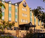
Village Hotel Newcastle
York House Hotel
Oaktree Lodge
Park Lodge
Mercure Newcastle George Washington Hotel Golf and Spa
The Chedburgh B&B
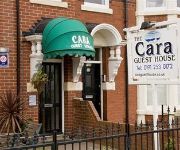
The Cara Guesthouse
Quality Hotel Boldon
Mill Dam Guest House
BEST WESTERN THE SEA HOTEL
Videos from this area
These are videos related to the place based on their proximity to this place.
Cob swan attacks and clears the way
Cob swan attacks and clears the way of a Mallard family to swim downstream Wallsend burn at Willington Quay.
TT2 Drivethrough (New Tyne Tunnel), Tyne and Wear, 2/2011
Drive North to South through the New Tyne Tunnel, 2 days after opening, light traffic, Tyne and Wear, England. 27/2/2011.
NoEAA Div.4 - Men's 100m Sprint at Monkton Jarrow
NoEAA Div.4 - Men's 100m Sprint at Monkton Jarrow Follow us on Facebook www.facebook.com/west8promotions or Twitter www.twitter.com/west8promotions tweet us @West8Promotions.
NoEAA Div.4 - Women's 100m Sprint at Monkton Jarrow
NoEAA Div.4 - Women's 100m Sprint at Monkton Jarrow Follow us on Facebook www.facebook.com/west8promotions or Twitter www.twitter.com/west8promotions tweet us @West8Promotions.
Diablo 66 (UK) - Live in Jarrow
Bands: DIABLO 66, LoGOz, BLACK BLOC Venue: Golden Lion, Jarrow. Date: 16/1/15.
Keyside Strike If the kids are united
Sham 69 cover recorded at The Alexandra Hotel, Jarrow on dec 13th 2008.
Videos provided by Youtube are under the copyright of their owners.
Attractions and noteworthy things
Distances are based on the centre of the city/town and sightseeing location. This list contains brief abstracts about monuments, holiday activities, national parcs, museums, organisations and more from the area as well as interesting facts about the region itself. Where available, you'll find the corresponding homepage. Otherwise the related wikipedia article.
Tyne Tunnel
The Tyne Tunnel is the name given to two two-lane vehicular toll tunnels under the River Tyne in North East England. Completed in 1967 and 2011 respectively, they connect the town of Jarrow on the south bank of the river with North Shields and Howdon on the north. The original tunnel was one of three forming the original Tyne Tunnel Project; the others are the pedestrian and cyclist tunnels opened in 1951.
Bede's World
Bede's World is a museum in Jarrow dedicated to the life and times of Venerable Bede, a monk, author and scholar who lived in at the Abbey Church of Saint Peter and Saint Paul, Wearmouth-Jarrow, a double monastery at Jarrow (today part of South Tyneside) and Monkwearmouth, (today part of Sunderland), England.
Percy Main Metro station
Percy Main Metro station is on the Yellow line of the Tyne and Wear Metro in the village of Percy Main in North Tyneside, England. The original station of the Newcastle & North Shields Railway opened in 1839 to serve a small riverside community clustered around a colliery. All of the original buildings were demolished when the station was converted for Metro use.
Howdon Metro station
Howdon Metro station is a station on the Yellow line of the Tyne and Wear Metro network, in Howdon, North Tyneside, UK. It was opened in June 1839 by the Newcastle & North Shields Railway, which later became part of the North Tyneside Loop served by the North Eastern Railway. On 1 December 1875, the station was renamed Howdon-on-Tyne to prevent it being confused with Howden in Yorkshire, on the line between Selby and Hull.
Bede Metro station
Bede is the name of a Tyne and Wear Metro station in Jarrow. It is named after the Venerable Bede, a monk who established St Paul's monastery nearby during the 7th century. It serves an area mostly consisting of industrial estates, and is immediately adjacent to the J. Barbour & Sons clothing factory. Bede station was new when the Metro line to South Shields opened, although the route had opened in 1872.
Willington Quay
Willington Quay is an area in the borough of North Tyneside in Tyne and Wear in northern England. It is situated on the north bank of the River Tyne, facing Jarrow, and between Wallsend and North Shields. It is served by the Howdon Metro station in Howdon. The area from 2006 onwards has been an area of new housing built on brownfield sites. The house building continues into 2013 and is changing the social and economic balance in the area.
South Shields F.C
South Shields F.C. are a football club based in South Shields, England. They have a long and complicated history, with three distinct incarnations taking the name. The current club was founded in 1974 and plays in Northern League Division One at Filtrona Park.
St Bedes Junction rail crash
St. Bedes Junction lies between Jarrow and Bede Metro stations on what was the North Eastern Railway line between Newcastle-Upon-Tyne and South Shields. From the junction a mineral line descends on a gradient of 1 in 100 to Tyne Dock Bottom. On 17 December 1915 in the early morning in fog, a goods train ran out onto the main line past St Bedes signalbox having been banked in the rear up the incline by a six-coupled tank engine.


