Safety Score: 3,0 of 5.0 based on data from 9 authorites. Meaning we advice caution when travelling to United Kingdom.
Travel warnings are updated daily. Source: Travel Warning United Kingdom. Last Update: 2024-04-19 08:03:45
Explore New Silksworth
New Silksworth in Sunderland (England) is located in United Kingdom about 239 mi (or 384 km) north of London, the country's capital.
Local time in New Silksworth is now 09:00 AM (Friday). The local timezone is named Europe / London with an UTC offset of one hour. We know of 10 airports in the wider vicinity of New Silksworth, of which 5 are larger airports. The closest airport in United Kingdom is Newcastle Airport in a distance of 16 mi (or 26 km), North-West. Besides the airports, there are other travel options available (check left side).
There are several Unesco world heritage sites nearby. The closest heritage site is Frontiers of the Roman Empire in Germany at a distance of 8 mi (or 13 km). The closest in United Kingdom is Durham Castle and Cathedral in a distance of 40 mi (or 13 km), North. Also, if you like golfing, there are multiple options in driving distance. We found 2 points of interest in the vicinity of this place. If you need a place to sleep, we compiled a list of available hotels close to the map centre further down the page.
Depending on your travel schedule, you might want to pay a visit to some of the following locations: Sunderland, Murton, Haswell, Hawthorn and Shotton. To further explore this place, just scroll down and browse the available info.
Local weather forecast
Todays Local Weather Conditions & Forecast: 9°C / 48 °F
| Morning Temperature | 6°C / 44 °F |
| Evening Temperature | 7°C / 45 °F |
| Night Temperature | 6°C / 43 °F |
| Chance of rainfall | 0% |
| Air Humidity | 58% |
| Air Pressure | 1018 hPa |
| Wind Speed | Fresh Breeze with 13 km/h (8 mph) from East |
| Cloud Conditions | Broken clouds, covering 60% of sky |
| General Conditions | Light rain |
Saturday, 20th of April 2024
8°C (46 °F)
6°C (43 °F)
Broken clouds, moderate breeze.
Sunday, 21st of April 2024
8°C (47 °F)
6°C (42 °F)
Broken clouds, gentle breeze.
Monday, 22nd of April 2024
8°C (46 °F)
5°C (42 °F)
Light rain, light breeze, overcast clouds.
Hotels and Places to Stay
Seaham Hall
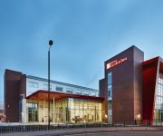
Hilton Garden Inn Sunderland
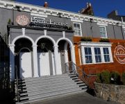
ROKER HOTEL
Sunderland Marriott Hotel
Quality Hotel Boldon
TRAVELODGE SUNDERLAND CENTRAL
TRAVELODGE SUNDERLAND HIGH STREET WEST
Sunderland A19/A1231
Highfield
Sunderland City Centre
Videos from this area
These are videos related to the place based on their proximity to this place.
University Of Sunderland
I'm the exchange student from Taiwan to UK. I make this film to introduce my University"University Of Sunderland" If you like this film, please wirte down your comment and recommend it!!...
British Dry Slope Ski Championships Dual Slalom 2012 at Sunderland
International Parallel Dual Slalom held after the British Dry Slope Ski Championships at the Silksworth Ski Centre, Sunderland on Saturday the 7th of July 2012. Teams from Scotland, Wales...
staffordshire bull rabbit
my 8 month old staffy Tyza messing around in a farmers field - crap quality because i used my phone.
More finishers at Grapplefit...
Pro boxer Kirk Goodings going through what I like to call a "nice" finisher at Grapplefit. 5 trips on the plate push, 5 trips bear crawl and 5 trips "Powerbag Death March" - Kirk does one trip...
Funniest bedtime story EVER!!!!!
One year old Teddy giving the best reaction to a bedtime story a dad could wish for. Teddy Stockdale: making gingers look cool since 2010 (gingerprince productions)
Peg by Steely Dan
Steely Dan hit Peg. Another cool one by Becker/ Fagan. Gibson Les Paul Marshall JCM 2000 TSL 60Watt Combo 4x12 1960A Cab Celestion V30 Radial Tonebone Hot British Seymour Duncan PAF ...
staffordshire bull terrier and bulldog puppy play
Staffordshire bull terrier floyd meets his new pal bulldog molly for first time.
Sunderland Minister - Try Out of New Ring of Ten
The try out on the new ring of 10 at Sunderland Minster on May 26th 2012. Grandsire Caters.
Videos provided by Youtube are under the copyright of their owners.
Attractions and noteworthy things
Distances are based on the centre of the city/town and sightseeing location. This list contains brief abstracts about monuments, holiday activities, national parcs, museums, organisations and more from the area as well as interesting facts about the region itself. Where available, you'll find the corresponding homepage. Otherwise the related wikipedia article.
A690 road
The A690 is a road in County Durham running from Sunderland in the east through Durham to Crook.
Sunderland South (UK Parliament constituency)
Sunderland South was, from 1950 until 2010, a constituency represented in the House of Commons of the Parliament of the United Kingdom. It elected one Member of Parliament (MP) by the first past the post system of election. The constituency was well known for trying to be the first seat to declare its results, doing so in the general elections of 1992, 1997, 2001 and 2005.
Millfield Metro station
Millfield is a suburb, a little to the west of the centre of Sunderland. This station dates from the opening of the Pelaw to Sunderland and South Hylton metro extension in 2002, but stands on the alignment of the former Sunderland to Durham mainline that fell to the Beeching Axe in the 1960s.
Barnes, Sunderland
Barnes is a suburb of the city of Sunderland, in northeast England, situated about a mile west of the city centre. The area is split into Barnes, which lies towards the east, and High Barnes, which lies around Barnes Park and the Bede Sixth Form Centre of City of Sunderland College. Barnes is bounded by Chester Road to the north, Durham Road on the south, Springwell Road to the west and the city centre to the east.
University Metro station
University Metro Station on the Tyne and Wear Metro is located on the western fringe of Sunderland City Centre, and is the nearest station to the University of Sunderland's City Campus. It opened as part of the Sunderland extension in 2002 and is one of the three stations serving the city centre of Sunderland, the others being Park Lane and Sunderland (Central). The station can be accessed by footpaths from the A183 Chester Road and the A690 New Durham Road.
Doxford International Business Park
Doxford International is a 125-acre business park located at the A19 / A690 interchange on the outskirts of Sunderland, in the North East of England. Previously it was a greenfield site, it was designated as an Enterprise Zone in 1990 in response to the decline of the area's former ship building and coal mining industries. A partnership between Sunderland City Council and Goodman Property (formerly Akeler Developments Ltd.
Bishopwearmouth Cemetery
Bishopwearmouth Cemetery is a cemetery in Sunderland, Tyne and Wear, England. It lies between Hylton Road and Chester Road.
Plains Farm
Plains Farm (known locally as Plainsy) is a suburb of Sunderland, Tyne and Wear, England, and is a council-built housing estate, erected in the 1940s. Neighbouring areas include Silksworth, The Barnes, Thorney Close, Springwell and Farringdon. The housing in the area is run predominantly by Home Group and Gentoo Sunderland. Many houses are rented via the two companies; others have been purchased by home owners. The majority of housing is either Terraced or Semi Detached.


