Safety Score: 3,0 of 5.0 based on data from 9 authorites. Meaning we advice caution when travelling to United Kingdom.
Travel warnings are updated daily. Source: Travel Warning United Kingdom. Last Update: 2024-05-07 07:59:51
Delve into Thornley
Thornley in County Durham (England) with it's 2,457 habitants is a town located in United Kingdom about 230 mi (or 371 km) north of London, the country's capital town.
Time in Thornley is now 09:45 PM (Tuesday). The local timezone is named Europe / London with an UTC offset of one hour. We know of 8 airports closer to Thornley, of which 3 are larger airports. The closest airport in United Kingdom is Durham Tees Valley Airport in a distance of 17 mi (or 27 km), South. Besides the airports, there are other travel options available (check left side).
There are several Unesco world heritage sites nearby. The closest heritage site is Frontiers of the Roman Empire in Germany at a distance of 17 mi (or 27 km). The closest in United Kingdom is Durham Castle and Cathedral in a distance of 40 mi (or 27 km), North. Also, if you like the game of golf, there are some options within driving distance. We saw 2 points of interest near this location. In need of a room? We compiled a list of available hotels close to the map centre further down the page.
Since you are here already, you might want to pay a visit to some of the following locations: Haswell, Fishburn, Pittington, Shotton and Murton. To further explore this place, just scroll down and browse the available info.
Local weather forecast
Todays Local Weather Conditions & Forecast: 14°C / 57 °F
| Morning Temperature | 9°C / 49 °F |
| Evening Temperature | 12°C / 54 °F |
| Night Temperature | 7°C / 45 °F |
| Chance of rainfall | 0% |
| Air Humidity | 71% |
| Air Pressure | 1025 hPa |
| Wind Speed | Gentle Breeze with 7 km/h (4 mph) from South |
| Cloud Conditions | Overcast clouds, covering 89% of sky |
| General Conditions | Overcast clouds |
Wednesday, 8th of May 2024
17°C (62 °F)
12°C (53 °F)
Light rain, gentle breeze, overcast clouds.
Thursday, 9th of May 2024
18°C (64 °F)
12°C (54 °F)
Light rain, gentle breeze, overcast clouds.
Friday, 10th of May 2024
17°C (62 °F)
13°C (56 °F)
Overcast clouds, light breeze.
Hotels and Places to Stay
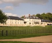
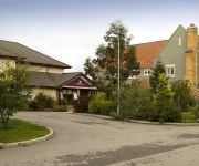
Best Western Hardwick Hall
Highfield
Hallgarth Manor
BOWBURN HALL HOTEL
Durham East
Videos from this area
These are videos related to the place based on their proximity to this place.
A Mackem visits Easington Lane
A trip from Hetton-Le-Hole to Easington lane on a Friday night with your local Mackem. The knars!
North East England, the location for Chemical, Pharmaceutical, Bioresource and Polymer investment
The following video about why the North East of England is the location of choice for the Process industries (Biotechnology, Chemical, Renewables, Pharmaceuticals, Fine & Speciality, Polymer...
Minecraft Xbox 1 Edition Ender Dragon Fight
here's the first of many video's on the minecraft xbox 1 edition we fight the ender dragon i am coughing alot in this video cause im a bit under the weather and i don't know if you can make...
Arrival of the Cessna Grand Caravan at Peterlee Parachute Centre - 26 March 2011
A historic milestone in the development of Peterlee Parachute Centre, the arrival of our Cessna Grand Caravan which replaces our GA Airvan. The aircraft will increase our altitude from 10000ft...
Videos provided by Youtube are under the copyright of their owners.
Attractions and noteworthy things
Distances are based on the centre of the city/town and sightseeing location. This list contains brief abstracts about monuments, holiday activities, national parcs, museums, organisations and more from the area as well as interesting facts about the region itself. Where available, you'll find the corresponding homepage. Otherwise the related wikipedia article.
Old Wingate
Old Wingate is a small village in County Durham, in England. It is situated a short distance to the west of Wingate. Most of the village was deserted in the Middle Ages.
Trimdon Colliery
Trimdon Colliery is a village in County Durham, in England. It is situated a few miles to the west of Hartlepool, and a short distance to the north of Trimdon. Its most famous resident was the former Prime Minister, Tony Blair.
High Haswell
High Haswell is a village in County Durham, in England. It is situated close to Haswell, a few miles to the east of Durham.
Shadforth
Shadforth is a village in County Durham, England. It is situated a few miles to the east of Durham. The historic centre of the village is designated a conservation area. Shadforth is also a civil parish that also incorporates Ludworth and Sherburn Hill.
Thornley, Durham
See also Thornley in Weardale. Thornley is a village in County Durham, in England. It is situated about 5 miles (9 km) to the east of Durham and 5 miles (7 km) west of Peterlee. Thornley is part of the Sedgefield parliamentary constituency of which Tony Blair was the Member of Parliament from 1983 until 2007.
Haswell Moor
Haswell Moor is a small village in County Durham, in England. It is situated between Haswell and Shotton Colliery.
Haswell Plough
Haswell Plough is a village in County Durham, in England. It is situated between Durham and Peterlee, south of Haswell.
Wheatley Hill
Wheatley Hill is a village in County Durham, in England. It is situated to the west of Peterlee, near Thornley and Wingate.


