Safety Score: 3,0 of 5.0 based on data from 9 authorites. Meaning we advice caution when travelling to United Kingdom.
Travel warnings are updated daily. Source: Travel Warning United Kingdom. Last Update: 2024-04-27 08:23:39
Touring Shadingfield
Shadingfield in Suffolk (England) is a town located in United Kingdom about 95 mi (or 153 km) north-east of London, the country's capital place.
Time in Shadingfield is now 08:45 AM (Sunday). The local timezone is named Europe / London with an UTC offset of one hour. We know of 11 airports nearby Shadingfield, of which 5 are larger airports. The closest airport in United Kingdom is Norwich International Airport in a distance of 23 mi (or 37 km), North-West. Besides the airports, there are other travel options available (check left side).
There are several Unesco world heritage sites nearby. The closest heritage site in United Kingdom is Canterbury Cathedral, St Augustine's Abbey, and St Martin's Church in a distance of 80 mi (or 129 km), South. Also, if you like the game of golf, there are several options within driving distance. Need some hints on where to stay? We compiled a list of available hotels close to the map centre further down the page.
Being here already, you might want to pay a visit to some of the following locations: Wrentham, Hellington, Rockland Saint Mary, Surlingham and Brundall. To further explore this place, just scroll down and browse the available info.
Local weather forecast
Todays Local Weather Conditions & Forecast: 10°C / 50 °F
| Morning Temperature | 10°C / 51 °F |
| Evening Temperature | 6°C / 42 °F |
| Night Temperature | 7°C / 45 °F |
| Chance of rainfall | 4% |
| Air Humidity | 87% |
| Air Pressure | 1001 hPa |
| Wind Speed | Fresh Breeze with 16 km/h (10 mph) from North |
| Cloud Conditions | Overcast clouds, covering 100% of sky |
| General Conditions | Moderate rain |
Monday, 29th of April 2024
12°C (53 °F)
9°C (47 °F)
Sky is clear, moderate breeze, clear sky.
Tuesday, 30th of April 2024
13°C (55 °F)
11°C (52 °F)
Light rain, moderate breeze, overcast clouds.
Wednesday, 1st of May 2024
15°C (59 °F)
10°C (51 °F)
Light rain, gentle breeze, overcast clouds.
Hotels and Places to Stay
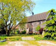
The Coach House
Videos from this area
These are videos related to the place based on their proximity to this place.
Ellough Park Raceway 30 Lap Iron Map - Jordan Kendal's Stag Do
10 minute practice/qualifying followed by 30 lap Iron Man race at Ellough Park Raceway, Beccles, for Jordan Kendals stag do. Filmed on a Go Pro Hero 3 Silver Edition. Great time was had...
R580 Tour of Duty United Kingdom Europe
Slideshow of trucks driven by R580 Several years ago while doing an OE in UK for a couple of years. Fodens from Terry Seaman transport and various makes from Turners (soham) distribution.
Out riding
Out on the vfr400 nc24 on one of the few nice days this year (sorry about the small screen still playing with the settings)
Paul Proposes To Lucy - Skydive Proposal
A few people asked to see the video of me proposing to Lucy. So I thought I would upload it online for those that didn't see it at the wedding. Lucy had no idea that I was going to propose,...
Videos provided by Youtube are under the copyright of their owners.
Attractions and noteworthy things
Distances are based on the centre of the city/town and sightseeing location. This list contains brief abstracts about monuments, holiday activities, national parcs, museums, organisations and more from the area as well as interesting facts about the region itself. Where available, you'll find the corresponding homepage. Otherwise the related wikipedia article.
A145 road
The A145 is a road that connects the town of Beccles in Suffolk to the South. The entire route is a standard A road classification and although not particularly long it does provide a useful route onto the main A12 to Ipswich.
Ellough Park Raceway
Ellough Park Raceway is a kart racing track in Ellough in the English county of Suffolk. It is located around 2 miles south-east of the market town of Beccles. It is primarily used for kart racing as it is a fast, but tight and twisty circuit. The authorities at the circuit extended the circuit in 2007, from 800m to just over 1000m to make it more suitable for other forms of kart and minimoto racing.
Brampton with Stoven
Brampton with Stoven is a civil parish in the Waveney district of Suffolk, England located south of the town of Beccles. The mid-2005 population estimate for the parish was 460. The parish includes the villages of Brampton and Stoven.
All Saints Church, Ellough
All Saints Church, Ellough, is a redundant Anglican church in the parish of Ellough in the English county of Suffolk. The church is medieval in origin and has been designated by English Heritage as a Grade I listed building, and is under the care of the Churches Conservation Trust. The church stands in an isolated position on the top of a low hill, some 2.5 miles to the south-east of Beccles.


