Safety Score: 3,0 of 5.0 based on data from 9 authorites. Meaning we advice caution when travelling to United Kingdom.
Travel warnings are updated daily. Source: Travel Warning United Kingdom. Last Update: 2024-05-18 08:26:29
Delve into Westoe
The district Westoe of South Shields in South Tyneside (England) is a district located in United Kingdom about 246 mi north of London, the country's capital town.
In need of a room? We compiled a list of available hotels close to the map centre further down the page.
Since you are here already, you might want to pay a visit to some of the following locations: Sunderland, Wallsend, Blyth, Murton and Gateshead. To further explore this place, just scroll down and browse the available info.
Local weather forecast
Todays Local Weather Conditions & Forecast: 15°C / 58 °F
| Morning Temperature | 11°C / 52 °F |
| Evening Temperature | 12°C / 54 °F |
| Night Temperature | 10°C / 50 °F |
| Chance of rainfall | 0% |
| Air Humidity | 67% |
| Air Pressure | 1018 hPa |
| Wind Speed | Gentle Breeze with 6 km/h (4 mph) from South-West |
| Cloud Conditions | Few clouds, covering 16% of sky |
| General Conditions | Few clouds |
Monday, 20th of May 2024
14°C (57 °F)
9°C (49 °F)
Broken clouds, gentle breeze.
Tuesday, 21st of May 2024
14°C (57 °F)
12°C (54 °F)
Scattered clouds, gentle breeze.
Wednesday, 22nd of May 2024
11°C (53 °F)
11°C (52 °F)
Moderate rain, moderate breeze, overcast clouds.
Hotels and Places to Stay
York House Hotel
ROKER HOTEL
Hilton Garden Inn Sunderland
Sunderland Marriott Hotel
Oaktree Lodge
Park Lodge
BEST WESTERN THE SEA HOTEL
The Cara Guesthouse
Quality Hotel Boldon
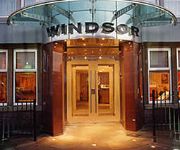
Windsor
Videos from this area
These are videos related to the place based on their proximity to this place.
Armed Forces Day 2014 - Sunderland to South Shields
Hundreds of bikes rode in convoy from Sunderland to South Shields (Bents Park) as part of Armed Forces Day 2014. Thanks to the Bad-Landers Motorcycle club for organising the run.
South Shields FC worst trainer December 11: Paul Kane
South Shields' players vote for the worst trainer of the week after the session on December 11 at Mortimer CA.
Roller Coaster @ Ocean Beach Amusement Park - South Shields {TP01}
"Roller Coaster" at Ocean Beach Amusement Park, in South Shields. A scary, creaky, noisy roller coaster with some scary drops which might make you feel that you might die on board. Filmed...
Radhuni Restaurant Ocean Road South Shields
Radhuni Restaurant in Ocean Road South Shields. http://www.anniesguesthouse.co.uk/accommodation-south-shields-ne33.shtml.
NIKKO Vaporizr at South Shields 1080
Playing with the NIKKO Vaporizr. Filmed in 1080 50fps on a GoPro4 Silver then rendered in Vegas at 25fps.
South Shields 11th August 2013
Highlights of my trip to South Shield in 2013 with Lauren, Miles and Dan in tow. :) WARNING: May include fun and other such awesome things. This video is pro...
QE2 enters South Shields
A quick video of the QE2 entering the Tyne, as seen from The Leas, South Shields.
Videos provided by Youtube are under the copyright of their owners.
Attractions and noteworthy things
Distances are based on the centre of the city/town and sightseeing location. This list contains brief abstracts about monuments, holiday activities, national parcs, museums, organisations and more from the area as well as interesting facts about the region itself. Where available, you'll find the corresponding homepage. Otherwise the related wikipedia article.
Tyneside
Tyneside is a conurbation in North East England, defined by the Office for National Statistics, which is home to over 80% of the population of Tyne and Wear. It includes the city of Newcastle upon Tyne and the Metropolitan Boroughs of Gateshead, North Tyneside and South Tyneside — all settlements on the banks of the River Tyne. The population of the conurbation was 879,996 according to the census of 2001, the 6th largest conurbation in the UK.
Tynemouth Castle and Priory
Tynemouth Castle is located on a rocky headland (known as Pen Bal Crag), overlooking Tynemouth Pier . The moated castle-towers, gatehouse and keep are combined with the ruins of the Benedictine priory where early kings of Northumbria were buried. The coat of arms of the town of Tynemouth still includes three crowns commemorating the tradition that the Priory had been the burial place for three kings.
Jarrow (UK Parliament constituency)
Jarrow is a constituency ESE of and adjoining Newcastle upon Tyne represented in the House of Commons of the UK Parliament by Stephen Hepburn of the Labour Party.
South Shields (UK Parliament constituency)
South Shields is a borough constituency represented in the House of Commons of the Parliament of the United Kingdom. It elects one Member of Parliament (MP) by the first past the post system of election.
Chichester Metro station
Chichester Metro is a station on the Yellow Line of the Tyne and Wear Metro. It is situated in the Chichester area of South Shields, North East England. Trains head eastbound to the terminus at South Shields (King Street) and westbound towards Gateshead and Newcastle, with an interchange at Pelaw for trains to South Hylton via Sunderland. A statue of Queen Victoria had been moved from her original postition of being in front of South Shields Town Hall in 1949 to Chichester. http://www.
Tyne Dock Metro station
Tyne Dock Metro station is situated on the Yellow line of the Tyne and Wear Metro system, in South Shields, Tyne and Wear, England. It takes its name from the Tyne Dock locality to the north of the station, although in primarily serves the residential area of West Harton to the south. The original Tyne Dock station opened on 19 June 1839, on the Branding Junction Railway from Gateshead to South Shields via Brockley Whins and High Shields.
Shields Ferry
The Shields Ferry operates across the River Tyne, England, between North Shields and South Shields. The service is operated by Nexus (The Tyne and Wear Passenger Transport Executive) and is part of the Tyne and Wear Metro System. It was known as The Market Place Ferry until takeover by the PTE in 1972.
St Mary's C of E Primary School
St Mary's C of E Primary School was a Christian voluntary aided school educating children aged 3–11 located in South Shields, Tyne and Wear, in England. The school was founded in 1867 to provide education for the children of the labouring and manufacturing and poorer classes, with regard to the principles of the established church of the same name which was affiliated with the school. This school closed in 2008.
South Shields Metro station
South Shields Metro station is the main Tyne and Wear Metro station for South Shields, England. In 2008-9 the station was used by over 1 million passengers. The station is located on a bridge above King Street, the main shopping street in South Shields Town Centre. The Metro station is located about 200 metres down the line from the former South Shields railway station, which it replaced.
Tynemouth Metro station
Tynemouth Metro station is one of the oldest stations on the Tyne and Wear Metro network. The railway station was opened in 1882 by the North Eastern Railway and is now a Grade II* listed building. It served as the terminus for the first section of the Metro network from Tynemouth to Haymarket (in Newcastle City Centre) via Benton and Jesmond, that opened on 11 August 1980; all trains used the present platform 2.
Simonside Metro station
Simonside Metro station is the name of a Tyne and Wear Metro station in South Tyneside, England, which opened on 17 March 2008. Costing GB£3 million it is the 60th station on the network. The decision to construct a new Metro station here was not universally welcomed by all local residents, with some worried it would lead to an increase in both crime and local road traffic.
South Shields railway station
South Shields railway station was the main railway station for South Shields, in Tyne and Wear, North-East England. The station was located on Mile End Road in the town centre. The station was closed and replaced by South Shields Metro station in the 1980s. The station building survived as an entrance to the Metro system until the 1990s, when it was demolished. Today, a Shopmobility centre stands on the site of the original station building.
A1300 road
The A1300 is the main 'cross town' route in South Shields, Tyne and Wear. The road runs from Simonside to Marsden via Harton Nook.
Westoe
Westoe is a suburb of South Shields, Tyne & Wear, United Kingdom.
MS Oslofjord (1938)
MS Oslofjord was an ocean liner built in 1938 by A/G Weser Shipbuilders, Bremen, Germany for Norwegian America Line. She was 18,673 gross register tons, and could carry 860 passengers. She sank on 21/22 January 1941 after hitting a mine off the River Tyne on 1 December 1940, after just two years of service. She sits in 15m at {{#invoke:Coordinates|coord}}{{#coordinates:55|0.17|N|1|23.72|W||| |primary |name= }}.
Harton, North Yorkshire
Harton is a village and civil parish in the Ryedale district of the county of North Yorkshire, England.
The Leas
The Leas is a large area of land owned and maintained by the National Trust along the coastal cliffs of South Shields, England. It is popular with dog walkers, joggers, kite flyers, horse riders, cyclists and other activities. It is the finishing line for the Great North Run which is a half marathon that takes place every year in or around October and the venue for the Great North Dog Walk. The Leas stretches for around 2 miles and goes as far as Souter Lighthouse on the way to Whitburn.
Ashley Primary School (South Tyneside)
Ashley Primary County School is situated in the town of South Shields in South Tyneside and educates over 450 pupils of mixed age, ability & gender. The school consists of six year groups with two classes for each year. The school first opened in 1971 as an open-plan structure building.
St Wilfrid's RC College
St Wilfrid's RC College is a Roman Catholic specialist college in mathematics and computing located in South Shields, Tyne and Wear, England, with pupils aged from 11 to 16.
Mortimer Community College
Mortimer Community College is located in South Shields, Tyne and Wear, England. It takes pupils from the age of 11-16. It is a specialist Arts and Sports College. The school teamed up with the National Glass Centre for a project to design a large glass mural for the foyer of the school. The glass mural when complete was unveiled by David Miliband, then the UK Foreign Secretary, on 19 March 2010.
Y Radio
'Y Radio' is a community-based and specialist interest radio service for North Tyneside, which broadcasts online at www. yradio. co. uk and is operated from the YMCA North Tyneside building in Church Way, North Shields. The station features community arts programmes, music programmes and local news and current affairs programmes specifically for the region and wider afield. Originally named Youth Voice FM and operated as part of the VODA scheme, Y Radio is now licensed and regulated.
Sharpness Point
Sharpness Point is a small headland projecting into the North Sea at Tynemouth, Tyne and Wear. The O.S. grid reference is NZ371699. It is the only promontory in Northumberland with the “ness” suffix. The word “ness” is a geographical term (or suffix) for a promontory, cape or headland, a strip of land projecting into a body of water, and derives from the Old English næs = headland (related to Old Norse nes)
Frenchman’s Bay (South Shields)
Frenchman’s Bay is a small bay between South Shields and Marsden Grotto, Tyne and Wear. The O.S. grid reference is NZ392660.
Christ Church, North Shields
Christ Church, North Shields, Tyne and Wear, England is an Anglican church in the parish of North Shields Christ Church, diocese of Newcastle. It has been designated by English Heritage as a Grade II listed building,
St Hilda's Church, South Shields
St Hilda's Church, South Shields is a Grade II listed parish church in the Church of England in South Shields.


