Safety Score: 3,0 of 5.0 based on data from 9 authorites. Meaning we advice caution when travelling to United Kingdom.
Travel warnings are updated daily. Source: Travel Warning United Kingdom. Last Update: 2024-05-09 08:23:21
Touring Pulham Saint Mary Magdalene
Pulham Saint Mary Magdalene in Norfolk (England) is a town located in United Kingdom about 87 mi (or 139 km) north-east of London, the country's capital place.
Time in Pulham Saint Mary Magdalene is now 09:49 PM (Thursday). The local timezone is named Europe / London with an UTC offset of one hour. We know of 10 airports nearby Pulham Saint Mary Magdalene, of which 4 are larger airports. The closest airport in United Kingdom is Norwich International Airport in a distance of 17 mi (or 27 km), North. Besides the airports, there are other travel options available (check left side).
There are several Unesco world heritage sites nearby. The closest heritage site in United Kingdom is Royal Botanic Gardens, Kew in a distance of 77 mi (or 124 km), South-West. Also, if you like the game of golf, there are several options within driving distance. Need some hints on where to stay? We compiled a list of available hotels close to the map centre further down the page.
Being here already, you might want to pay a visit to some of the following locations: Norwich, Hellington, Rockland Saint Mary, Surlingham and Brundall. To further explore this place, just scroll down and browse the available info.
Local weather forecast
Todays Local Weather Conditions & Forecast: 19°C / 66 °F
| Morning Temperature | 10°C / 49 °F |
| Evening Temperature | 20°C / 68 °F |
| Night Temperature | 12°C / 53 °F |
| Chance of rainfall | 0% |
| Air Humidity | 70% |
| Air Pressure | 1026 hPa |
| Wind Speed | Light breeze with 5 km/h (3 mph) from North-East |
| Cloud Conditions | Broken clouds, covering 71% of sky |
| General Conditions | Light rain |
Friday, 10th of May 2024
18°C (64 °F)
10°C (50 °F)
Overcast clouds, gentle breeze.
Saturday, 11th of May 2024
19°C (66 °F)
11°C (52 °F)
Few clouds, gentle breeze.
Sunday, 12th of May 2024
20°C (68 °F)
14°C (57 °F)
Overcast clouds, gentle breeze.
Hotels and Places to Stay
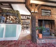
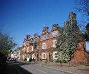
Red House Farm
Dickleburgh Crown
The Scole Inn
Videos from this area
These are videos related to the place based on their proximity to this place.
Lego Batman: The Chase for Two-Face
The Dark Knight struggles with Robin's ambitions, while the dreaded Two-Face reeks havoc upon the city. Can he be stopped? Score: "Hold Me, Thrill Me, Kiss Me, Kill Me" - U2.
JW CORE Training video 2
A promotional video demonstrating a mixture of different martial arts and strength & conditioning exercises at JW CORE in Long Stratton. Here are a couple of useful links to my other works....
Aftermath of Fire in the Harleston Thoroughfare
A view of the damage resulting from a recent fire in buildings at the Thoroughfare, Harleston, Norfolk.
Harleston Bottle pit ! (Ollie Grand and Sam Gilham)
Spent 3 days here with my mate ollie fishing for carp ! The first two days we both blanked without a bite but on the last day we caught 4 carp between us 21lb 22lb 23lb and a 23.8oz. This lake...
Pancake Races
Harleston Pancake Races, held in this market town in Norfolk on Shrove Tuesday - Pancake Day! Note the competitor dressed in the red-striped sweater - he looks straight out of the children's...
Videos provided by Youtube are under the copyright of their owners.
Attractions and noteworthy things
Distances are based on the centre of the city/town and sightseeing location. This list contains brief abstracts about monuments, holiday activities, national parcs, museums, organisations and more from the area as well as interesting facts about the region itself. Where available, you'll find the corresponding homepage. Otherwise the related wikipedia article.
Shelton Hall (Norfolk)
Shelton Hall is a large estate in the village of Shelton and Hardwick, Norfolk, England. The estate has around 72 acres of surrounding fields, the names of the fields include "Magic field" and "Echo field" and has a moat around the house and another smaller one in one of the fields. There are also lots of trees, shrubs and a bridge. The house belonged to the Shelton family, who reached their zenith during the reign of Henry VIII. John De Shelton, the first Lord of the Manor, was born c.1140.
Manor Farm, Diss
Manor Farm, a property belonging to the Landmark Trust, is located at Pulham Market, near the town of Diss, in Norfolk, England.
Pulham Market railway station
Pelham Market was a railway station on the Waveney Valley Line in Norfolk, England. It was closed as part of the Beeching Axe which saw many rural services heavily curtailed. Former Services Preceding station Disused railways Following station Tivetshall Great Eastern RailwayWaveney Valley Line Pulham St Mary
Pulham St Mary railway station
Pulham St Mary was a station in Pulham St Mary, Norfolk on the Waveney Valley Line which is now closed. The station has been demolished. Former Services Preceding station Disused railways Following station Pulham Market Great Eastern RailwayWaveney Valley Line Starston
Starston railway station
Starston was a railway station on the Waveney Valley Line in Norfolk, England. It was open for just ten years before low traffic usage caused its closure in 1866 nearly a century before the rest of the line. It is now a cottage. Former Services Preceding station Disused railways Following station Pulham St Mary Great Eastern RailwayWaveney Valley Line Harleston
Starston Windpump
Starston Wind Pump is a hollow post mill for pumping water, situated west of the village of Starston in the English county of Norfolk. The Pump is 330 yards away from the parish church of Saint Margaret in Mill Field. The windpump is a Grade II listed building and a scheduled ancient monument. After some years on the Heritage at Risk Register because of its poor condition, it was restored in 2010.


