Safety Score: 3,0 of 5.0 based on data from 9 authorites. Meaning we advice caution when travelling to United Kingdom.
Travel warnings are updated daily. Source: Travel Warning United Kingdom. Last Update: 2024-04-29 08:03:39
Delve into Barnoldswick
Barnoldswick in Lancashire (England) with it's 10,435 habitants is a city located in United Kingdom about 187 mi (or 302 km) north-west of London, the country's capital town.
Current time in Barnoldswick is now 11:32 AM (Monday). The local timezone is named Europe / London with an UTC offset of one hour. We know of 10 airports closer to Barnoldswick, of which 5 are larger airports. The closest airport in United Kingdom is Leeds Bradford Airport in a distance of 22 mi (or 35 km), East. Besides the airports, there are other travel options available (check left side).
There are several Unesco world heritage sites nearby. The closest heritage site in United Kingdom is Liverpool – Maritime Mercantile City in a distance of 60 mi (or 96 km), South-East. Also, if you like playing golf, there are some options within driving distance. In need of a room? We compiled a list of available hotels close to the map centre further down the page.
Since you are here already, you might want to pay a visit to some of the following locations: Burnley, Oxenhope, Keighley, Rochdale and Addingham. To further explore this place, just scroll down and browse the available info.
Local weather forecast
Todays Local Weather Conditions & Forecast: 10°C / 50 °F
| Morning Temperature | 6°C / 43 °F |
| Evening Temperature | 9°C / 49 °F |
| Night Temperature | 9°C / 48 °F |
| Chance of rainfall | 4% |
| Air Humidity | 86% |
| Air Pressure | 1009 hPa |
| Wind Speed | Fresh Breeze with 16 km/h (10 mph) from North |
| Cloud Conditions | Overcast clouds, covering 100% of sky |
| General Conditions | Light rain |
Tuesday, 30th of April 2024
15°C (59 °F)
8°C (47 °F)
Light rain, fresh breeze, broken clouds.
Wednesday, 1st of May 2024
14°C (56 °F)
11°C (52 °F)
Light rain, moderate breeze, overcast clouds.
Thursday, 2nd of May 2024
12°C (54 °F)
10°C (50 °F)
Overcast clouds, moderate breeze.
Hotels and Places to Stay
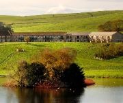
The Coniston Hotel and Country Estate
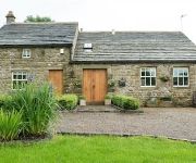
Dam Head Barn
The Barley Mow
The Pendle Inn
Skipton North (Gargrave)
Videos from this area
These are videos related to the place based on their proximity to this place.
Homeboy
A tired racing pigeon has been fed and watered at the rear of a pub in Colne, Lancashire, UK but is reluctant to continue his journey.
Cherry Lee Mewis - Big Ten Inch Record - Colne
Recorded at the British stage of the Great British Rhythm & Blues Festival on the 27th August, 2011. Cherry Lee Mewis - Vocals Nick Slater - dobro Robbie Matthews - Bass, harmonica and...
Dangerous Driver Cuts Car Up Forcing Him Off The Road
We went to pick my car up from the dealership, and we were driving home. My boyfriend is in the orange Audi TT in front of me and my dashcam is filming in my car. We were in the left lane....
plurielvideo.mp4
2008 Citroen C3 1.4 Pluriel Kiwi Convertable - full Leather, electric soft top roof with removable bars - superb car!!!!!!!!!!!!!!!!!!!!!! Another top marque from A J Car Sales of Colne Lancashire...
Sailing, Lake Burwain, Foulridge, Absolutely Tranquil
The best Friday of 2011, 30 September! The Classic Clinker Built Wooton Bridge Ibiza 12 drifts down the lake towards the sun set over Pendle Hill. A rare and exotic moment on the Yorkshire...
CitC4CoupeVideo.mp4
2007 Citroen C4 VT 1.4 Coupe in black - lovely car - very futuristic - all the extras - get it bought! Another superstar car from A J Car Sales of Colne - Lancashire, 2 mins from the eastbound...
autoaygovid.mp4
57 plate Toyota Aygo + 1.0 vvti 5 door in ice blue and it's a Automatic! A brilliant little car and only £20 per year road tax - get out of town!!!!! Another top deal from AJ Car Sales of...
ajcars04smart
04 smart passion semi auto coupe with glass panoramic roof in two tone blue over silver - it's number one!!!! lovely little 2 seater car at low,low price - with a full history. available now...
Videos provided by Youtube are under the copyright of their owners.
Attractions and noteworthy things
Distances are based on the centre of the city/town and sightseeing location. This list contains brief abstracts about monuments, holiday activities, national parcs, museums, organisations and more from the area as well as interesting facts about the region itself. Where available, you'll find the corresponding homepage. Otherwise the related wikipedia article.
A58 road
The A58 is a major road in northern England that runs between Prescot, Merseyside and Wetherby, West Yorkshire. It runs north east from Prescot on the outskirts of Liverpool via St Helens, Ashton-in-Makerfield, Hindley, Westhoughton, Bolton, Bury, Heywood, Rochdale and Littleborough then over the Pennines into West Yorkshire. The road then goes through Ripponden, Sowerby Bridge to Halifax and onwards to Leeds via the villages of Hipperholme, Birkenshaw and Drighlington.
West Craven
West Craven is an area in the east of Lancashire, England in the far northern part of the borough of Pendle. Historically the area has lain within the ancient county boundaries of Yorkshire and was administered as part of the Skipton Rural District of the West Riding of Yorkshire until 1974.
Weets Hill
Weets Hill is a hill in the West Craven area of Pendle, Lancashire, England. It is 2+⁄2 miles south-west of the town of Barnoldswick and is 4 miles north-east of Pendle Hill. The hill was originally part of Yorkshire, but following boundary changes in 1974 it became part of Lancashire. The summit has a Triangulation Pillar and commands views over much of east Lancashire, the north Ribble Valley, north Aire Valley and the Yorkshire Dales.
West Craven High Technology College
West Craven High Technology College is a mixed 11-16 comprehensive school in Barnoldswick, Lancashire, England, with specialist status as a Technology College.
Barnoldswick Town F.C
Barnoldswick Town F.C. are an English football club based in Barnoldswick, Lancashire. They play in the North West Counties League Premier Division.
Church of St Mary le Ghyll, Barnoldswick
The Church of St Mary le Ghyll (also known as St Mary-le-Gill) is located in Ghyll Lane, Barnoldswick, Lancashire, England. It is an active Anglican parish church in the deanery of Skipton, the archdeaconry of Craven, and the diocese of Bradford. Its benefice is united with those of Holy Trinity, Barnoldswick, and St Michael, Bracewell. The church is designated by English Heritage as a Grade I listed building.
St Michael's Church, Bracewell
St Michael's Church, Bracewell, is located in Bracewell Lane, Bracewell, Lancashire, England. It is an active Anglican parish church in the deanery of Skipton, the archdeaconry of Craven, and the diocese of Bradford. Its benefice is united with those of Holy Trinity, Barnoldswick, and St Mary le Ghyll, Barnoldswick. The church has been designated by English Heritage as a Grade I listed building.
Gledstone Hall
Gledstone Hall is a 20th century country house in West Marton, near Skipton, North Yorkshire. The house was designed by Edwin Lutyens and stands in a 12 hectare (30 acre) estate.


