Safety Score: 3,0 of 5.0 based on data from 9 authorites. Meaning we advice caution when travelling to United Kingdom.
Travel warnings are updated daily. Source: Travel Warning United Kingdom. Last Update: 2024-05-01 08:01:32
Explore Shepley
Shepley in Kirklees (England) with it's 5,444 inhabitants is located in United Kingdom about 158 mi (or 255 km) north-west of London, the country's capital.
Local time in Shepley is now 07:53 PM (Wednesday). The local timezone is named Europe / London with an UTC offset of one hour. We know of 9 airports in the wider vicinity of Shepley, of which 5 are larger airports. The closest airport in United Kingdom is Leeds Bradford Airport in a distance of 20 mi (or 32 km), North. Besides the airports, there are other travel options available (check left side).
There are several Unesco world heritage sites nearby. The closest heritage site in United Kingdom is Liverpool – Maritime Mercantile City in a distance of 32 mi (or 51 km), East. Also, if you like golfing, there are multiple options in driving distance. If you need a place to sleep, we compiled a list of available hotels close to the map centre further down the page.
Depending on your travel schedule, you might want to pay a visit to some of the following locations: Mirfield, Huddersfield, Penistone, Meltham and Cawthorne. To further explore this place, just scroll down and browse the available info.
Local weather forecast
Todays Local Weather Conditions & Forecast: 17°C / 63 °F
| Morning Temperature | 9°C / 49 °F |
| Evening Temperature | 15°C / 59 °F |
| Night Temperature | 12°C / 53 °F |
| Chance of rainfall | 1% |
| Air Humidity | 77% |
| Air Pressure | 1013 hPa |
| Wind Speed | Gentle Breeze with 7 km/h (5 mph) from West |
| Cloud Conditions | Overcast clouds, covering 88% of sky |
| General Conditions | Light rain |
Thursday, 2nd of May 2024
17°C (62 °F)
10°C (50 °F)
Overcast clouds, moderate breeze.
Friday, 3rd of May 2024
11°C (52 °F)
10°C (50 °F)
Moderate rain, gentle breeze, overcast clouds.
Saturday, 4th of May 2024
11°C (51 °F)
9°C (48 °F)
Moderate rain, gentle breeze, overcast clouds.
Hotels and Places to Stay
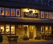
The Woodman Inn
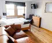
The Rooms at the Nook
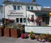
The Fountain Inn
The Grove
Elephant & Castle
Bagden Hall Hotel
Huddersfield Central Lodge Hotel
Cambridge
The Red Lion Inn
Old Bridge Inn
Videos from this area
These are videos related to the place based on their proximity to this place.
'MiddleBarn' barn conversion SOLD!
Beautiful barn conversion. THIS PROPERTY IS NOW SOLD. It will remain here for reference purposes for a while longer. But look out for more properties coming up! MiddleBarn is a beautifully...
45407 and 44871 with The Tin Bath 17-03-2013
The Tin Bath ran from Preston and Manchester over the steeply graded routes to West Yorkshire and passed through areas renowned for Lancashire cotton mills and Yorkshire woollen mills. The...
Kirkburton Royal Wedding Dresses Exhibition
Organiser Shirley Lingwood talks about the Royal Wedding Dresses Exhibition held at All Hallows Church, Kirkburton, West Yorkshire, over the Jubilee Weekend. As well as student projects to...
Jackson Bridge Jaunt
42 in the first (100 climbs) book finds bikebritain at Jackson Bridge early one morning....
Greyhound Dan running in the snow
Winter 2010/2011: Dan running around loving the snow in Shelley Woods near Huddersfield.
B&B Bed and Breakfast Accomodation Huddersfiield, Kirklees, West Yorkshire, UK
An old church conversion, Dogley Chapel B&B prices average £24.50 per night per person. all year round. Three beautiful doubles and one single bedroom by the proprietor. This B&B was restored...
Motorhome Hire
http://www.motorhomesdirect.co.uk/motorhome-hire/motorhome-hire-7/ If you are thinking about a motorhome hire holiday for the first time this summer, you might be a little apprehensive about...
How to fit car spark plugs
A video on how to fit new spark plugs. MicksGarage sells the full range of Haynes car DIY manuals. MicksGarage is Europe's leading online retailer of car parts and accessories. These products...
quick tip remote medical resources
interesting resources for Wilderness or WROL first aid/medicine. The books: Where there is no doctor and Where There Is no Dentist These books can be downloaded for free at: http://www.h...
Videos provided by Youtube are under the copyright of their owners.
Attractions and noteworthy things
Distances are based on the centre of the city/town and sightseeing location. This list contains brief abstracts about monuments, holiday activities, national parcs, museums, organisations and more from the area as well as interesting facts about the region itself. Where available, you'll find the corresponding homepage. Otherwise the related wikipedia article.
Shelley, West Yorkshire
Shelley is a village in the county of West Yorkshire, England, 3 miles (5 km) north of Holmfirth and 6 miles (9.5 km) south east of Huddersfield. It sometimes appears as Shelley Woodhouse and has a population of 3,059 (2001 census). http://www. kirklees. gov. uk/community/statistics/census-by-settlement/KS02settle2003. xls It is part of the Kirkburton ward of the local council. Road transport links are provided by the A629 and B6116.
River Dearne
The River Dearne is a river in South Yorkshire, England. It flows roughly east for more than 30 kilometres, from its source just inside West Yorkshire, through Denby Dale, Clayton West, Darton, Barnsley, Darfield, Wath upon Dearne, Bolton on Dearne, Adwick upon Dearne and Mexborough to its confluence with the River Don at Conisbrough. This was just one of many rivers that was involved in the 2007 United Kingdom floods.
Highburton
Highburton is part of the township of Kirkburton, a village in the county of West Yorkshire, England. It is located five miles southeast of Huddersfield. It occupies much of the high ground that can be found at the top of the steep inclines of Far Dene and Slant Gate and is a mixture of densely congregated housing estates and open pastoral farmland. According to the 2001 census it had a population of 3,288.
New Mill, West Yorkshire
New Mill, West Yorkshire, England, is a small, semi-rural village near the town of Holmfirth. It is in the metropolitan borough of Kirklees and the civil parish of Holme Valley. The village had a population of 1,259 (with Fulstone) in the 2001 census. The centre of the village is now on the crossroads of the Huddersfield - Sheffield A616 and Barnsley - Manchester A635 roads.
Stocksmoor
Stocksmoor is a hamlet, near Huddersfield, West Yorkshire, England. It is situated between the villages of Shepley and Brockholes. The total population of Thurstonland, Stocksmoor and Thunderbridge together was 953 in the 2001 census. http://www. kirklees. gov. uk/community/statistics/census-by-settlement/KS02settle2003.
A635 road
The A635 is a main road that runs between Manchester and Doncaster running east–west through Stalybridge, Saddleworth Moor, Holmfirth and Barnsley. The section forming the eastern part of the Mancunian Way is in fact a motorway and is officially designated as the A635(M) though there is no road sign with this designation; indeed the signs at the entrance of Mancunian Way westbound show A57(M).
Storthes Hall
Storthes Hall is a part of the township of Kirkburton, West Yorkshire, England. A heavily wooded area, it comprises a single road, Storthes Hall Lane, which links Kirkburton with the nearby villages of Farnley Tyas and Thurstonland. To the immediate north is North Spring Wood. Boothroyd Wood occupies the area to the south whilst Myers Wood can be found to the east. Myers Wood is the site of a medieval iron working site. A psychiatric hospital operated at Storthes Hall from 1904–1991.
Myers Wood
Myers Wood is a wooded area in the village of Kirkburton, West Yorkshire, England. It forms part of a heavily forested area to the west of the village, occupying the rise in the valley leading up to Storthes Hall and beyond. It can be found directly west of the main Penistone Road, opposite Riley. Saville Wood is directly south, close to Thunderbridge. The wood is famous for the discovery of an iron-working site dating from the Middle Ages.






!['Wagtail [Moticilla alba yarrellii]' preview picture of video 'Wagtail [Moticilla alba yarrellii]'](https://img.youtube.com/vi/8lJDTlagMy8/mqdefault.jpg)


