Safety Score: 3,0 of 5.0 based on data from 9 authorites. Meaning we advice caution when travelling to United Kingdom.
Travel warnings are updated daily. Source: Travel Warning United Kingdom. Last Update: 2024-05-02 08:23:34
Explore Dunford Bridge
Dunford Bridge in Barnsley (England) with it's 627 inhabitants is a city in United Kingdom about 155 mi (or 249 km) north-west of London, the country's capital.
Local time in Dunford Bridge is now 10:03 AM (Thursday). The local timezone is named Europe / London with an UTC offset of one hour. We know of 9 airports in the vicinity of Dunford Bridge, of which 5 are larger airports. The closest airport in United Kingdom is Manchester Woodford Airport in a distance of 20 mi (or 32 km), South-West. Besides the airports, there are other travel options available (check left side).
There are several Unesco world heritage sites nearby. The closest heritage site in United Kingdom is Liverpool – Maritime Mercantile City in a distance of 32 mi (or 52 km), East. Also, if you like golfing, there are multiple options in driving distance. If you need a place to sleep, we compiled a list of available hotels close to the map centre further down the page.
Depending on your travel schedule, you might want to pay a visit to some of the following locations: Meltham, Huddersfield, Penistone, Mirfield and Bradfield. To further explore this place, just scroll down and browse the available info.
Local weather forecast
Todays Local Weather Conditions & Forecast: 16°C / 60 °F
| Morning Temperature | 10°C / 49 °F |
| Evening Temperature | 12°C / 54 °F |
| Night Temperature | 9°C / 48 °F |
| Chance of rainfall | 0% |
| Air Humidity | 77% |
| Air Pressure | 1004 hPa |
| Wind Speed | Moderate breeze with 13 km/h (8 mph) from West |
| Cloud Conditions | Overcast clouds, covering 100% of sky |
| General Conditions | Overcast clouds |
Friday, 3rd of May 2024
10°C (51 °F)
9°C (48 °F)
Moderate rain, gentle breeze, overcast clouds.
Saturday, 4th of May 2024
10°C (49 °F)
7°C (45 °F)
Moderate rain, gentle breeze, overcast clouds.
Sunday, 5th of May 2024
13°C (55 °F)
10°C (49 °F)
Light rain, light breeze, overcast clouds.
Hotels and Places to Stay
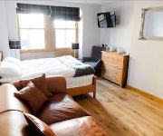
The Rooms at the Nook
Holmfirth Vineyard
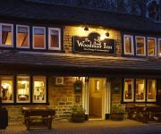
The Woodman Inn
Elephant & Castle
Durker Roods
The Red Lion Inn
Old Bridge Inn
Videos from this area
These are videos related to the place based on their proximity to this place.
Mikey plays - Tropico 5 - The Great Tornado! - #3
Today i've been wanting some city builders and Tropico 5 will sort that craving! Tropico 5 is a city building game with an interesting dynamic, You have wars and fight and the story line...
Mikey plays - Tropico 5 - A New Home, New Opportunities - #1
Today i've been wanting some city builders and Tropico 5 will sort that craving! Tropico 5 is a city building game with an interesting dynamic, You have wars and fight and the story line...
Mikey plays - Tropico 5 - Our Very FIRST Mansion! - #2
Today i've been wanting some city builders and Tropico 5 will sort that craving! Tropico 5 is a city building game with an interesting dynamic, You have wars and fight and the story line...
Feed The Beast - Season 2 - Let's Build! - Episode 2
BlueCircuit FTB is a modded Minecraft server setup for the People of the BlueCircuit Network. It is a private (whitelisted) server. We are currently accepting applications to active youtubers....
Feed The Beast - Season 2 - The Tunnel Bore! - Episode 29
Blue Circuit FTB is a modded Minecraft server setup for the People of the Blue Circuit Network. It is a private (white listed) server. We are currently accepting applications to active you...
Feed The Beast - Season 2 - Power Facility!! - Episode 17
Blue Circuit FTB is a modded Minecraft server setup for the People of the Blue Circuit Network. It is a private (white listed) server. We are currently accepting applications to active you...
Modded SMP Minecraft - BlueCircuit - #7 - Nuclear Cooling Towers
This pack is a custom pack created by me for the people on the blue circuit server. In todays episode we use the building guide from open blocks to create an awesome looking nuclear cooling towers ...
Minecraft Modded SMP - Season 2 - Third Degree Burns, BURN! - #2
We use a private FTB modpack with 169 mods currently. You can find a list of all the players on this server on my channel. -------------------------------------------------------------------------...
BlueCircuit - Feed The Beast - Season 4 - Episode 6 -- Ars Earth Elemental Brawl
In todays video we get a tonne of stuff done, Everything from logistics to spawning a earth elemental! ▻I hope you guys enjoyed the video! Be sure to leave a like.
BlueCircuit - Feed The Beast - S4 - E15 -- 22 Boss Battles!
In today's episode its action all the way as we fight 22 bosses within this episode these include 20 wither's, Hydra and twilight lich!
Videos provided by Youtube are under the copyright of their owners.
Attractions and noteworthy things
Distances are based on the centre of the city/town and sightseeing location. This list contains brief abstracts about monuments, holiday activities, national parcs, museums, organisations and more from the area as well as interesting facts about the region itself. Where available, you'll find the corresponding homepage. Otherwise the related wikipedia article.
Longdendale
Longdendale is a valley in Northern England, north of Glossop and south east of Holmfirth. The name means "long wooded valley" and the valley marks the boundary between the counties of Derbyshire and Greater Manchester.
River Don, South Yorkshire
The River Don (also called Dun in some stretches) is a river in South Yorkshire, England. It rises in the Pennines and flows for 70 miles eastwards, through the Don Valley, via Penistone, Sheffield, Rotherham, Mexborough, Conisbrough, Doncaster and Stainforth. It originally joined the Trent, but was re-engineered by Vermuyden as the Dutch River in the 1620s, and now joins the River Ouse at Goole in the East Riding of Yorkshire.
Carlecotes
Carlecotes is a village in the metropolitan borough of Barnsley in South Yorkshire, England, on the edge of the Peak District National Park. It is situated about 5 miles west of Penistone, in the township of Thurlstone.
Lane, West Yorkshire
Lane Village is a small hamlet 3 miles southwest of Holmfirth and approximately half a mile southwest of Holme Village on the A6024 Woodhead Road. It lies on the edge of Holme Moss just inside the Peak District National Park boundary. The rainwater springs seeping from Holme Moss and Kaye Edge provide the source of the River Holme. The village consists of farmhouses, holiday cottages and some private homes.


