Safety Score: 3,0 of 5.0 based on data from 9 authorites. Meaning we advice caution when travelling to United Kingdom.
Travel warnings are updated daily. Source: Travel Warning United Kingdom. Last Update: 2024-04-27 08:23:39
Explore Boughton Street
Boughton Street in Kent (England) is a city in United Kingdom about 49 mi (or 78 km) east of London, the country's capital.
Local time in Boughton Street is now 08:48 AM (Sunday). The local timezone is named Europe / London with an UTC offset of one hour. We know of 11 airports in the vicinity of Boughton Street, of which 5 are larger airports. The closest airport in United Kingdom is Kent International Airport in a distance of 17 mi (or 28 km), East. Besides the airports, there are other travel options available (check left side).
There are several Unesco world heritage sites nearby. The closest heritage site in United Kingdom is Canterbury Cathedral, St Augustine's Abbey, and St Martin's Church in a distance of 6 mi (or 9 km), East. Also, if you like golfing, there are multiple options in driving distance. We found 1 points of interest in the vicinity of this place. If you need a place to sleep, we compiled a list of available hotels close to the map centre further down the page.
Depending on your travel schedule, you might want to pay a visit to some of the following locations: Ashford, Southend-on-Sea, Upper Stoke, Leigh-on-Sea and Boxley. To further explore this place, just scroll down and browse the available info.
Local weather forecast
Todays Local Weather Conditions & Forecast: 11°C / 51 °F
| Morning Temperature | 10°C / 49 °F |
| Evening Temperature | 7°C / 45 °F |
| Night Temperature | 7°C / 45 °F |
| Chance of rainfall | 0% |
| Air Humidity | 77% |
| Air Pressure | 1003 hPa |
| Wind Speed | Strong breeze with 22 km/h (14 mph) from North-East |
| Cloud Conditions | Broken clouds, covering 84% of sky |
| General Conditions | Light rain |
Monday, 29th of April 2024
12°C (54 °F)
8°C (47 °F)
Few clouds, moderate breeze.
Tuesday, 30th of April 2024
14°C (58 °F)
10°C (50 °F)
Light rain, moderate breeze, overcast clouds.
Wednesday, 1st of May 2024
15°C (60 °F)
12°C (53 °F)
Overcast clouds, gentle breeze.
Hotels and Places to Stay
Holiday Inn Express CANTERBURY
Howfield Manor Hotel
Hotel Continental
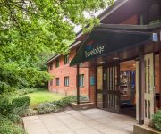
TRAVELODGE CANTERBURY DUNKIRK
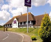
TRAVELODGE CANTERBURY WHITSTABLE
Whitstable
Videos from this area
These are videos related to the place based on their proximity to this place.
Faversham Town v Redhill - Oct 2014
Faversham Town v Redhill, Ryman League - Division One South, Saturday, 25 October 2014, Score: Faversham Town 3 Redhill 2, Attendance: 202.
Faversham Town v Guernsey - Sept 2014
Faversham Town v Guernsey, Ryman League - Division One South, Tuesday, 16 September 2014, Score: Faversham Town 3 Guernsey 0, Attendance: 154.
Faversham Town v Sittingbourne - Dec 2014
Faversham Town v Sittingbourne, Ryman League - Division One South, Saturday, 27 December 2014, Score: Faversham Town 3 Sittingbourne 0, Attendance: 463.
Faversham Town v Whitstable Town - Jan 2015
Faversham Town v Whitstable Town, Ryman League - Division One South, Saturday, 24 January 2015, Score: Faversham Town 1 Whitstable Town 3, Attendance: 451.
Faversham Town v Three Bridges - Jan 2015
Faversham Town v Three Bridges, Ryman League - Division One South, Saturday, 10 January 2015, Score: Faversham Town 3 Three Bridges 0, Attendance: 202.
Faversham Town v East Grinstead Town - Feb 2015
Faversham Town v East Grinstead Town, Ryman League - Division One South, Saturday, 14 February 2015, Score: Faversham Town 3 East Grinstead Town 0, Attendance: 203.
Faversham Town v Tooting & Mitcham United - Apr 2015
Faversham Town v Tooting & Mitcham United, Ryman League - Division One South, Saturday, 4 April 2015, Score: Faversham Town 1 Tooting & Mitcham United 0, Attendance: 233.
Faversham Town v Burgess Hill Town - Mar 2015
Faversham Town v Burgess Hill Town, Ryman League - Division One South, Saturday, 28 March 2015, Score: Faversham Town 0 Burgess Hill Town 0, Attendance: 335.
Faversham Town v Carshalton Athletic - Mar 2015
Faversham Town v Carshalton Athletic, Ryman League - Division One South, Tuesday, 24 March 2015, Score: Faversham Town 5 Carshalton Athletic 0, Attendance: 170.
Faversham Town v Chipstead - Jan 2015
Faversham Town v Chipstead, Ryman League - Division One South, Tuesday, 27 January 2015, Score: Faversham Town 2 Chipstead 1, Attendance: 133.
Videos provided by Youtube are under the copyright of their owners.
Attractions and noteworthy things
Distances are based on the centre of the city/town and sightseeing location. This list contains brief abstracts about monuments, holiday activities, national parcs, museums, organisations and more from the area as well as interesting facts about the region itself. Where available, you'll find the corresponding homepage. Otherwise the related wikipedia article.
Selling railway station
Selling railway station serves the village of Selling in Kent, England. The station is 55+⁄4 miles south east of London Victoria on the Chatham Main Line towards Dover Priory. The station is served and operated by Southeastern. The station and the line it serves were built by the London, Chatham and Dover Railway. Formerly an excellent example of country station architecture, it was mysteriously destroyed by fire in the early 1990s, shortly before it was to be awarded listed building status.
A299 road
The A299, better known as the Thanet Way, is a major road in the county of Kent, England, and runs from Brenley Corner near Faversham (where it merges into the M2) to Ramsgate via Whitstable and Herne Bay. It is predominantly used for freight traffic to Ramsgate Harbour and local traffic to Thanet, and is 22 miles long. It also provides access to Manston Airport.
Battle of Bossenden Wood
The Battle of Bossenden Wood took place on 31 May 1838 near Hernhill in Kent; it has been called the last battle on English soil. The battle was fought between a small group of labourers from the Hernhill, Dunkirk, and Boughton area and a detachment of soldiers sent from Canterbury to arrest the marchers' leader, the self-styled Sir William Courtenay, who was actually John Nichols Tom, a Truro maltster who had spent four years in Kent County Lunatic Asylum.
Crouch, Swale
Crouch is a hamlet in the civil parish of Boughton under Blean in the Swale District, in the county of Kent, England. Nearby settlements include the town of Faversham and the villages of Selling, Gushmere, South Street and Neames Forstal.
Perrywood
Perrywood is a village and a wood near the village of Selling, in the Swale District, in the English county of Kent. It is south of the town of Faversham.
Staplestreet
Staplestreet is a village near the village of Boughton Street, in the Swale District of the English county of Kent. It is east of the town of Faversham. For transport there is the A2 road and the A299 road nearby.
St Bartholomew's Church, Goodnestone
St Bartholomew's Church, Goodnestone, is a redundant Anglican church in the village of Goodnestone, Kent, England. It has been designated by English Heritage as a Grade I listed building, and is under the care of the Churches Conservation Trust. The village is some 1.5 miles east of Faversham, to the west of the A299 road.


