Safety Score: 3,0 of 5.0 based on data from 9 authorites. Meaning we advice caution when travelling to United Kingdom.
Travel warnings are updated daily. Source: Travel Warning United Kingdom. Last Update: 2024-04-28 08:22:10
Discover Padfield
Padfield in Derbyshire (England) is a town in United Kingdom about 155 mi (or 250 km) north-west of London, the country's capital city.
Current time in Padfield is now 07:19 PM (Sunday). The local timezone is named Europe / London with an UTC offset of one hour. We know of 8 airports near Padfield, of which 6 are larger airports. The closest airport in United Kingdom is Manchester Woodford Airport in a distance of 12 mi (or 19 km), South-West. Besides the airports, there are other travel options available (check left side).
There are several Unesco world heritage sites nearby. The closest heritage site in United Kingdom is Liverpool – Maritime Mercantile City in a distance of 39 mi (or 63 km), East. Also, if you like playing golf, there are a few options in driving distance. Looking for a place to stay? we compiled a list of available hotels close to the map centre further down the page.
When in this area, you might want to pay a visit to some of the following locations: Mossley, Disley, Ashton-under-Lyne, Meltham and Oldham. To further explore this place, just scroll down and browse the available info.
Local weather forecast
Todays Local Weather Conditions & Forecast: 6°C / 43 °F
| Morning Temperature | 4°C / 39 °F |
| Evening Temperature | 7°C / 45 °F |
| Night Temperature | 4°C / 40 °F |
| Chance of rainfall | 8% |
| Air Humidity | 91% |
| Air Pressure | 1003 hPa |
| Wind Speed | Moderate breeze with 11 km/h (7 mph) from East |
| Cloud Conditions | Overcast clouds, covering 100% of sky |
| General Conditions | Moderate rain |
Monday, 29th of April 2024
11°C (51 °F)
9°C (48 °F)
Light rain, fresh breeze, overcast clouds.
Tuesday, 30th of April 2024
15°C (59 °F)
9°C (48 °F)
Light rain, moderate breeze, broken clouds.
Wednesday, 1st of May 2024
16°C (61 °F)
11°C (52 °F)
Light rain, gentle breeze, broken clouds.
Hotels and Places to Stay
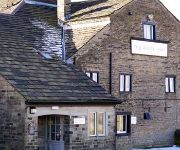
The White Hart
TRAVELODGE GLOSSOP
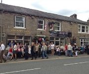
The Waggon Inn
Videos from this area
These are videos related to the place based on their proximity to this place.
Glossop North End AFC v Bootle FC 04/04/2015
Glossop North End v Bootle NWCFL MEN UNITED CUP Semi Final.
GoPro Yamaha Grizzly 700 Glossop
Camera Test Around Glossop Derbyshire UK March 2015, GoPro Hero 3+ Black and Headcam Ten80.
Pilates and Pre Natal at the Pilates Studio Glossop Part One
Pilates and Pre Natal at the Pilates Studio Glossop (http://www.thestudioglossop.co.uk) with Cherry Baker (http://www.cherrybaker.com) Part One.
Glossop North End v Squires Gate, Carey Penalty
Jason Carey converts from the penalty spot for Glossop North End v Squires Gate in the NWCFL League Cup. Tue 17th Feb 2015.
Glossop North End v AFC Blackpool 25/10/2014
Glossop North End v AFC Blackpool 2014/15 NWCFL MEN Cup.
Glossop North End v Gamesley Highlights 11/11/2014
Glossop North End v Gamesley Derbyshire Cup 2nd Round.
Glossop North End v Gamesley (Full Match) 11/11/2014
Glossop North End v Gamesley Derbyshire Cup 2nd Round full game.
Videos provided by Youtube are under the copyright of their owners.
Attractions and noteworthy things
Distances are based on the centre of the city/town and sightseeing location. This list contains brief abstracts about monuments, holiday activities, national parcs, museums, organisations and more from the area as well as interesting facts about the region itself. Where available, you'll find the corresponding homepage. Otherwise the related wikipedia article.
Tintwistle Rural District
Tintwistle Rural District was a local government district in north east Cheshire, England from 1894 to 1974. It was created a rural district by the Local Government Act 1894 from the part of the Ashton-under-Lyne rural sanitary district which was in Cheshire. It consisted of the civil parishes of: Tintwistle Hattersley (until 1936) Matley (until 1936) Hattersley and Matley formed an exclave of the district.
Dinting
Dinting is also a mining practice of removing parts of the floor that lift due to floor heave. Dinting is a district of Glossop in Derbyshire, England. It is a small village and has no shops; the nearest are in neighbouring Glossop or Hadfield. However, there is a small primary school, Dinting C of E, located near the viaduct. The village is served by Dinting railway station.
Dinting railway station
Dinting railway station serves the village of Dinting near Glossop in Derbyshire, England. The station is on the Manchester-Glossop Line 12¼ miles (20 km) east of Manchester Piccadilly. Prior to the Woodhead Line closure in 1981 Dinting was a station on a major cross Pennine route. At Piccadilly, you can access other lines, such as Stockport, through New Mills Newtown and on to Buxton.
Valehouse Reservoir
Valehouse (or Vale House) Reservoir is a man-made lake in Longdendale in north Derbyshire. It was built between 1865 and 1869 as part of the Longdendale chain, which was built to supply water from the River Etherow to the urban areas of Greater Manchester while maintaining a constant flow into the river. The upper reservoirs supply the drinking water, while Vale House and Bottoms are compensation reservoirs which guarantee the flow of water to water-powered mills downstream.
Bottoms Reservoir (Derbyshire)
Bottoms Reservoir is a man-made lake in Longdendale in north Derbyshire, England. It was constructed between 1865 and 1877, by John Frederick Bateman as part of the Longdendale chain to supply water from the River Etherow to the urban areas of Greater Manchester. The upper reservoirs supplied the drinking water, while Bottoms and Vale House reservoirs regulated the flow downstream for the benefit of local water-powered mills. The reservoir was obliged to release ten million gallons a day.
Glossop Hall
Glossop Hall was the last residential building on the site of Royle Hall in Glossop, Derbyshire. Work started on the penultimate building around 1730 and it was used as a hunting lodge by Phillipa Howard, daughter of Henry Howard, 6th Duke of Norfolk, and her husband. The building as shown was only used for part of the year. Rebuilt around 1870 by Lord Howard of Glossop and sold to the council in 1924 it became Kingsmoor School and was eventually demolished around 1950.
North Road Ground, Glossop
North Road Ground is a cricket ground in Glossop, England which Derbyshire used between 1899 and 1910, during which period the ground hosted one or two County Championship matches each year. Derbyshire have clearly not totally forgotten about the ground, as they have played a Second XI Trophy match at the ground annually since 1997, the 2008 fixture taking place on 4 July against Lancashire. The ground hosted fifteen first-class matches. Game Information: Game Statistics: first-class:
Glossop Castle
Glossop Castle (also known as Mouselow Castle) is a Norman earthwork north of Glossop, off "Hilltop Road", 14 miles east of Manchester, on the A57. The site is visible from the main road, standing atop a commanding ridge. Some 16 miles southeast is Peveril Castle.


