Safety Score: 3,0 of 5.0 based on data from 9 authorites. Meaning we advice caution when travelling to United Kingdom.
Travel warnings are updated daily. Source: Travel Warning United Kingdom. Last Update: 2024-04-27 08:23:39
Discover Diggle
Diggle in Oldham (England) with it's 1,716 citizens is a town in United Kingdom about 163 mi (or 262 km) north-west of London, the country's capital city.
Current time in Diggle is now 07:56 PM (Saturday). The local timezone is named Europe / London with an UTC offset of one hour. We know of 8 airports near Diggle, of which 5 are larger airports. The closest airport in United Kingdom is Manchester Woodford Airport in a distance of 17 mi (or 27 km), South. Besides the airports, there are other travel options available (check left side).
There are several Unesco world heritage sites nearby. The closest heritage site in United Kingdom is Liverpool – Maritime Mercantile City in a distance of 42 mi (or 68 km), East. Also, if you like playing golf, there are a few options in driving distance. Looking for a place to stay? we compiled a list of available hotels close to the map centre further down the page.
When in this area, you might want to pay a visit to some of the following locations: Mossley, Oldham, Ashton-under-Lyne, Meltham and Rochdale. To further explore this place, just scroll down and browse the available info.
Local weather forecast
Todays Local Weather Conditions & Forecast: 10°C / 49 °F
| Morning Temperature | 4°C / 39 °F |
| Evening Temperature | 8°C / 47 °F |
| Night Temperature | 5°C / 41 °F |
| Chance of rainfall | 0% |
| Air Humidity | 66% |
| Air Pressure | 1006 hPa |
| Wind Speed | Gentle Breeze with 9 km/h (5 mph) from South-West |
| Cloud Conditions | Overcast clouds, covering 99% of sky |
| General Conditions | Overcast clouds |
Sunday, 28th of April 2024
4°C (39 °F)
4°C (39 °F)
Rain and snow, moderate breeze, overcast clouds.
Monday, 29th of April 2024
12°C (53 °F)
10°C (49 °F)
Light rain, moderate breeze, overcast clouds.
Tuesday, 30th of April 2024
15°C (58 °F)
11°C (51 °F)
Light rain, moderate breeze, overcast clouds.
Hotels and Places to Stay
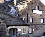
The White Hart
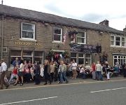
The Waggon Inn
Videos from this area
These are videos related to the place based on their proximity to this place.
Saddleworth Morris Men at Boarshurst Band Club, Greenfield, Nr. Oldham. OL3 7EU
28th March 2013, Boarshurst Band Club in Greenfield, Saddleworth. Every year on Maundy Thursday their is village fair held at the bottom of Kinders Lane in Greenfield. It is mentioned in the...
A62 - Marsden to Diggle
A clip from the dashcam showing how the councils deal with gritting...one side is Kirklees and the other Oldham....see if you can spot where they meet...
Banshee 425ypvs chased by an S8
Just having a laugh trying out the Modded Engine..... It worked as you can hear.
2011 Brighouse & Rastrick pay tribute to Alan Chamberlain at Greenfield Whitfriday Band Contest
Brighouse & Rastrick pay tribute to Alan Chamberlain who died in a tragic accident at the 2010 Greenfield Contest by playing "There is a green hill far away" This footage was taken on 17th...
Delph Youth Brass Band play at the Greenfield contest on Whit Friday 2012
Delph Youth Brass Band play at Greenfield on 1 June 2012 as part of the world famous Saddleworth Brass Band contests. Tune they play is Cross of Honour.
A Walk with Viszlas Around Yeoman Hey and Greenfield Reservoirs
Filmed on an iPhone 4S with inspiration from iPhone Video Hero - http://bit.ly/Sgqs6b - my first video, so thank you Jules Watkins! A lovely 3 mile walk from Binn Green car park, where RSPB...
Videos provided by Youtube are under the copyright of their owners.
Attractions and noteworthy things
Distances are based on the centre of the city/town and sightseeing location. This list contains brief abstracts about monuments, holiday activities, national parcs, museums, organisations and more from the area as well as interesting facts about the region itself. Where available, you'll find the corresponding homepage. Otherwise the related wikipedia article.
Huddersfield Narrow Canal
The Huddersfield Narrow Canal is an inland waterway in northern England. It runs just under 20 miles from Lock 1E at the rear of the University of Huddersfield campus, near Aspley Basin at Huddersfield to the junction with the Ashton Canal at Whitelands Basin in Ashton-under-Lyne. It crosses the Pennines by means of 74 locks and the Standedge Tunnel.
Saddleworth School
Saddleworth School is a mixed-sex secondary school for 11-16 year olds and is located in Uppermill, in the civil parish of Saddleworth in the Metropolitan Borough of Oldham, England. The school contains approximately 1300 students and 80 teachers.
Standedge
Standedge (pronounced Stannige) is a moorland escarpment in the Pennine Hills of northern England. Located between Marsden, West Yorkshire and Diggle, Greater Manchester, Standedge has been a major moorland crossing point since Roman times and possibly earlier. From east to west, Standedge is crossed by five generations of road crossing, the earliest being a Roman road from York to Chester and the latest being the current A62.
List of United Kingdom locations: Do-Dor
Yeoman Hey Reservoir
Yeoman Hey Reservoir is a reservoir in the English Peak District. On its margin is a commemorative stone laid by the King of Tonga in 1981. The reservoir is within the boundaries of Greater Manchester but was formerly in the West Riding of Yorkshire. It is one of three reservoirs in the same valley: above it is Greenfield Reservoir, and adjacent to and below it is Dovestone Reservoir. The reservoirs lie to the south of the A635 road across Saddleworth Moor.
Diggle railway station
Diggle railway station served the village of Diggle and was located on the Huddersfield Line to the north of Uppermill. Situated immediately to the west of the Standedge tunnels, it was opened in 1849 along with the first rail tunnel and closed to passenger traffic in 1968. In its heyday, the station had platforms serving all four lines but little trace remains of it today (although the nearby signal box remains operational).
Friezland railway station
Friezland Railway Station served the Hamlet of Friezland in Saddleworth until closure on 1 January 1917. It was built by the London and North Western Railway on its Micklehurst Line. Preceding station Disused railways Following station Micklehurst L&NWMicklehurst Line Uppermill
St Thomas' Church, Friarmere
St Thomas' Church, Friarmere, also known as Heights Chapel, is a redundant Anglican church standing on a hillside overlooking the village of Delph, Greater Manchester, England. It is designated by English Heritage as a Grade II* listed building, and is under the care of the Churches Conservation Trust.


