Safety Score: 3,0 of 5.0 based on data from 9 authorites. Meaning we advice caution when travelling to United Kingdom.
Travel warnings are updated daily. Source: Travel Warning United Kingdom. Last Update: 2024-05-02 08:23:34
Touring Loweswater
Loweswater in Cumbria (England) is a town located in United Kingdom about 250 mi (or 403 km) north-west of London, the country's capital place.
Time in Loweswater is now 03:11 AM (Friday). The local timezone is named Europe / London with an UTC offset of one hour. We know of 10 airports nearby Loweswater, of which 4 are larger airports. The closest airport in United Kingdom is Barrow Walney Island Airport in a distance of 31 mi (or 50 km), South. Besides the airports, there are other travel options available (check left side).
There are several Unesco world heritage sites nearby. The closest heritage site in United Kingdom is New Lanark in a distance of 87 mi (or 140 km), North-East. Also, if you like the game of golf, there are several options within driving distance. We collected 1 points of interest near this location. Need some hints on where to stay? We compiled a list of available hotels close to the map centre further down the page.
Being here already, you might want to pay a visit to some of the following locations: Carlisle, Dumfries, Blackpool, Greenhead and Warton. To further explore this place, just scroll down and browse the available info.
Local weather forecast
Todays Local Weather Conditions & Forecast: 13°C / 56 °F
| Morning Temperature | 9°C / 49 °F |
| Evening Temperature | 12°C / 53 °F |
| Night Temperature | 11°C / 51 °F |
| Chance of rainfall | 1% |
| Air Humidity | 90% |
| Air Pressure | 1006 hPa |
| Wind Speed | Moderate breeze with 9 km/h (6 mph) from South-West |
| Cloud Conditions | Overcast clouds, covering 99% of sky |
| General Conditions | Light rain |
Saturday, 4th of May 2024
11°C (52 °F)
9°C (49 °F)
Heavy intensity rain, gentle breeze, overcast clouds.
Sunday, 5th of May 2024
11°C (52 °F)
10°C (50 °F)
Overcast clouds, gentle breeze.
Monday, 6th of May 2024
14°C (57 °F)
11°C (52 °F)
Light rain, light breeze, overcast clouds.
Hotels and Places to Stay
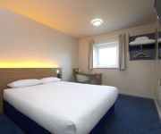
TRAVELODGE COCKERMOUTH
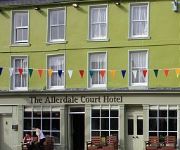
Allerdale Court Hotel
Allerdale Court
Videos from this area
These are videos related to the place based on their proximity to this place.
Lake District: High Lorton to Buttermere (B5289) drive
A drive along the B5289 from High Lorton towards Buttermere. I was told that the junction (left turn) for Buttermere is easy to miss, but I found it easily e...
Lake District Cumbria England
Slide show of a selection of photographs taken between 9 and 15 July 2011 during a holiday to The Lake District Cumbria England, the weather was glorious for the whole holiday unusual for here...
Hopegill Head, Lake District 22 August 20
Created on August 23, 2009 using FlipShare. A walk from to Hopegill Head via Ladysyke Pike starting and finishing in the village of Lorton.
Dodd Wood in the school holidays
We went the green route - 2 hours to get to the summit. It took us 40 minutes to drive to Dodd Wood from the Tranquil Otter.
Loweswater, Cumbria, Dive sites 2 & 3
a short, HD wide screen video film, for divers. Showing features above the water line . . . including path access to site along with audio commentary on what to expect during this dive...
Lake District Country Walk Loweswater Mosedale Crummock Water round
Our video is a guided walk in the Lake District. From Loweswater village we along the western side of Mellbreak in the Mosedale valley to Scale Beck then return along the shore of Crummock...
Lake District Country Walk Rannerdale Knotts and the Bluebells round
Our video is a guided walk in the Lake District. From the northern end of Crummock Water near Buttermere we follow the shore of the water through Rannerdale and then head uphill to Rannerdale...
Videos provided by Youtube are under the copyright of their owners.
Attractions and noteworthy things
Distances are based on the centre of the city/town and sightseeing location. This list contains brief abstracts about monuments, holiday activities, national parcs, museums, organisations and more from the area as well as interesting facts about the region itself. Where available, you'll find the corresponding homepage. Otherwise the related wikipedia article.
Buttermere and Ennerdale
Buttermere and Ennerdale is a National Trust property located in the Lake District of Cumbria, England. The property comprises an area of 8,866 acres of fell and common land, including the lakes of Buttermere, Crummock Water and Loweswater, seven farms and woodland, as well as access to Ennerdale Water.
Crummock Water
Crummock Water is a lake in the Lake District in Cumbria, North West England situated between Buttermere to the south and Loweswater to the north. Crummock Water is two and a half miles long, three quarters of a mile wide and 140 feet deep. The River Cocker is considered to start at the north of the lake, before then flowing into Lorton Vale.
Loweswater
Loweswater is one of the smaller lakes in the English Lake District. The village of Loweswater is situated at the foot of the lake. The lake is not far from Cockermouth and is also easily reached from elsewhere in West Cumbria. The group of fells to the south of Loweswater is known as the Loweswater Fells and consists of Mellbreak, Gavel Fell, Blake Fell, Hen Comb and Burnbank Fell. To the north of the lake lies the Fellbarrow range.
Scale Force
Scale Force is considered the highest waterfall in the English Lake District. Opinions can vary about how its precise height is calculated, but the total height is normally stated as 170 feet (51.8m), with a single drop of water of 120 feet (36.6m) and several smaller drops. It is on the stream Scale Beck. The waterfall – or force (a Norse term for waterfall) – is hidden in a deep gorge on the northern flank of Red Pike (Buttermere).


