Safety Score: 3,0 of 5.0 based on data from 9 authorites. Meaning we advice caution when travelling to United Kingdom.
Travel warnings are updated daily. Source: Travel Warning United Kingdom. Last Update: 2024-04-28 08:22:10
Discover Arlecdon
Arlecdon in Cumbria (England) with it's 757 citizens is a place in United Kingdom about 252 mi (or 406 km) north-west of London, the country's capital city.
Current time in Arlecdon is now 07:28 PM (Sunday). The local timezone is named Europe / London with an UTC offset of one hour. We know of 11 airports near Arlecdon, of which 5 are larger airports. The closest airport in United Kingdom is Barrow Walney Island Airport in a distance of 30 mi (or 49 km), South. Besides the airports, there are other travel options available (check left side).
There are several Unesco world heritage sites nearby. The closest heritage site in United Kingdom is New Lanark in a distance of 91 mi (or 147 km), North-East. Also, if you like playing golf, there are a few options in driving distance. We encountered 1 points of interest in the vicinity of this place. If you need a hotel, we compiled a list of available hotels close to the map centre further down the page.
While being here, you might want to pay a visit to some of the following locations: Dumfries, Carlisle, Blackpool, Maughold and Bride. To further explore this place, just scroll down and browse the available info.
Local weather forecast
Todays Local Weather Conditions & Forecast: 9°C / 48 °F
| Morning Temperature | 5°C / 41 °F |
| Evening Temperature | 9°C / 48 °F |
| Night Temperature | 9°C / 48 °F |
| Chance of rainfall | 0% |
| Air Humidity | 70% |
| Air Pressure | 1003 hPa |
| Wind Speed | Fresh Breeze with 13 km/h (8 mph) from North-East |
| Cloud Conditions | Overcast clouds, covering 100% of sky |
| General Conditions | Light rain |
Monday, 29th of April 2024
11°C (51 °F)
10°C (51 °F)
Moderate rain, high wind, near gale, broken clouds.
Tuesday, 30th of April 2024
13°C (56 °F)
11°C (52 °F)
Light rain, strong breeze, overcast clouds.
Wednesday, 1st of May 2024
12°C (54 °F)
12°C (53 °F)
Light rain, moderate breeze, overcast clouds.
Hotels and Places to Stay
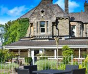
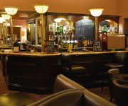
Hunday Manor
The Ennerdale Country House Hotel Main Street
Videos from this area
These are videos related to the place based on their proximity to this place.
Triumph Bonnevelle Vlog Themed Ride with Marcus Aurelius
Join us for a ride on the Triumph Bonneville. English Lake District, Ennerdale to Calder Bridge. The theme is philosophy, with some tunes to go with the journey. 4%, just 4% of the observed...
Outrun Online Arcade PS3. Time Attack MT Tuned Goal A Giant Statues 4.23.264
Outrun Online Arcade PS3 logitech driving force GT wheelstand pro. i can go faster :) psn id SEGASPENCE outrun boards: http://www.gamefaqs.com/boards/gentopic.php?board=955477.
Cleator Moor town bid with 'Carson' .wmv
Dreams of a better Cleator Moor with the Mary Portas bid in mind.
Cleator Moor The Square
A quick look over The Square & surroundings. (Subscribe to my YouTube channel to see all my video's)
MMRA of Great Britain Minimoto Racing Promo Video
MMRA of GB racing promotional video from June 1995. Shot on location at Rowrah Kart Circuit in Cumbria on a glorious sunny day featuring some of the best minimoto riders of all time (I am biased...
Project Space Eye Sub Zero Testing
The Project Space Eye team continue to develop their mission. This week the team from West Lakes Academy conduct sub zero testing for the balloon capsule. Follow their progress in the Lab at...
Graphskill Ltd 1205 Munsen style pipe clamp with Unistrut
Shows how easy it is to connect the Graphskill 1205 bossed pipe clamp to unistrut / Oglaend channelling.
Branthwaite Hall
Hi Here is a video of the little known Branthwaite Hall. Branthwaite Hall with its Peel Tower was built near the village of Branthwaite and the towns of Workington / Cockermouth in the mid-15th...
Videos provided by Youtube are under the copyright of their owners.
Attractions and noteworthy things
Distances are based on the centre of the city/town and sightseeing location. This list contains brief abstracts about monuments, holiday activities, national parcs, museums, organisations and more from the area as well as interesting facts about the region itself. Where available, you'll find the corresponding homepage. Otherwise the related wikipedia article.
List of United Kingdom locations: As-Az
Ullock
Ullock is a village in Cumbria, England. It is located 254 miles from London.
Arlecdon railway station
Arlecdon railway station was a station which served the village of Arlecdon in the former English county of Cumberland, now part of Cumbria. It was served by trains on the line between Workington and Cleator Moor.
Ennerdale Bridge
Ennerdale Bridge is a settlement in the county of Cumbria, England. Ennerdale Bridge lies at the confluence of Croasdale Beck and the River Ehen and is on the border of the Lake District National Park that uses both watercourses as its boundary. The nearest town is Cleator Moor to its west. Ennerdale Bridge appear in many versions of the Coast to Coast Walk and is 13 miles from its western end. The parish church, dedicated to St Mary, is Victorian - dating from 1858 - in the Romanesque style.
Kirkland, Copeland
Kirkland is a small village near the A5086 road, in the Copeland district, in the English county of Cumbria. The nearest town is Cleator Moor. The Bible Christian chapel was built when Cornish tin-miners relocated to the iron ore workings in West Cumbria. It replicates the Bible Christian Chapels in Devon & Cornwall. The Bible Christians amalgamated into the Methodist Movement in the early 20th century. This chapel was 'revived' and used until the mid-1990s.
Kelton Head
Kelton Head is a hamlet in Cumbria, England. It has just 4 houses, and is very close to Kelton Head Quarry, near Rowrah. Despite this, it is in the Lamplugh Neighbourhood.


