Safety Score: 3,0 of 5.0 based on data from 9 authorites. Meaning we advice caution when travelling to United Kingdom.
Travel warnings are updated daily. Source: Travel Warning United Kingdom. Last Update: 2024-04-28 08:22:10
Delve into Point
Point in Cornwall (England) is located in United Kingdom about 234 mi (or 376 km) south-west of London, the country's capital town.
Current time in Point is now 04:02 PM (Sunday). The local timezone is named Europe / London with an UTC offset of one hour. We know of 10 airports close to Point, of which 3 are larger airports. The closest airport in United Kingdom is Newquay Cornwall Airport in a distance of 16 mi (or 26 km), North. Besides the airports, there are other travel options available (check left side).
There is one Unesco world heritage site nearby. It's Cornwall and West Devon Mining Landscape in a distance of 21 mi (or 33 km), East. Also, if you like playing golf, there is an option about 4 mi (or 6 km). away. If you need a hotel, we compiled a list of available hotels close to the map centre further down the page.
While being here, you might want to pay a visit to some of the following locations: Perranarworthal, Falmouth, Truro, Chacewater and St. Day. To further explore this place, just scroll down and browse the available info.
Local weather forecast
Todays Local Weather Conditions & Forecast: 12°C / 53 °F
| Morning Temperature | 7°C / 44 °F |
| Evening Temperature | 10°C / 50 °F |
| Night Temperature | 7°C / 45 °F |
| Chance of rainfall | 1% |
| Air Humidity | 64% |
| Air Pressure | 1010 hPa |
| Wind Speed | Moderate breeze with 11 km/h (7 mph) from South-East |
| Cloud Conditions | Few clouds, covering 22% of sky |
| General Conditions | Light rain |
Monday, 29th of April 2024
11°C (52 °F)
11°C (52 °F)
Light rain, strong breeze, overcast clouds.
Tuesday, 30th of April 2024
11°C (52 °F)
9°C (48 °F)
Moderate rain, strong breeze, overcast clouds.
Wednesday, 1st of May 2024
12°C (54 °F)
9°C (49 °F)
Light rain, moderate breeze, overcast clouds.
Hotels and Places to Stay
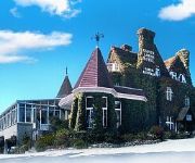
Merchants Manor
South Point Antigua
St Michael's Hotel & Spa
Anacapri Guest House
Donnington Guest House
The Oasis Guesthouse
Hawthorne Dene Hotel
Penmere Manor Hotel
The Falmouth Hotel
Penmorvah Manor
Videos from this area
These are videos related to the place based on their proximity to this place.
TRURO BUSES 2009
a trailer for www.pmpfilms.com the world's largest range of transport hobby films, see website for shop, list, links, blog etc.
Mylor Churchyard and Marina
Filmed in early April 2009. For more videos of Cornwall: http://www.visitcornwall.tv.
Sprint coaching 2
Windsport International - Sprint 15 Catamaran coaching from Brian Phipps at the Cat Clinic. In the stunning sailing waters of the Carrick Roads off the Windsport Centre based at Mylor Yacht...
Cornwall Summer Holiday 2014
Our holiday last Summer to Ferris's Cottage (on the Fal River) was amazing and here is the annual edit that I eventually get down to finishing & uploading. Enjoy :)
The Long Way Up 2
Footage from the bikes as we travel from Lands End to John O Groats 'off-road style' in aid of St Michaels Hospice (Hereford). If you want to knopw more abou...
Videos provided by Youtube are under the copyright of their owners.
Attractions and noteworthy things
Distances are based on the centre of the city/town and sightseeing location. This list contains brief abstracts about monuments, holiday activities, national parcs, museums, organisations and more from the area as well as interesting facts about the region itself. Where available, you'll find the corresponding homepage. Otherwise the related wikipedia article.
Angarrick
Angarrick (Cornish: An Garrek, meaning The Rock) is a small settlement in Cornwall, England, United Kingdom. It is situated three miles (5 km) north of Falmouth in the civil parish of Mylor. The hamlet is a mile north of Mylor Bridge on the hills above Restronguet Creek.
Devoran
Devoran is a village in south Cornwall, England, United Kingdom. It is 4 miles southwest of Truro at grid reference SW 793 392. Formerly an ecclesiastical parish, Devoran is now in the civil parish of Feock. The village is on the northeast bank of the Carnon River at its confluence with Restronguet Creek, a tidal creek which flows into Carrick Roads above Falmouth.
Restronguet Creek
Restronguet Creek is a tidal ria in south Cornwall, United Kingdom. It is a tributary of Carrick Roads, the estuary of the River Fal, and is situated approximately four miles (6.5 km) south of Truro and three miles (5 km) north of Falmouth. The creek is approximately two miles (3 km) long from its Normal Tidal Limit (NTL) to its mouth and half-a-mile (800 metres) across at its widest point.
Restronguet Point
Restronguet Point (Cornish: Ros Trongoos, meaning promontory of a wooded point) is a small narrow promontory in the civil parish of Feock in south Cornwall, United Kingdom. It is situated approximately three-quarters of a mile (1 km) south of Feock village.
Restronguet Passage
Restronguet Passage is a coastal hamlet in Cornwall, United Kingdom. It is situated on the south bank of Restronguet Creek one mile north of Mylor Bridge and five miles (8 km) south of Truro. Restronguet Passage is in Mylor civil parish and was the site of a ferry across Restronguet Creek to Restronguet Point. The creek is a popular location for yachting and dinghy racing and there are mororing for visiting boats at the Pandora Inn, a waterside public house.
Chycoose
Chycoose (Cornish: Chy'n Coos, meaning house of the wood), Point and Penpol (Cornish: Pen Pol, meaning head of a creek) form a coastal settlement around Penpol Creek in Cornwall, England, United Kingdom. The creek is a ria, a tidal inlet on the north side of Restronguet Creek. It is situated approximately three-quarters of a mile (1 km) west of Feock village which is four miles (6.5 km) south of Truro.
Friends Meeting House, Come-to-Good
The Friends Meeting House, Come-to-Good, is a meeting house of the Society of Friends, on the southern border of the Parish of Kea, near Truro in Cornwall, UK. It was also known as Kea Meeting House and Feock Meeting House. It is a Grade I Listed building. From 30 May 1967 until 14 April 1999, it was Grade II*. The building is in cob, on a stone rubble base and was completed in 1710. A single storey extension for an entrance lobby, kitchen and lavatories was built in 1967.
Porthgwidden
Porthgwidden (Cornish: Porth Gwydn, meaning white cove) is a small hamlet in Cornwall, United Kingdom. It is located in the civil parish of Feock on the shore of the Carrick Roads.


