Safety Score: 2,7 of 5.0 based on data from 9 authorites. Meaning we advice caution when travelling to United States.
Travel warnings are updated daily. Source: Travel Warning United States. Last Update: 2024-04-28 08:22:10
Discover Inland Colony
Inland Colony in City of Chesapeake (Virginia) is a city in United States about 155 mi (or 250 km) south of Washington DC, the country's capital city.
Local time in Inland Colony is now 09:46 PM (Sunday). The local timezone is named America / New York with an UTC offset of -4 hours. We know of 8 airports in the vicinity of Inland Colony, of which 4 are larger airports. The closest airport in United States is Norfolk International Airport in a distance of 12 mi (or 20 km), North. Besides the airports, there are other travel options available (check left side).
There is one Unesco world heritage site nearby. It's Monticello and the University of Virginia in Charlottesville in a distance of 112 mi (or 180 km), North-West. Also, if you like golfing, there are a few options in driving distance. We discovered 6 points of interest in the vicinity of this place. Looking for a place to stay? we compiled a list of available hotels close to the map centre further down the page.
When in this area, you might want to pay a visit to some of the following locations: Chesapeake, Portsmouth, Norfolk, Suffolk and Hampton. To further explore this place, just scroll down and browse the available info.
Local weather forecast
Todays Local Weather Conditions & Forecast: 27°C / 80 °F
| Morning Temperature | 17°C / 63 °F |
| Evening Temperature | 25°C / 77 °F |
| Night Temperature | 20°C / 69 °F |
| Chance of rainfall | 0% |
| Air Humidity | 46% |
| Air Pressure | 1019 hPa |
| Wind Speed | Moderate breeze with 9 km/h (6 mph) from East |
| Cloud Conditions | Few clouds, covering 12% of sky |
| General Conditions | Few clouds |
Monday, 29th of April 2024
27°C (81 °F)
21°C (70 °F)
Sky is clear, moderate breeze, clear sky.
Tuesday, 30th of April 2024
25°C (77 °F)
16°C (61 °F)
Overcast clouds, gentle breeze.
Wednesday, 1st of May 2024
20°C (69 °F)
12°C (54 °F)
Few clouds, gentle breeze.
Hotels and Places to Stay
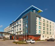
Aloft Chesapeake
Delta Hotels Chesapeake
SpringHill Suites Chesapeake Greenbrier
Comfort Suites Chesapeake
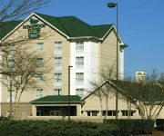
Homewood Suites by Hilton Chesapeake-Greenbrier
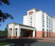
Hampton Inn - Suites Chesapeake-Battlefield Blvd
Courtyard Chesapeake Greenbrier
Fairfield Inn & Suites Chesapeake
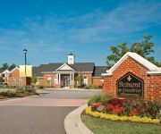
ExecuStay at Belmont Greenbrie
Hilton Garden Inn Chesapeake-Greenbrier
Videos from this area
These are videos related to the place based on their proximity to this place.
800 Shenandoah River Road Chesapeake, 23320
http://www.800ShenandoahRiverRoad.com/ 800 Shenandoah River Road Chesapeake, 23320 For Sale $164900 Beautiful carriage house style condo with garage in Riverwalk! Call for information: ...
The Evil Within: À la Corvo Achievement/Trophy
To get this trophy you must Open the wooden gate in the village without killing any of the zombies in Chapter 2, Except for the one Zombie at the beginning when you get the revolver. Also...
Mayor's Youth Day 2015 - Fire Department Presentation
This video was created by one of the City of Chesapeake's Firefighters on Mayor's Youth Day 2015. The demonstration is what the firefighters showed the kids at Station 15.
Evolve Extraction Mode Hunters Day 5
Day 5 Evolve is set on Shear, a distant planet located in the "Far Arm" of space, that humanity has traveled to in the distant future. The established colonies, considered the most valuable...
Evolve Extraction Mode Hunters Day 2
Day 1 Evolve is set on Shear, a distant planet located in the "Far Arm" of space, that humanity has traveled to in the distant future. The established colonies, considered the most valuable...
Evolve Extraction Mode Monster Day 1
Day 1 Evolve is set on Shear, a distant planet located in the "Far Arm" of space, that humanity has traveled to in the distant future. The established colonies, considered the most valuable...
Evolve Extraction Mode Hunters Day 1
Day 1 Evolve is set on Shear, a distant planet located in the "Far Arm" of space, that humanity has traveled to in the distant future. The established colonies, considered the most valuable...
Evolve Extraction Mode Monster Day 4
Day 4 Evolve is set on Shear, a distant planet located in the "Far Arm" of space, that humanity has traveled to in the distant future. The established colonies, considered the most valuable...
Evolve Extraction Mode Hunters Day 4
Day 4 Evolve is set on Shear, a distant planet located in the "Far Arm" of space, that humanity has traveled to in the distant future. The established colonies, considered the most valuable...
Videos provided by Youtube are under the copyright of their owners.
Attractions and noteworthy things
Distances are based on the centre of the city/town and sightseeing location. This list contains brief abstracts about monuments, holiday activities, national parcs, museums, organisations and more from the area as well as interesting facts about the region itself. Where available, you'll find the corresponding homepage. Otherwise the related wikipedia article.
Chesapeake, Virginia
Chesapeake is an independent city located in the South Hampton Roads portion of the Hampton Roads metropolitan area of Virginia in the United States. One of the cities Hampton Roads, Chesapeake was formed in 1963 by a political consolidation of the city of South Norfolk with the former Norfolk County, which dated to 1691. Chesapeake is the second-largest city by land area in the Commonwealth of Virginia.
Battle of Great Bridge
The Battle of Great Bridge was fought December 9, 1775, in the area of Great Bridge, Virginia, early in the American Revolutionary War. The victory by Continental Army and militia forces led to the departure of Governor Lord Dunmore and any remaining vestiges of British power from the Colony of Virginia during the early days of the conflict.
Dominion Boulevard Steel Bridge
Dominion Boulevard Steel Bridge (known locally as simply the Steel Bridge) is a double leaf bascule, two lane drawbridge which spans the southern branch of the Elizabeth River in the City of Chesapeake in South Hampton Roads in southeastern Virginia. It carries U.S. Route 17 in Virginia which is Dominion Boulevard (formerly numbered Virginia Route 104). The bridge was built in 1962 and is operated by the City of Chesapeake.
High Rise Bridge
High Rise Bridge is a bascule drawbridge which carries a portion of the Hampton Roads Beltway designated as Interstate 64 across the Southern Branch of the Elizabeth River in Chesapeake, Virginia. The twin spans of concrete and steel were completed in 1972, and are owned by the Virginia Department of Transportation (VDOT). On Wednesday November 10, 2010 after the 2:30 opening the bridge was stuck in the up position causing widespread traffic delays.
Oscar F. Smith High School
Oscar Frommel Smith High School was originally built in South Norfolk, Virginia, to replace the aging South Norfolk High School in 1954. In 1994, a new school was constructed in the Greenbrier/Great Bridge area of Chesapeake, Virginia, and has a current enrollment of over 2,100 students. OSHS was authorized to begin administering the IB Diploma Program by the International Baccalaureate Organization in 2002 and IB students from all six Chesapeake zones feed into it.
WFOS
WFOS is Variety music format broadcast high school radio station licensed to Chesapeake, Virginia, serving the Southside of Hampton Roads. WFOS is owned and operated by Chesapeake Public Schools.
Grassfield High School
Grassfield High School is a public high school located in Chesapeake, Virginia, USA, and is administered by Chesapeake City Public Schools. It was built to ease overcrowding at Deep Creek High School, Great Bridge High School, and Hickory High School. Grassfield, along with Western Branch High School and Oscar Smith High School, features the latest technology available in the school district.
Great Bridge Bridge
The Great Bridge Bridge is a double rolling bascule drawbridge that carries Battlefield Blvd. and spans the Atlantic Intracoastal Waterway in Chesapeake, Virginia. It was constructed in 2004 by the Army Corps of Engineers and operated by the City of Chesapeake. It has a mean daily traffic of 35,000 vehicles.


