Safety Score: 2,7 of 5.0 based on data from 9 authorites. Meaning we advice caution when travelling to United States.
Travel warnings are updated daily. Source: Travel Warning United States. Last Update: 2024-05-07 07:59:51
Delve into Stumptown
Stumptown in Lancaster County (Pennsylvania) is a city located in United States about 93 mi (or 150 km) north-east of Washington DC, the country's capital town.
Current time in Stumptown is now 05:53 PM (Tuesday). The local timezone is named America / New York with an UTC offset of -4 hours. We know of 10 airports closer to Stumptown, of which 4 are larger airports. The closest airport in United States is Lancaster Airport in a distance of 8 mi (or 13 km), North-West. Besides the airports, there are other travel options available (check left side).
There is one Unesco world heritage site nearby. It's Independence Hall in a distance of 70 mi (or 113 km), East. Also, if you like playing golf, there are some options within driving distance. In need of a room? We compiled a list of available hotels close to the map centre further down the page.
Since you are here already, you might want to pay a visit to some of the following locations: Lancaster, Reading, Lebanon, Bel Air and Elkton. To further explore this place, just scroll down and browse the available info.
Local weather forecast
Todays Local Weather Conditions & Forecast: 23°C / 74 °F
| Morning Temperature | 16°C / 61 °F |
| Evening Temperature | 22°C / 72 °F |
| Night Temperature | 17°C / 63 °F |
| Chance of rainfall | 6% |
| Air Humidity | 70% |
| Air Pressure | 1008 hPa |
| Wind Speed | Light breeze with 5 km/h (3 mph) from North |
| Cloud Conditions | Broken clouds, covering 62% of sky |
| General Conditions | Moderate rain |
Tuesday, 7th of May 2024
26°C (79 °F)
17°C (63 °F)
Moderate rain, moderate breeze, scattered clouds.
Wednesday, 8th of May 2024
21°C (71 °F)
17°C (63 °F)
Moderate rain, gentle breeze, overcast clouds.
Thursday, 9th of May 2024
16°C (61 °F)
10°C (50 °F)
Scattered clouds, fresh breeze.
Hotels and Places to Stay
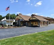
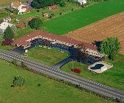
THE INN AT LEOLA VILLAGE
Tru by Hilton Lancaster East PA
La Quinta Inn and Suites Lancaster
Comfort Inn Lancaster - Rockvale Outlets
After Eight Bed and Breakfast
Amish View Inn and Suites
Candlelight Inn Bed & Breakfast
Americas Best Value Inn-Ronks/Lancaster County
Amish Country Motel
Eastbrook Inn
Videos from this area
These are videos related to the place based on their proximity to this place.
Aaron & Jessica's Buggy Rides
http://www.amishbuggyrides.com/ http://www.twitter.com/AmishJack "At Aaron and Jessica's you can have your own private buggy. As couples or families you may have your choice of buggies or...
Bird in Hand Farmer's Market with the Amish Road Show
http://www.amishroadshow.com Come with us as we discover some of the great treats that the Bird in Hand Farmer's Market has to offer. This is the first video from Amishroadshow.com and we are...
James drumming with The Elders!
PA Renaissance Faire Celtic Fling- 6-24-07 The Elders had James come up on stage and jam with them... he is great~
Hurricane Sandy Hits Amish Country - Horse & Buggy Lose Wheel
We were out in Lancaster County PA today. Unfortunately, Hurricane Sandy's wrath was felt all the way up here. The horse couldnt go anywhere because they lost a wheel. Dont know whether it...
#1 Barracuda Storage Lancaster County PA, (877) 772-0784 Backup 390|690 |Message Archiver 350|650
1 Barracuda Storage Lancaster County PA, (877) 772-0784 Backup 390|690 |Message Archiver 350|650|Cost http://youtu.be/UA3fN0yzRDE Barracuda Link Balancers It's Your Bandwidth. Use it....
Reno in trail class
See http://equinenow.com/821038 This is Reno in an Extreme Trail class. The video starts with him in the upper right corner side passes over a poll in both directions, the video was taken...
Ukrainian Easter Egg Fun
http://jrhagerhubpages.blogspot.com/2014/04/ukrainian-easter-egg-fun.html There has never been a time around my house that Mom wasn't working on a Ukrainian egg design. And we arn't even ...
Conservation photographer documents Mill Creek
Conservation photographer documents Mill Creek View article at http://articles.lancasteronline.com/local/4/279858.
Amish Sleigh
Amish sleigh on a wintery day in Lancaster County, Pa Gotta love living in Amish country in the winter... This is on the road we live on, taken from my shop at my mother in law, Rhoda's, place.
Videos provided by Youtube are under the copyright of their owners.
Attractions and noteworthy things
Distances are based on the centre of the city/town and sightseeing location. This list contains brief abstracts about monuments, holiday activities, national parcs, museums, organisations and more from the area as well as interesting facts about the region itself. Where available, you'll find the corresponding homepage. Otherwise the related wikipedia article.
Willow Hill Covered Bridge
The Willow Hill Covered Bridge is a covered bridge located off U.S. Route 30 that spans Miller’s Run (which flows into Mill Creek, a tributary of the Conestoga River) in Lancaster County, Pennsylvania, United States. It was built in 1962 by Roy Zimmerman as a reconstruction using parts of the Miller's Farm Covered Bridge, built in 1871 by Elias McMellen, and Good's Fording Covered Bridge, built in 1855. It crosses Mill Creek and is 93 feet long and 15 feet wide.
Leacock-Leola-Bareville, Pennsylvania
Leacock-Leola-Bareville is a census-designated place (CDP) in Lancaster County, Pennsylvania, in the United States. As of the 2000 census, the CDP population was 6,625. The area is heavily populated by the Amish and Mennonites. Bareville is often named in lists of "delightfully-named towns" in Pennsylvania Dutchland, along with Intercourse, Blue Ball, Lititz, Mount Joy, Bird-in-Hand and Paradise.
Leacock Township, Lancaster County, Pennsylvania
Leacock Township is a township in east central Lancaster County, Pennsylvania, United States. The population was 4,878 at the 2000 census. The township has a large Amish and Mennonite population.
Upper Leacock Township, Lancaster County, Pennsylvania
Upper Leacock Township is a township in east central Lancaster County, Pennsylvania, United States. The population was 8,229 at the 2000 census. The township includes a village called Mascot, named by Annie Groff, a deceased member of the Ressler family, owners of the Mascot Roller Mills. She dedicated the name of the village to a canine actor she watched at a Broadway theatre show on her honeymoon.
Leola, Pennsylvania
Leola formerly part of the Leacock-Leola-Bareville CDP before consolidating into the current census-designated place for the 2010 census, is a community in Upper Leacock and West Earl Townships in Lancaster County in the state of Pennsylvania. It is located along Pennsylvania Route 23 between the city of Lancaster and the borough of New Holland. As of the 2010 census the population was 7,214 residents.
Smoketown Airport
Smoketown Airport is an airport open to the public, located in Smoketown, 6.3 miles east of Lancaster, in Lancaster County, Pennsylvania, USA. The airport is owned by Marlin Horst and managed by Mel Glick. The FAA reports an average of 74 aircraft operations per day and also reports that there are 86 aircraft based on the field. The airport also offers 100 LL aircraft fuel on the field as well as nearby lodging and food.


