Safety Score: 2,7 of 5.0 based on data from 9 authorites. Meaning we advice caution when travelling to United States.
Travel warnings are updated daily. Source: Travel Warning United States. Last Update: 2024-05-04 08:22:41
Delve into Rives
Rives in Prince George's County (Maryland) is located in United States a little north-east of Washington DC, the country's capital town.
Current time in Rives is now 04:33 AM (Saturday). The local timezone is named America / New York with an UTC offset of -4 hours. We know of 8 airports close to Rives, of which 4 are larger airports. The closest airport in United States is Ronald Reagan Washington National Airport in a distance of 7 mi (or 11 km), South-West. Besides the airports, there are other travel options available (check left side).
There is one Unesco world heritage site nearby. It's Monticello and the University of Virginia in Charlottesville in a distance of 69 mi (or 110 km), South-West. Also, if you like playing golf, there are some options within driving distance. We encountered 10 points of interest near this location. If you need a hotel, we compiled a list of available hotels close to the map centre further down the page.
While being here, you might want to pay a visit to some of the following locations: Washington DC, Alexandria, Arlington, Falls Church and Upper Marlboro. To further explore this place, just scroll down and browse the available info.
Local weather forecast
Todays Local Weather Conditions & Forecast: 13°C / 56 °F
| Morning Temperature | 12°C / 54 °F |
| Evening Temperature | 12°C / 53 °F |
| Night Temperature | 12°C / 53 °F |
| Chance of rainfall | 5% |
| Air Humidity | 88% |
| Air Pressure | 1024 hPa |
| Wind Speed | Gentle Breeze with 7 km/h (4 mph) from West |
| Cloud Conditions | Overcast clouds, covering 100% of sky |
| General Conditions | Moderate rain |
Saturday, 4th of May 2024
16°C (60 °F)
16°C (62 °F)
Moderate rain, gentle breeze, overcast clouds.
Sunday, 5th of May 2024
25°C (77 °F)
19°C (66 °F)
Moderate rain, light breeze, overcast clouds.
Monday, 6th of May 2024
27°C (81 °F)
20°C (68 °F)
Light rain, gentle breeze, broken clouds.
Hotels and Places to Stay
Sleeps 5-6 Guests Capitol Hill Fully Furnished Apartments
Kimpton George Hotel
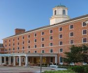
College Park Marriott Hotel & Conference Center
Fairfield Inn & Suites Washington DC/New York Avenue
Phoenix Park Hotel
Birdhouse Bed and Breakfast
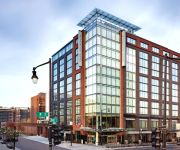
Homewood Suites by Hilton Washington DC Capitol-Navy Yard
Found Places Capitol Hill Bed & Breakfast
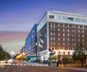
Hilton Garden Inn Washington DC-US Capitol
Malolo Bed and Breakfast
Videos from this area
These are videos related to the place based on their proximity to this place.
2003 Chrysler Town & Country Used Cars Brentwood MD
http://www.mrcarmd.com This 2003 Chrysler Town & Country is available from Mr. Car. For details, call us at 301-277-3838.
2010 Chrysler Town & Country Used Cars Brentwood MD
http://www.mrcarmd.com This 2010 Chrysler Town & Country is available from Mr. Car. For details, call us at 301-277-3838.
2003 Chrysler Town & Country Used Cars Brentwood MD
http://www.mrcarmd.com This 2003 Chrysler Town & Country is available from Mr. Car. For details, call us at 301-277-3838.
2005 Chevrolet Suburban Blue
Thank you for your interest in one of Mr. Car llc's online offerings. Please continue for more information regarding this 2005 Chevrolet Tahoe Z71 with 128,7...
Mount Rainier's Resurfaced Bunker Hill Road
A portion of Mount Rainier's torn up Bunker Hill Road was resurfaced this spring. Here's a look at it. Compare to how it was in winter: https://vimeo.com/633...
Twins Moving Mt Rainier (301) 200-9068
Twins Moving Mt Rainier 4012 32nd St, Mt Rainier, MD 20712 (301) 200-9068 We can offer you professional moving service, including long distance and local, co...
2003 HUMMER H2 Used Cars Brentwood MD
http://www.mrcarmd.com This 2003 HUMMER H2 is available from Mr. Car. For details, call us at 301-277-3838.
2006 Ford Focus Used Cars Brentwood MD
http://www.mrcarmd.com This 2006 Ford Focus is available from Mr. Car. For details, call us at 301-277-3838.
2000 Honda Odyssey Used Cars Brentwood MD
http://www.mrcarmd.com This 2000 Honda Odyssey is available from Mr. Car. For details, call us at 301-277-3838.
2003 Honda Accord Used Cars Brentwood MD
http://www.mrcarmd.com This 2003 Honda Accord is available from Mr. Car. For details, call us at 301-277-3838.
Videos provided by Youtube are under the copyright of their owners.
Attractions and noteworthy things
Distances are based on the centre of the city/town and sightseeing location. This list contains brief abstracts about monuments, holiday activities, national parcs, museums, organisations and more from the area as well as interesting facts about the region itself. Where available, you'll find the corresponding homepage. Otherwise the related wikipedia article.
Brentwood, Maryland
Brentwood is a town in Prince George's County, Maryland, United States. The population was 3,046 at the 2010 census. Brentwood is less than 1-mile away from Washington, D.C. The municipality of Brentwood is located just outside the northeast boundary of the District of Columbia and surrounded by the communities of Mount Rainier, Cottage City, North Brentwood, and the nearby Hyattsville, . Along the Route 1 Corridor, Brentwood is part of the Gateway Arts District.
Cottage City, Maryland
Cottage City is a town in Prince George's County, Maryland, United States. The population was 1,305 at the 2010 census. Cottage City is a small, quiet community lying between Eastern Avenue (the border with Washington, D.C. ), Brentwood, Colmar Manor, and the Anacostia River. Cottage City was developed beginning in 1870 under the name of "The Highlands". The area was incorporated in 1924 as Cottage City.
North Brentwood, Maryland
North Brentwood is a town in Prince George's County, Maryland, United States. The population was 517 at the 2010 census. The municipality of North Brentwood is located north of Washington, D.C. , and is surrounded by the communities of Hyattsville, Brentwood, and Cottage City, and the nearby Mount Rainier. The Town of North Brentwood was incorporated in 1924, and was the first African-American-majority municipality in Prince George's County.
Mount Rainier, Maryland
Mount Rainier is a city in Prince George's County, Maryland, United States. The population was 8,080 at the 2010 census. Bordering Washington, D.C. , Mount Rainier got its start as a streetcar suburb. According to local tradition, surveyors from the Pacific Northwest named the town, giving the streets names such as "Shasta" and "Cascade". Historic U.S. 1 runs through the center of the town and serves as the main street and central business district.
Woodridge, Washington, D.C
Woodridge, is a residential neighborhood located on the northeastern edge of Washington, D.C. , bounded by Eastern Avenue on the east, Michigan Avenue to the north, South Dakota then 18th St. to the west, and Bladensburg Road to the south. Its central commercial strip is Rhode Island Avenue NE. It is located roughly between the neighborhood of Brookland in D.C. and the city of Mount Rainier, Maryland.
Gateway (Washington, D.C.)
Gateway is the name of a small industrial and residential neighborhood in Northeast Washington, D.C. It is bounded by New York Avenue NE to the south and southeast, Bladensburg Road to the west, and South Dakota Avenue to the northeast. Gateway is across New York Avenue from the U.S. National Arboretum. The neighborhood takes its name from the period when the Washington Branch of the Baltimore and Ohio Railroad ran in place of present-day New York Avenue.
Fort Lincoln (Washington, D.C.)
Fort Lincoln is a neighborhood located in northeastern Washington, D.C. It is bounded by Bladensburg Road to the northwest, Eastern Avenue to the northeast, New York Avenue NE to the south, and South Dakota Avenue NE to the southwest. The town of Colmar Manor, Maryland, is across Eastern Avenue from the Fort Lincoln neighborhood, as is the Fort Lincoln Cemetery. The name Fort Lincoln was originally used for a Civil War Fort in adjacent Prince George's County, Maryland, across the D.C.
Bladensburg Dueling Grounds
Bladensburg Dueling Grounds is a small spit of land along Dueling Creek, formerly in the town of Bladensburg, Maryland, and now within the town of Colmar Manor, just to the northeast of Washington, D.C. , United States. Dueling Creek, formerly known as Blood Run, is a tributary of the Anacostia River. From 1808 the grove witnessed approximately fifty duels by gentlemen, military officers, and politicians, settling "affairs of honor".
Amtrak Railroad Anacostia Bridge
The Amtrak Railroad Anacostia Bridge is a railway-only bridge which crosses the Anacostia River in Washington, D.C. As of 2010, it carries only Amtrak's Northeast Corridor passenger rail traffic. It was the site of the famous "Crescent Limited wreck" in August 1933, caused when the bridge was damaged by the 1933 Chesapeake–Potomac hurricane.
Bladensburg Park Pedestrian Bridge
The Bladensburg Park Pedestrian Bridge is a bicycle and pedestrian bridge over the Anacostia River in the U.S. state of Maryland. The bridge lies between the communities of Colmar Manor and Bladensburg.
Bladensburg Road Bridge
The Bladensburg Road Bridge is a bridge that carries Bladensburg Road over the Anacostia River between the communities of Colmar Manor and Bladensburg in the U.S. state of Maryland.
Dueling Creek
Dueling Creek is a tributary of the Anacostia River in southern Maryland in the United States, located in the town of Colmar Manor. It was notorious as a favorite spot for duels in the 19th Century, the most infamous being between Stephen Decatur and James Barron.


