Safety Score: 2,7 of 5.0 based on data from 9 authorites. Meaning we advice caution when travelling to United States.
Travel warnings are updated daily. Source: Travel Warning United States. Last Update: 2024-04-26 08:02:42
Explore Brentwood Village
Brentwood Village in Washington County (District of Columbia) is a city in United States a little north-east of Washington DC, the country's capital.
Local time in Brentwood Village is now 03:29 AM (Saturday). The local timezone is named America / New York with an UTC offset of -4 hours. We know of 8 airports in the vicinity of Brentwood Village, of which 4 are larger airports. The closest airport in United States is Ronald Reagan Washington National Airport in a distance of 6 mi (or 9 km), South-West. Besides the airports, there are other travel options available (check left side).
There is one Unesco world heritage site nearby. It's Monticello and the University of Virginia in Charlottesville in a distance of 67 mi (or 108 km), South-West. Also, if you like golfing, there are multiple options in driving distance. We found 10 points of interest in the vicinity of this place. If you need a place to sleep, we compiled a list of available hotels close to the map centre further down the page.
Depending on your travel schedule, you might want to pay a visit to some of the following locations: Washington DC, Arlington, Alexandria, Falls Church and Rockville. To further explore this place, just scroll down and browse the available info.
Local weather forecast
Todays Local Weather Conditions & Forecast: 13°C / 55 °F
| Morning Temperature | 10°C / 50 °F |
| Evening Temperature | 11°C / 51 °F |
| Night Temperature | 10°C / 51 °F |
| Chance of rainfall | 1% |
| Air Humidity | 67% |
| Air Pressure | 1031 hPa |
| Wind Speed | Gentle Breeze with 6 km/h (4 mph) from North |
| Cloud Conditions | Overcast clouds, covering 100% of sky |
| General Conditions | Light rain |
Saturday, 27th of April 2024
24°C (76 °F)
19°C (67 °F)
Light rain, light breeze, broken clouds.
Sunday, 28th of April 2024
31°C (88 °F)
22°C (71 °F)
Light rain, light breeze, overcast clouds.
Monday, 29th of April 2024
28°C (82 °F)
20°C (69 °F)
Light rain, gentle breeze, scattered clouds.
Hotels and Places to Stay
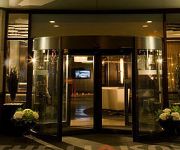
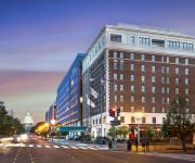
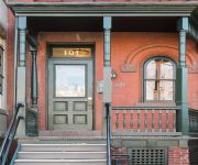
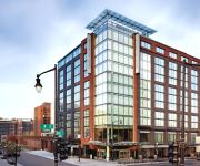
Sleeps 5-6 Guests Capitol Hill Fully Furnished Apartments
Liaison Capitol Hill DC
Kimpton George Hotel
Phoenix Park Hotel
Found Places Capitol Hill Bed & Breakfast
Birdhouse Bed and Breakfast
Homewood Suites by Hilton Washington DC Capitol-Navy Yard
Holiday Inn Express & Suites WASHINGTON DC NORTHEAST
Ginosi Washington Apartel
Courtyard Washington DC/U.S. Capitol
Videos from this area
These are videos related to the place based on their proximity to this place.
WMATA (Metrobus): 2007 New Flyer C40LFR (CNG) #2802 on Route B2 @ Douglas Avenue
Bladensburg Road & Douglas Avenue (near Bladensburg Bus Division) Route: B2 | Anacostia [M] (to/from) Mount Rainier Division: Bladensburg (B) Route B2 is not a "MetroExtra" route.
1723 CAPITOL AVENUE NORTHEAST, WASHINGTON, DC Presented by Jordan Murray.
Click to see more: http://www.searchallproperties.com/listings/2031277/1723-CAPITOL-AVENUE-NORTHEAST-WASHINGTON-DC/auto?reqpage=video 1723 CAPITOL AVENUE NORTHEAST ...
Trinidad: A Blossoming Community: Trinidad Block Party on May 26, 2012- Part One
Neighbors participating in the Trinidad Block Party on May 26, 2012. Hidden talent came out of the karaoke mike, neighbors got down listening to Chuck Brown, and the sprinklers finally came...
2916 16th St. NE Washington DC 20017 Real Property Management DC Metro
Call 202-656-0014 or visit www.rpmdcmetro.com for a list of our properties that are currently available. As you pull up to this fantastic home you will want to make this house your home! $3400...
How to Rent an Apartment in Washington DC -- Insider Tips -- Video A
If the next video does not automatically start click this link - http://www.youtube.com/playlist?list=PL1xtLT22maJCtdKCayTU2ERB8CexyOFhp&feature=edit_ok Finding and renting an apartment...
DC Casineros Demo at the 2014 DC Dance Festival
Demonstrating Casino and Rueda for the 2014 DC Dance Festival at Edgewood Arts Center.
DC Casineros Demo at Dance Place Grand Opening - 2014-09-06
An improvised demonstration of casino and rueda de casino at our monthly Cuban dance social, held at the grand opening of the new Dance Place theater.
Gallaudet University: Journey into the Theatre - Spring 2014
Gallaudet University: Journey into the Theatre - Spring 2014.
WMATA (Metrobus): 2002 New Flyer C40LF (CNG) #2422 on Route G8 @ Monroe Street
Brookland-CUA [M] Station Route: G8 | Farragut West [M] (to/from) Avondale Division: Bladensburg (B)
Scott B Greene Memorial Bowl Crawl - Green Skate Lab session - 9-4-2011
Green Skate Lab Washington DC. Just a taste of what really went on for two great days of skating in memory of Scott B Greene.
Videos provided by Youtube are under the copyright of their owners.
Attractions and noteworthy things
Distances are based on the centre of the city/town and sightseeing location. This list contains brief abstracts about monuments, holiday activities, national parcs, museums, organisations and more from the area as well as interesting facts about the region itself. Where available, you'll find the corresponding homepage. Otherwise the related wikipedia article.
Brentwood (Washington, D.C.)
Brentwood is a neighborhood in Northeast Washington, D.C. and is named after the Brentwood Mansion built at Florida Avenue and 6th Street NE in 1817 by Robert Brent, the first mayor of Washington City. He built it as a wedding present for his daughter Eleanor on her marriage as second wife to Congressman Joseph Pearson.
Rhode Island Avenue – Brentwood (WMATA station)
Rhode Island Ave-Brentwood is a Washington Metro station in Washington, D.C. on the Red Line. The station is located in Northeast Washington, on an elevated platform crossing Rhode Island Avenue, with its entrance near 5th Street. Service began on March 27, 1976 as one of the first stations in the system. Among the entire Metro system, Rhode Island Ave-Brentwood has the highest elevation for any station.
Brookland (Washington, D.C.)
Brookland is a neighborhood in the Northeast quadrant of Washington, D.C. , historically centered along 12th Street NE. Brookland is bounded by 9th Street NE to the west, Rhode Island Avenue NE to the south, and South Dakota Avenue to the east. Michigan Avenue is the northern boundary between 9th and 14th Streets; The President Lincoln and Soldiers' Home National Monument is also located near Brookland. (It is technically in Park View.
Trinidad, Washington, D.C
Trinidad is a neighborhood located in Ward 5, in the northeast quadrant of Washington, D.C. and is a largely residential area.
Rhode Island Avenue (Washington, D.C.)
Rhode Island Avenue is a diagonal avenue in the Northwest and Northeast quadrants of Washington, D.C. and the capital's inner suburbs in Prince George's County, Maryland. Paralleling New York Avenue, Rhode Island Avenue was one of the original streets in Pierre L'Enfant's plan for the capital. Today it is a major commuter route, carrying U.S. Route 1 traffic into the city from Prince George's County.
Mount Olivet Cemetery (Washington, D.C.)
Mount Olivet Cemetery is an historic cemetery located at 1300 Bladensburg Road, NE in Washington, D.C. It is maintained by the Roman Catholic Archdiocese of Washington. The largest Catholic burial ground in the District of Columbia, it was one of the first in the city to be racially integrated.
Ivy City
Ivy City is a small neighborhood in Northeast Washington. It is primarily an industrial neighborhood, dominated by warehouses and the Ivy City Yard, a railroad coach yard and maintenance facility for Amtrak. The area has undergone some revitalization with the influx of a few dance clubs and the gentrification moving across the Northeast quadrant. However Ivy City still remains among the poorest parts of the city.
The Model Secondary School
Model Secondary School for the Deaf is a school for the deaf in Washington, D.C.. The Model Secondary School for the Deaf Act was signed by President Lyndon B. Johnson on October 15, 1966 (P.L. 89-694). In May 1969, the Secretary of the U.S. Department of Health, Education and Welfare and the President of Gallaudet College signed an agreement authorizing the establishment and operation of MSSD at the College.
Langdon, Washington, D.C
Langdon, or Langdon Park, is a neighborhood near the U.S. National Arboretum in Northeast Washington, D.C. Langdon is roughly bounded by New York Avenue NE to the south, Montana Avenue to the west, Bladensburg Road to the east, Rhode Island Avenue NE to the northwest, and South Dakota Avenue to the northeast. The neighborhood of Brentwood is to the east, Woodridge is to the west, Brookland to the north. It is directly North of DC's "Gateway.
Arboretum (Washington, D.C.)
Arboretum is a predominantly residential neighborhood located in Northeast Washington, D.C. , tucked into the corner of the National Arboretum. The tiny neighborhood is bounded by New York Avenue NE to the north, R Street NE to the south. The residential area is located North of the National Arboretum and east of Bladensburg Road. It includes the apartment community and three blocks of detached bungalow style homes.
Fort Bunker Hill
Fort Bunker Hill was a brick and earthenwork fortification built as part of the defenses of Washington, D.C. during the American Civil War. The fort was built in late 1861 by soldiers from the 11th Massachusetts Infantry regiment and was intended to assist in the defense of the northeast approaches to Washington between Fort Totten and Fort Lincoln. Company F of the 11th Vermont Infantry Regiment was assigned to Fort Bunker Hill to assist in the defense of the city until November 17, 1862.
Columbian Harmony Cemetery
Columbian Harmony Cemetery was an African American cemetery which formerly existed at 9th Street NE and Rhode Island Avenue NE in Washington, D.C. , in the United States. Constructed in 1859, it was the successor to the smaller Harmoneon Cemetery in downtown Washington. All graves in the cemetery were moved to National Harmony Memorial Park in Landover, Maryland, in 1959.


