Safety Score: 2,7 of 5.0 based on data from 9 authorites. Meaning we advice caution when travelling to United States.
Travel warnings are updated daily. Source: Travel Warning United States. Last Update: 2024-04-28 08:22:10
Delve into Eleven Cedars
The district Eleven Cedars of in Prince George's County (Maryland) is a district located in United States a little north-east of Washington DC, the country's capital town.
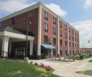
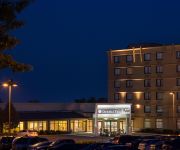
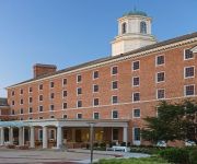
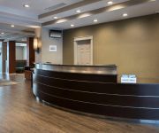
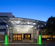
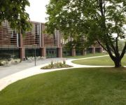
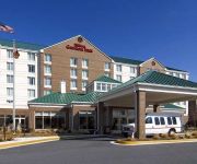
In need of a room? We compiled a list of available hotels close to the map centre further down the page.
Since you are here already, you might want to pay a visit to some of the following locations: Washington DC, Rockville, Arlington, Ellicott City and Alexandria. To further explore this place, just scroll down and browse the available info.
Local weather forecast
Todays Local Weather Conditions & Forecast: 26°C / 80 °F
| Morning Temperature | 12°C / 54 °F |
| Evening Temperature | 25°C / 77 °F |
| Night Temperature | 21°C / 69 °F |
| Chance of rainfall | 0% |
| Air Humidity | 45% |
| Air Pressure | 1021 hPa |
| Wind Speed | Gentle Breeze with 6 km/h (4 mph) from East |
| Cloud Conditions | Scattered clouds, covering 34% of sky |
| General Conditions | Scattered clouds |
Monday, 29th of April 2024
30°C (86 °F)
22°C (71 °F)
Scattered clouds, gentle breeze.
Tuesday, 30th of April 2024
28°C (83 °F)
18°C (64 °F)
Light rain, moderate breeze, broken clouds.
Wednesday, 1st of May 2024
24°C (76 °F)
16°C (60 °F)
Sky is clear, gentle breeze, clear sky.
Hotels and Places to Stay
Sheraton College Park North Hotel
BEST WESTERN PLUS COLLEGE PARK
DoubleTree by Hilton Laurel
College Park Marriott Hotel & Conference Center
Greenbelt Marriott
Holiday Inn WASHINGTON D.C.-GREENBELT MD
Residence Inn Silver Spring
Holiday Inn WASHINGTON-COLLEGE PK (I-95)
THE KIRKLAND CONFERENCE CENTER
Hilton Garden Inn Washington DC-Greenbelt
Videos from this area
These are videos related to the place based on their proximity to this place.
CIEMAP FESTIVIDAD JUNIO 2012
Con motivo a los daños causados por una tormenta, el sitio rentado se nos cancelo a última hora y nos toco que hacer el tercer culto en el local bajo remodelación de la Iglesia Misionera...
hair salons Beltsville
A beauty salon or hair salon located here in Beltsville Maryland providing great services, and excellent client communication. http://www.clickitcoupon.com/beltsville-maryland/ Hair salon...
Como llegar a- Iglesia de Beltsville Maranatha
Este es un Video sobre como llegar a la Iglesia Adventista del septimo Dia Beltsville Maranatha en Beltsville Md.
OCT11th@SRT in Beltsville, MD Running very rich AFR in the 10's
Just a video of my exhaust note more than anything. Went to dyno to establish my current number for porting work I am currently having done but found out I was losing power up top when my AFR...
4619 Quimby Ave Beltsville MD 20705 - Jonathan Lahey - REMAX Town Center
http://homesite.obeo.com/viewer/default.aspx?tourid=954038&refURL=youtube.com Contact: Jonathan Lahey RE/MAX Town Center (301) 651-4900 office@thelaheygroup.com ...
HeartGold Johto Journeys Part 1 I WILL CUT YOU ALL!
Heart Gold Johto Journeys! Gold starts his journey as a......guy who is english. Talks to people in english. All figures owned in video by GameFreak and Nintendo. 020DE16C E1A00000 020D3FA8...
Kesogon Self Help Group Beekeeping Project: Peter Otengo
Beekeeping in rural Kenya is a way for villagers to increase their income by selling cash crops of honey, wax and propolis. The Kesogon Self Help Group is working to build hives and teach villagers...
Behe Performance Porsche 993 Custom chip vs. Steve Wong chip
Behe Performance tuning a 993 Track Car that had a previously installed Steve Wong Chip. The Behe tune manages to defeat the Wong tune across the entire power curve. Behe Performance is a...
PGFD Engine 835 & Ambulance 835 Responding
Greenbelt Engine 835 and Ambulance 835 responding through Beltsville.
Steam: Chessie 614, 4 runbys
Ex C&O 4-8-4 614 at Beltsville, White Marsh and Frederick Junction, MD and at Shenandoah Jct., WV, September and October, 1981.
Videos provided by Youtube are under the copyright of their owners.
Attractions and noteworthy things
Distances are based on the centre of the city/town and sightseeing location. This list contains brief abstracts about monuments, holiday activities, national parcs, museums, organisations and more from the area as well as interesting facts about the region itself. Where available, you'll find the corresponding homepage. Otherwise the related wikipedia article.
College Park, Maryland
College Park is a city in Prince George's County, Maryland, USA. The population was 30,413 at the 2010 census. It is best known as the home of the University of Maryland, College Park, and since 1994 the city has also been home to the "Archives II" facility of the U.S. National Archives. College Park's United States Postal Service ZIP codes are 20740, 20741 (Berwyn Heights; North College Park) and 20742 (University of Maryland).
Fairland, Maryland
Fairland is a census-designated place and an unincorporated area in Montgomery County, Maryland, United States.
Beltsville, Maryland
Beltsville is a census-designated place (CDP) in northern Prince George's County, Maryland, United States. The population was 16,772 at the 2010 census. Beltsville includes the unincorporated community of Vansville.
Berwyn Heights, Maryland
Berwyn Heights is a town in Prince George's County, Maryland, United States. The population was 3,123 at the 2010 census. It is bordered by College Park to the west, Greenbelt to the northeast, East Riverdale to the southwest, and Riverdale Park to the south.
Calverton, Maryland
Calverton is an unincorporated area and census-designated place located on the boundary between Montgomery and Prince George's counties, Maryland, in the United States. As of the 2010 census, it had a population of 17,724.
Hillandale, Maryland
Hillandale is an unincorporated area and census-designated place located on the boundary between Montgomery and Prince George's counties, Maryland, in the United States. As of the 2010 census, it had a population of 6,043.
Greenbelt (WMATA station)
Greenbelt is a Washington Metro and MARC station in Prince George's County, Maryland on the Green Line. It is the northeastern end of the of certain rush hour Yellow Line trains and Green Line. The station is located in Greenbelt, off of Cherrywood Lane near the Capital Beltway. With a parking lot of over 3,300 spaces, and with quick access to the outerloop of the Beltway (Interstate 95 North ONLY) and from the inner loop of the Beltway (Interstate 95 South).
General Conference of Seventh-day Adventists
The General Conference of Seventh-day Adventists is the governing organization of the Seventh-day Adventist Church. It is located in Silver Spring, Maryland, United States, where it moved in 1989. The church headquarters building, commonly known as the General Conference of Seventh-day Adventists, houses and supports the administration of the church. The General Conference is overseen by an executive committee, headed by a President.
Lake Artemesia
Lake Artemesia is a man-made lake in Prince George's County, Maryland, USA. It is part of the Lake Artemesia Natural Area in College Park and Berwyn Heights. The lake itself covers an area of 38 acres (15 hectares), and the surrounding natural area is administered by Maryland-National Capital Park and Planning Commission and includes aquatic gardens, fishing piers, and hiker-biker trails.
Comcast Center (College Park, Maryland)
Comcast Center is the arena for the University of Maryland Terrapins men's and women's basketball teams. The Comcast Center, dubbed "The House Gary Built", was ranked the 7th-toughest venue to play in by EA Sports. The on-campus facility is named for the Comcast Corporation, which purchased a 20-year, $25 million corporate naming agreement. Comcast Center replaced Cole Field House as home court, which had served as the home of Maryland basketball since 1955.
United States National Agricultural Library
The United States National Agricultural Library (NAL) is one of the world's largest agricultural research libraries, and serves as a national library of the United States and as the library of the United States Department of Agriculture. Located in Beltsville, Maryland, it is one of four national libraries of the United States. It is also the coordinator for the Agriculture Network Information Center, a national network of state land-grant institutions and coordinator for the U.S.
International Religious Liberty Association
The International Religious Liberty Association (IRLA) is a non-sectarian and non-political organization promoting religious freedom. It was originally organised by the Seventh-day Adventist Church leaders in 1893 to campaign for religious freedom for all when the danger of restrictions from blue laws became apparent. Its headquarters are in Silver Spring, Maryland in the United States.
University of Maryland Observatory
University of Maryland Observatory is an astronomical observatory owned and operated by the University of Maryland, College Park. It is located in College Park, Maryland, USA. The Observatory hosts free open houses for the public twice a month, where visitors receive a lecture and access to three of the Observatory's telescopes. The open houses begin at 9 PM from May to October, and at 8 PM from November to April.
College Park Trolley Trail
The College Park Trolley Trail is a 2.6-mile long rail trail within the city of College Park Maryland. The trail runs on the abandoned right-of-way of the Washington, Berwyn and Laurel Electric Railway. Streetcars started running on the line in 1903 as part of the Columbia and Maryland Railway and ran until 1962 when the entire DC Transit system switched to buses. The first section of the trail, a 1.1-mile long stretch north from Paint Branch Parkway to Greenbelt Road, opened in 2002.
Henry A. Wallace Beltsville Agricultural Research Center
The Henry A. Wallace Beltsville Agricultural Research Center (BARC) is a unit of the United States Department of Agriculture's Agricultural Research Service. It is located at {{#invoke:Coordinates|coord}}{{#coordinates:39|02|N|76|53|W||| |primary |name= }} in Beltsville, Maryland, and is named for Henry A. Wallace, former United States vice president and secretary of agriculture. BARC houses the Abraham Lincoln Building of the National Agricultural Library.
Space Systems Laboratory
The Space Systems Laboratory (SSL) is part of the Aerospace Engineering Department and A. James Clark School of Engineering at the University of Maryland in College Park, Maryland. The Space Systems Laboratory is centered around the Neutral Buoyancy Research Facility, a 50-foot-diameter, 25-foot-deep water tank that is used to simulate the microgravity environment of space.
College Park Interchange
The College Park Interchange is the southern end of the segment of Interstate 95 in Maryland between the Baltimore Beltway and the Capital Beltway; it is the point where Interstate 95 and Interstate 495 join with one another within Maryland. Like its companion in Virginia, the Springfield Interchange, it has required modifications to handle the traffic flows it experiences today.
A. James Clark School of Engineering
The A. James Clark School of Engineering is the engineering college of the University of Maryland, College Park. The school consists of fourteen buildings on the College Park campus that cover over 750,000 sq ft . The school is in close proximity to Washington, D.C. , Baltimore, and technology-driven institutions such as NASA's Goddard Space Flight Center.
Muirkirk (MARC station)
Muirkirk is a passenger rail station on the MARC Camden Line between Washington, DC and Baltimore's Camden Station It is located at 7012-B Muirkirk Road over the bridge that carries Muirkirk Road above both the Camden Line and US 1. Muirkirk station consists of two platforms with open shelters on both sides of the former Baltimore and Ohio Railroad Washington Division line. A concrete open storm drain runs beneath the northbound platform.
Greenbelt Police Department (Maryland)
The Greenbelt Police Department (GPD) is the primary law enforcment agency servicing a population of 21,972 within 6.5 square miles of the city of Greenbelt.
Indian Creek Village, Maryland
Indian Creek Village is a subdivision in Beltsville, Maryland, located adjacent to Edmonston Road and north of Powder Mill Road. Located just to the north is Muirkirk, Maryland. It is immediately west of the Beltsville Agricultural Research Center, north of the Birmingham Masonic Lodge, and east of undeveloped land adjacent to Indian Creek, a tributary of the Anacostia River.
Beltway Plaza
The Beltway Plaza mall is located in Greenbelt, Maryland. It was developed by the late Sidney J. Brown and First National Realty, opening on October 17, 1963. It was originally composed of a massive S. Klein department store separated by a large parking lot from an A&P Supermarket located in a strip shopping center along with a barbershop, single screen movie theater, and Drug Fair store. By 1972-73, a small indoor mall was created, situated between the strip shopping center and the S.
Konterra, Maryland
Konterra is an unincorporated area and census-designated place (CDP) in Prince George's County, Maryland, United States. The population was 2,527 at the 2010 census.
College Park Volunteer Fire Department
The College Park Volunteer Fire Department (CPVFD) has the responsibility for protecting the citizens and property of College Park, Maryland from fires and fire hazards and providing emergency medical services as well as providing first response to biological, chemical and radioactive hazards.
Forcey Christian Middle School
Forcey Christian Middle School, or FCMS for short, is a private school located in Silver Spring, Maryland that provides Christian education for students in grades 6 through 8. Its mission is "to help middle school students become more fully-devoted followers of Christ."


