Safety Score: 2,7 of 5.0 based on data from 9 authorites. Meaning we advice caution when travelling to United States.
Travel warnings are updated daily. Source: Travel Warning United States. Last Update: 2024-04-28 08:22:10
Touring Edgewood
Edgewood in Prince George's County (Maryland) is a town located in United States a little north-east of Washington DC, the country's capital place.
Time in Edgewood is now 03:49 PM (Sunday). The local timezone is named America / New York with an UTC offset of -4 hours. We know of 8 airports nearby Edgewood, of which 3 are larger airports. The closest airport in United States is Ronald Reagan Washington National Airport in a distance of 13 mi (or 21 km), South-West. Besides the airports, there are other travel options available (check left side).
There is one Unesco world heritage site nearby. It's Monticello and the University of Virginia in Charlottesville in a distance of 75 mi (or 120 km), South-West. Also, if you like the game of golf, there are several options within driving distance. We collected 10 points of interest near this location. Need some hints on where to stay? We compiled a list of available hotels close to the map centre further down the page.
Being here already, you might want to pay a visit to some of the following locations: Washington DC, Arlington, Rockville, Alexandria and Upper Marlboro. To further explore this place, just scroll down and browse the available info.
Local weather forecast
Todays Local Weather Conditions & Forecast: 26°C / 80 °F
| Morning Temperature | 12°C / 54 °F |
| Evening Temperature | 25°C / 77 °F |
| Night Temperature | 21°C / 69 °F |
| Chance of rainfall | 0% |
| Air Humidity | 45% |
| Air Pressure | 1021 hPa |
| Wind Speed | Gentle Breeze with 6 km/h (4 mph) from East |
| Cloud Conditions | Scattered clouds, covering 34% of sky |
| General Conditions | Scattered clouds |
Sunday, 28th of April 2024
30°C (86 °F)
22°C (71 °F)
Scattered clouds, gentle breeze.
Monday, 29th of April 2024
28°C (83 °F)
18°C (64 °F)
Light rain, moderate breeze, broken clouds.
Tuesday, 30th of April 2024
24°C (76 °F)
16°C (60 °F)
Sky is clear, gentle breeze, clear sky.
Hotels and Places to Stay
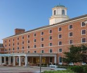
College Park Marriott Hotel & Conference Center
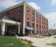
BEST WESTERN PLUS COLLEGE PARK
Greenbelt Marriott
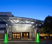
Sheraton College Park North Hotel
Holiday Inn WASHINGTON-COLLEGE PK (I-95)
THE KIRKLAND CONFERENCE CENTER
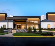
Courtyard Silver Spring North
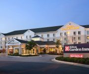
Hilton Garden Inn Silver Spring North
Residence Inn Silver Spring
Holiday Inn WASHINGTON D.C.-GREENBELT MD
Videos from this area
These are videos related to the place based on their proximity to this place.
CSX Q410-18
Q410 heads eastbound through Sunnyside in Beltsville with SD70MAC #4814 leading ES44AC #923.
CSX Q410-16
Q410 heads eastbound through Sunnyside in Beltsville with ES40DC #5355 leading Union Pacific AC45CCTE #7657, SD50 #8504, SD50-2 #2492.
PGFD Engine 835 & Ambulance 835 Responding
Greenbelt Engine 835 and Ambulance 835 responding through Beltsville.
CSX Q036-14
Q036 heads eastbound through Sunnyside in Beltsville with ES40DC #5451 leading boxcar logo AC6000CW #5009.
NYS&W in Maryland
Former D&H trains R402 and R403 operated by NYS&W as a run-through on CSX in Beltsville and Laurel, MD. B40-8s on both, an SD45 on the first and a rare CSX U30C and an NS GP38AC on the ...
CSX Q031-26
CSX Q031 heads westbound through Beltsville at Sunnyside Grade Crossing with ES44AC #875 leading ES40DC #5???, AC6000CW #648, and ES40DC #5???.
Videos provided by Youtube are under the copyright of their owners.
Attractions and noteworthy things
Distances are based on the centre of the city/town and sightseeing location. This list contains brief abstracts about monuments, holiday activities, national parcs, museums, organisations and more from the area as well as interesting facts about the region itself. Where available, you'll find the corresponding homepage. Otherwise the related wikipedia article.
College Park, Maryland
College Park is a city in Prince George's County, Maryland, USA. The population was 30,413 at the 2010 census. It is best known as the home of the University of Maryland, College Park, and since 1994 the city has also been home to the "Archives II" facility of the U.S. National Archives. College Park's United States Postal Service ZIP codes are 20740, 20741 (Berwyn Heights; North College Park) and 20742 (University of Maryland).
Beltsville, Maryland
Beltsville is a census-designated place (CDP) in northern Prince George's County, Maryland, United States. The population was 16,772 at the 2010 census. Beltsville includes the unincorporated community of Vansville.
Berwyn Heights, Maryland
Berwyn Heights is a town in Prince George's County, Maryland, United States. The population was 3,123 at the 2010 census. It is bordered by College Park to the west, Greenbelt to the northeast, East Riverdale to the southwest, and Riverdale Park to the south.
Greenbelt (WMATA station)
Greenbelt is a Washington Metro and MARC station in Prince George's County, Maryland on the Green Line. It is the northeastern end of the of certain rush hour Yellow Line trains and Green Line. The station is located in Greenbelt, off of Cherrywood Lane near the Capital Beltway. With a parking lot of over 3,300 spaces, and with quick access to the outerloop of the Beltway (Interstate 95 North ONLY) and from the inner loop of the Beltway (Interstate 95 South).
United States National Agricultural Library
The United States National Agricultural Library (NAL) is one of the world's largest agricultural research libraries, and serves as a national library of the United States and as the library of the United States Department of Agriculture. Located in Beltsville, Maryland, it is one of four national libraries of the United States. It is also the coordinator for the Agriculture Network Information Center, a national network of state land-grant institutions and coordinator for the U.S.
College Park Trolley Trail
The College Park Trolley Trail is a 2.6-mile long rail trail within the city of College Park Maryland. The trail runs on the abandoned right-of-way of the Washington, Berwyn and Laurel Electric Railway. Streetcars started running on the line in 1903 as part of the Columbia and Maryland Railway and ran until 1962 when the entire DC Transit system switched to buses. The first section of the trail, a 1.1-mile long stretch north from Paint Branch Parkway to Greenbelt Road, opened in 2002.
Indian Creek Village, Maryland
Indian Creek Village is a subdivision in Beltsville, Maryland, located adjacent to Edmonston Road and north of Powder Mill Road. Located just to the north is Muirkirk, Maryland. It is immediately west of the Beltsville Agricultural Research Center, north of the Birmingham Masonic Lodge, and east of undeveloped land adjacent to Indian Creek, a tributary of the Anacostia River.
Beltway Plaza
The Beltway Plaza mall is located in Greenbelt, Maryland. It was developed by the late Sidney J. Brown and First National Realty, opening on October 17, 1963. It was originally composed of a massive S. Klein department store separated by a large parking lot from an A&P Supermarket located in a strip shopping center along with a barbershop, single screen movie theater, and Drug Fair store. By 1972-73, a small indoor mall was created, situated between the strip shopping center and the S.


