Safety Score: 2,7 of 5.0 based on data from 9 authorites. Meaning we advice caution when travelling to United States.
Travel warnings are updated daily. Source: Travel Warning United States. Last Update: 2024-04-27 08:23:39
Explore O'Donnell Heights
O'Donnell Heights in City of Baltimore (Maryland) is located in United States about 37 mi (or 60 km) north-east of Washington DC, the country's capital.
Local time in O'Donnell Heights is now 10:40 AM (Saturday). The local timezone is named America / New York with an UTC offset of -4 hours. We know of 8 airports in the wider vicinity of O'Donnell Heights, of which 3 are larger airports. The closest airport in United States is Baltimore/Washington International Thurgood Marshal Airport in a distance of 10 mi (or 16 km), South-West. Besides the airports, there are other travel options available (check left side).
There are two Unesco world heritage sites nearby. The closest heritage site in United States is Monticello and the University of Virginia in Charlottesville in a distance of 100 mi (or 161 km), South-West. Also, if you like golfing, there are multiple options in driving distance. We found 10 points of interest in the vicinity of this place. If you need a place to sleep, we compiled a list of available hotels close to the map centre further down the page.
Depending on your travel schedule, you might want to pay a visit to some of the following locations: Baltimore, Towson, Ellicott City, Annapolis and Bel Air. To further explore this place, just scroll down and browse the available info.
Local weather forecast
Todays Local Weather Conditions & Forecast: 13°C / 55 °F
| Morning Temperature | 11°C / 51 °F |
| Evening Temperature | 11°C / 52 °F |
| Night Temperature | 11°C / 52 °F |
| Chance of rainfall | 4% |
| Air Humidity | 63% |
| Air Pressure | 1032 hPa |
| Wind Speed | Moderate breeze with 9 km/h (6 mph) from North |
| Cloud Conditions | Overcast clouds, covering 100% of sky |
| General Conditions | Light rain |
Saturday, 27th of April 2024
22°C (71 °F)
19°C (66 °F)
Light rain, gentle breeze, broken clouds.
Sunday, 28th of April 2024
27°C (80 °F)
19°C (67 °F)
Light rain, light breeze, overcast clouds.
Monday, 29th of April 2024
25°C (77 °F)
20°C (68 °F)
Light rain, light breeze, broken clouds.
Hotels and Places to Stay
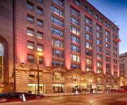
Hotel RL by Red Lion Baltimore Inner Harbor
Renaissance Baltimore Harborplace Hotel
Pier 5 Hotel Baltimore Curio Collection by Hilton
1840s Carrollton Inn
Baltimore Marriott Waterfront
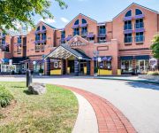
Hilton Garden Inn Baltimore Inner Harbor
Holiday Inn Express BALTIMORE-DOWNTOWN
Fairfield Inn & Suites Baltimore Downtown/Inner Harbor
Homewood Suites by Hilton Baltimore
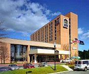
Best Western Plus Hotel & Conference Center
Videos from this area
These are videos related to the place based on their proximity to this place.
NEW YEARS EVE BASH 1999-2000 PART 2
THE BASHCREW OF BALTIMORE CELEBRATING NEW YEARS EVE 1999-2000 AT PHILLIPS INN ON HOLIBIRD AVE. IN DUNDALK MD.
Canton Rail Road in Baltimore
holabird ave. This is the first time I had my camera when I've caught their locomotive in action!
1999 Chevrolet Tahoe Used Cars Baltimore MD
http://www.realityautosalesinc.net This 1999 Chevrolet Tahoe is available from Reality Auto Sales Inc.. For details, call us at 410-675-1710.
I-95 / 695 Interchange & Fort McHenry Tunnel
New 695/95 interchange in rosedale, and drive through fort mchenry tunnel.
RhysXLX! The new generation of epicness!?
OMG im back after like 500 years! Why!? BECAUSE IM A LEGEND!!! Follow me on twitter at @rhysxlx and watch my soon to be posted vids! Well until i get my computer back head on over to ultimatelraft ...
Canton Railroad's CTN 1204 Crosses Eastern Avenue in Baltimore
Canton Railroad's CTN 1204 crosses Eastern Ave. in Baltimore. I was refueling at Wawa when this train rolled by hauling one boxcar. This crossing has no gates, as is clearly apparent by the...
Canton Railroad Gets Stuck on Slippery Rails
baltimore docks, savannah nuclear powered ship, and canton railroad.
Baltimore BMX Charm City Skatepark - Grindz and Rhymes Tour
lots of good riding by the locals at charm city skatepark.
Videos provided by Youtube are under the copyright of their owners.
Attractions and noteworthy things
Distances are based on the centre of the city/town and sightseeing location. This list contains brief abstracts about monuments, holiday activities, national parcs, museums, organisations and more from the area as well as interesting facts about the region itself. Where available, you'll find the corresponding homepage. Otherwise the related wikipedia article.
Baltimore Assembly
Baltimore Assembly (properly named Broening Highway General Motors Plant) was a General Motors factory in Baltimore, Maryland. The plant opened in 1935 to produce Chevrolets and closed on May 13, 2005. It was a two-level plant located near the harbor and railroad lines in Baltimore. Baltimore Assembly scored a major coup with the 1984 decision to assemble the Chevrolet Astro/GMC Safari minivans there.
Fort Holabird
Fort Holabird was a U.S. Army post in the city of Baltimore, Maryland, from 1917-1973. It was located in the southeast corner of the city, fronting on Holabird Ave. between Broening Highway and Dundalk Ave.
O'Donnell Heights, Baltimore
O'Donnell Heights is a neighborhood named for a public housing development in the far southeastern part of the city of Baltimore, Maryland, United States. It is located south and east of Interstate 95, just west of the border with Baltimore County, and north of the St. Helena neighborhood. The community was built to house factory workers during World War II. Today operated by the Housing Authority of Baltimore City, the original 900 unit development was modernized in 1983.
St Helena, Baltimore
St Helena is the southeasternmost neighborhood in the city of Baltimore, Maryland. St. Helena is a neighborhood within the community of Dundalk. The Baltimore City/Baltimore County boundary line runs through St. Helena. So, St. Helena is located in both Baltimore County and Baltimore City. It has a mix of rowhouses and detached homes. It is divided by railroad tracks from the Point Breeze Industrial Park.
Patterson High School (Baltimore)
Patterson High School (formerly Patterson Park High School) is a public high school located in the Hopkins-Bayview neighborhood in Baltimore, Maryland.
Graceland Park, Baltimore
Graceland Park is a neighborhood in Baltimore, Maryland, located adjacent O'Donnell Heights neighborhood. The neighborhood abuts the Baltimore City-Baltimore County line. The Baltimore County portion, Harbor View, is adjacent the community of Dundalk.
Johns Hopkins Bayview Medical Center
Johns Hopkins Bayview Medical Center, formerly known as Francis Scott Key Medical Center, is a hospital and medical office center in East Baltimore. It is located along Eastern Avenue near Bayview Boulevard. The hospital is part of the Johns Hopkins Health System, and includes the Hopkins Burn Center, which is the only burn trauma and surgical facility in the Baltimore area.
Joseph Lee, Baltimore
Joseph Lee, the residential part of Bayview, is a neighborhood located in Baltimore, Maryland, United States. Sometimes called the "A to K" or "ABC neighborhood" since all of the north-south streets are arranged in alphabetical order. (Anglesea, Bonsal, Cornwall, Drew, Elrino, Folcroft, Gusryan, Hornel, Imla, Joplin, and Kane. ) This neighborhood is a part of the larger Bayview or Hopkins Bayview neighborhood and borders the Greektown neighborhood.
Riverview Park (Baltimore)
Riverview Park was an early amusement park in Baltimore, Maryland, located off Broening Parkway in the area known as Point Breeze. The park began operating in 1890 and featured a roller coaster, water attractions, and live shows and concerts. Future ragtime legends Eubie Blake and Noble Sissle met, and began their songwriting partnership, while working at Riverview Park. The park closed in 1929, and the property was sold at auction to Western Electric, who constructed a plant on the site.


