Safety Score: 2,7 of 5.0 based on data from 9 authorites. Meaning we advice caution when travelling to United States.
Travel warnings are updated daily. Source: Travel Warning United States. Last Update: 2024-05-18 08:26:29
Explore Hollofield
Hollofield in Baltimore County (Maryland) is located in United States about 32 mi (or 51 km) north-east of Washington DC, the country's capital.
Local time in Hollofield is now 05:29 AM (Saturday). The local timezone is named America / New York with an UTC offset of -4 hours. We know of 8 airports in the wider vicinity of Hollofield, of which 3 are larger airports. The closest airport in United States is Baltimore/Washington International Thurgood Marshal Airport in a distance of 12 mi (or 19 km), South-East. Besides the airports, there are other travel options available (check left side).
There is one Unesco world heritage site nearby. It's Monticello and the University of Virginia in Charlottesville in a distance of 96 mi (or 155 km), South-West. Also, if you like golfing, there are multiple options in driving distance. We found 10 points of interest in the vicinity of this place. If you need a place to sleep, we compiled a list of available hotels close to the map centre further down the page.
Depending on your travel schedule, you might want to pay a visit to some of the following locations: Ellicott City, Baltimore, Towson, Westminster and Rockville. To further explore this place, just scroll down and browse the available info.
Local weather forecast
Todays Local Weather Conditions & Forecast: 13°C / 56 °F
| Morning Temperature | 14°C / 56 °F |
| Evening Temperature | 13°C / 56 °F |
| Night Temperature | 13°C / 55 °F |
| Chance of rainfall | 19% |
| Air Humidity | 98% |
| Air Pressure | 1015 hPa |
| Wind Speed | Gentle Breeze with 6 km/h (4 mph) from West |
| Cloud Conditions | Overcast clouds, covering 100% of sky |
| General Conditions | Heavy intensity rain |
Saturday, 18th of May 2024
21°C (69 °F)
15°C (60 °F)
Broken clouds, light breeze.
Sunday, 19th of May 2024
24°C (76 °F)
17°C (63 °F)
Broken clouds, light breeze.
Monday, 20th of May 2024
27°C (80 °F)
18°C (64 °F)
Sky is clear, gentle breeze, clear sky.
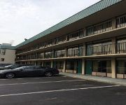
Hotels and Places to Stay
Baltimore North Pikesville DoubleTree
Hampton Inn - Suites Baltimore-Woodlawn Maryland
BALTIMORE WEST
Quality Inn Catonsville
Residence Inn Columbia
Hampton Inn Columbia MD
Sonesta ES Suites Columbia
DAYS INN BALTIMORE WEST SECURI
LEISURE INN BALTIMORE
Quality Inn Windsor Mill
Videos from this area
These are videos related to the place based on their proximity to this place.
Wildlife at Daniels Dam, Ellicott City, MD
General video of Daniels Dam before it's gone. "Daniels Dam furnished 400 horsepower for canvas and denim mills and also generated surplus electricity for Baltimore Gas and Electric. Daniels...
Old House Foundation Ruins In Patapsco Park Daniels Ghost Town 1-19-14 HD
This is a little bit of footage of an old house foundation and a few other foundations in Daniels, which is part of Pataspsco State Park now. One of the few ghost towns located in Patapsco...
Long Coal Train Near Union Dam
A long eastbound coal train heading down the old main line through the Patapsco Valley State Park, heading towards Ellicott City. Taken Saturday Dec. 28, 2013. Anyone know any companies looking...
B&O OML Old Main Line Mileposts 0 to 83 (Baltimore To Harper's Ferry)
I will be uploading some videos within the next few weeks from various cameras, some current, and some older, to see what works and what doesn't. I have 1000's of pics and lots of video,...
CSX Exiting Union Dam Tunnel
with some EMD's eastbound on the Old Main Line near Ellicott City, Maryland.
Videos provided by Youtube are under the copyright of their owners.
Attractions and noteworthy things
Distances are based on the centre of the city/town and sightseeing location. This list contains brief abstracts about monuments, holiday activities, national parcs, museums, organisations and more from the area as well as interesting facts about the region itself. Where available, you'll find the corresponding homepage. Otherwise the related wikipedia article.
WUTB
WUTB, digital channel 41, is the MyNetworkTV owned-and-operated television station for Baltimore, Maryland. Its transmitter is located near Gilson Park in Catonsville. The station has studios on Seton Drive in Baltimore near the city and county line. Syndicated programming on WUTB includes: The Big Bang Theory, Two and a Half Men, Everybody Loves Raymond, The Office, My Name Is Earl, Divorce Court, and Judge Alex.
WJZ (AM)
WJZ ("CBS Sports Radio 1300") is a sports radio station operating on 1300 kHz and licensed to Baltimore, Maryland with transmitter operations in Towson. Under ownership of CBS Radio, it is currently airing the CBS Sports Radio network full-time.
Arlington Baptist High School
Arlington Baptist High School is a Christian private high school located in Baltimore, Maryland. It was established in 1975, with the first seniors graduating in 1976 and is an extension of Arlington Baptist Church which was founded in 1947 by Peter Bisset. As the ministry grew (it reached its peak in the early 1980s), a lower school was added in 1969 and the High School in 1975.
Howard County Police Department (Maryland)
The Howard County Police Department (HCPD) is the primary law enforcement agency servicing 272,452 persons within 252.04 square miles of Howard County, Maryland.
The Woodlands Golf Course
The Woodlands Golf Course, designed by Joe Lee and sister course of Greystone golf course, opened in 1998.
Daniels, Maryland
Daniels is a ghost town straddling the Patapsco River east of Woodstock and north of Old Ellicott City in Baltimore County and Howard County, Maryland, United States. It is the location of the Daniels Mill, a site listed on the National Register of Historic Places.
Mount Gilboa Chapel
Mt. Gilboa Chapel is a historic African Methodist Episcopal Church located at Oella, Baltimore County, Maryland. It is a small stone church measuring 28 feet by 42 feet, built about 1859 by free African Americans. The front façade is ashlar masonry, but the sides and rear are of rubble. It replaced an earlier log chapel, where neighbor Benjamin Banneker may have attended services. It was listed on the National Register of Historic Places in 1976.
Linwood, Howard County, Maryland
Linwood is an unincorporated community in Howard County, Maryland, United States.


