Safety Score: 2,7 of 5.0 based on data from 9 authorites. Meaning we advice caution when travelling to United States.
Travel warnings are updated daily. Source: Travel Warning United States. Last Update: 2024-05-17 08:07:57
Touring Brandon Shores
Brandon Shores in Anne Arundel County (Maryland) is a town located in United States about 34 mi (or 54 km) north-east of Washington DC, the country's capital place.
Time in Brandon Shores is now 12:44 AM (Saturday). The local timezone is named America / New York with an UTC offset of -4 hours. We know of 8 airports nearby Brandon Shores, of which 3 are larger airports. The closest airport in United States is Baltimore/Washington International Thurgood Marshal Airport in a distance of 7 mi (or 12 km), West. Besides the airports, there are other travel options available (check left side).
There are two Unesco world heritage sites nearby. The closest heritage site in United States is Monticello and the University of Virginia in Charlottesville in a distance of 95 mi (or 154 km), South-West. Also, if you like the game of golf, there are several options within driving distance. We collected 10 points of interest near this location. Need some hints on where to stay? We compiled a list of available hotels close to the map centre further down the page.
Being here already, you might want to pay a visit to some of the following locations: Baltimore, Annapolis, Towson, Ellicott City and Bel Air. To further explore this place, just scroll down and browse the available info.
Local weather forecast
Todays Local Weather Conditions & Forecast: 15°C / 58 °F
| Morning Temperature | 14°C / 58 °F |
| Evening Temperature | 15°C / 59 °F |
| Night Temperature | 14°C / 58 °F |
| Chance of rainfall | 15% |
| Air Humidity | 91% |
| Air Pressure | 1016 hPa |
| Wind Speed | Gentle Breeze with 8 km/h (5 mph) from West |
| Cloud Conditions | Overcast clouds, covering 100% of sky |
| General Conditions | Moderate rain |
Saturday, 18th of May 2024
20°C (68 °F)
17°C (63 °F)
Broken clouds, gentle breeze.
Sunday, 19th of May 2024
22°C (71 °F)
18°C (65 °F)
Scattered clouds, light breeze.
Monday, 20th of May 2024
24°C (75 °F)
19°C (67 °F)
Few clouds, gentle breeze.
Hotels and Places to Stay
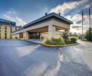
La Quinta Inn and Suites Baltimore South Glen Burnie
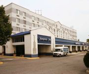
Hampton Inn Baltimore-Glen Burnie
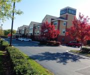
EXTENDED STAY AMERICA GLEN BUR
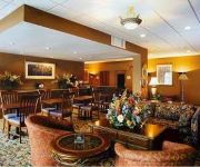
DAYS BALTIMORE SOUTH GLEN BURN
Videos from this area
These are videos related to the place based on their proximity to this place.
St Jane Frances Class of 2012 Entrance.... Pasadena, MD
St Jane Frances Class of 2012 Entrance... Pasadena, MD - Riviera Beach, MD.
434 Carvel Beach Road
For more details click here: http://www.visualtour.com/showvt.asp?t=2217039 434 Carvel Beach Road Curtis Bay, MD 21226 $545000, 4 bed, 2.0 bath, SF, MLS# AA7355770 Expansive water view...
Basic Oxygen Furnace - Controlled Demolition, Inc.
Controlled Demolition, Inc. (CDI) of Phoenix, Maryland, USA (acting as Explosives Subcontractor to Property Owners MCM Management Corp. Industrial Services of Bloomfield Hills, Michigan and...
Phantom Down!
Crash Footage - Not exactly a crash, but more of a gentle auto-landing into the forest canopy due to a faulty battery. Details of incident below: Last night I decided to head out for a relaxing...
Northeast High School #2
Just killing time doing a flight over Northeast High School in Pasadena, MD. Second flight just as twilight approaches. Her 38th flight.
New House on 8th Street
Last lot on 8th street is under construction. (7.5 years waiting to build!). The house to the right of new build (last house next to woods) was built over a year ago. Still unsold, but not...
AMJ Lawn & Landscaping - 2010 Boulder Retaining Wall and Waterfall
The homeowner asked to have a grand entrance for this new construction and chose natural stone boulders to create the retaining wall and steps from the upper property, plus added a waterfall...
Ezra the Electric Car Driver, age 4
Atalie Justice-Brown's first movie making effort, starring Ezra Brown and a friend. This was edited on Final Cut, for a class at the Corcoran. Ezra works on his electric car, takes a friend...
Videos provided by Youtube are under the copyright of their owners.
Attractions and noteworthy things
Distances are based on the centre of the city/town and sightseeing location. This list contains brief abstracts about monuments, holiday activities, national parcs, museums, organisations and more from the area as well as interesting facts about the region itself. Where available, you'll find the corresponding homepage. Otherwise the related wikipedia article.
Riviera Beach, Maryland
Riviera Beach is a census-designated place and a neighborhood within Pasadena, Maryland in Anne Arundel County, Maryland, United States. The population was 12,677 at the 2010 census. Locals to the area do not pronounce the name as it is spelled. Rather, it is pronounced as "revere-a", as in Paul Revere.
Francis Scott Key Bridge (Baltimore)
Not to be confused with the Francis Scott Key Bridge (Washington, D.C. ) The Francis Scott Key Bridge, also known as the Outer Harbor Bridge or simply the Key Bridge, is a continuous truss bridge spanning the Patapsco River in Baltimore, Maryland, USA. The main span of 1,200 feet is the third longest span of any continuous truss in the world. It is also the longest bridge in the Baltimore area.
Fort Carroll
Fort Carroll is a 3.4-acre artificial island and abandoned fort in the middle of the Patapsco River, just south of Baltimore, Maryland. It is named for Charles Carroll of Carrollton (1737-1832), a signer of the Declaration of Independence.
WWIN-FM
WWIN-FM is an urban adult contemporary radio station in Baltimore owned by Radio One. It is known as "Magic 95.9", playing a great variety of urban adult contemporary music from the 1960s to present. Its transmitter is located along I-695 in Hawkins Point near Curtis Bay.
Wagner's Point, Baltimore
Wagner's Point is an industrial area in Baltimore, Maryland. The name of the area comes from the Martin Wagner Company, which operated a beef packing plant there before the property was acquired by the Baltimore City government. The Martin Wagner plant was destroyed by a fire in 1913.
Chestnut Hill Cove, Maryland
Chestnut Hill Cove is an unincorporated community in Anne Arundel County, Maryland, United States. Designated as a "city" by the United States Postal Service, Chestnut Hill Cove is a waterfront community situated on 100 acres of land, in the Chesapeake Bay Watershed, containing 394 town homes. Located on Nabbs Creek in Chestnut Hill Cove Maryland, minutes from the Inner Harbor in Baltimore, the community offers a 30 slip marina, boat ramp facility, and a storage area.
Thoms Cove
Thoms Cove, the nickname for Thomas Cove, is a natural cove approximately 1,500 feet in diameter in Hawkins Point, Baltimore on the northeastern end of the peninsula with the tidal Patapsco River to the northeast, Curtis Bay to the northwest, Hawkins Point to the west and I-695 to the south. Thoms Cove is bordered by Eastalco Aluminum Company's loading and storage facility and a Superfund landfill.


