Safety Score: 3,0 of 5.0 based on data from 9 authorites. Meaning we advice caution when travelling to United Kingdom.
Travel warnings are updated daily. Source: Travel Warning United Kingdom. Last Update: 2024-05-05 08:24:42
Discover Pontnewydd
The district Pontnewydd of Cwmbran in Torfaen County Borough (Wales) is a district in United Kingdom about 125 mi west of London, the country's capital city.
Looking for a place to stay? we compiled a list of available hotels close to the map centre further down the page.
When in this area, you might want to pay a visit to some of the following locations: New Inn, Pontypool, Ponthir, Newport and Newbridge. To further explore this place, just scroll down and browse the available info.
Local weather forecast
Todays Local Weather Conditions & Forecast: 13°C / 55 °F
| Morning Temperature | 8°C / 47 °F |
| Evening Temperature | 11°C / 52 °F |
| Night Temperature | 8°C / 46 °F |
| Chance of rainfall | 2% |
| Air Humidity | 88% |
| Air Pressure | 1007 hPa |
| Wind Speed | Gentle Breeze with 7 km/h (5 mph) from North-West |
| Cloud Conditions | Broken clouds, covering 74% of sky |
| General Conditions | Light rain |
Monday, 6th of May 2024
14°C (58 °F)
10°C (51 °F)
Light rain, light breeze, broken clouds.
Tuesday, 7th of May 2024
14°C (56 °F)
12°C (54 °F)
Overcast clouds, light breeze.
Wednesday, 8th of May 2024
15°C (59 °F)
12°C (53 °F)
Overcast clouds, light breeze.
Hotels and Places to Stay
The Parkway
BW PONTYPOOL METRO HOTEL
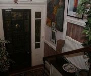
The Knoll Guesthouse
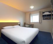
TRAVELODGE PONTYPOOL
Pontypool
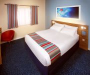
TRAVELODGE NEWPORT CENTRAL
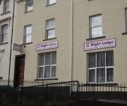
Night Lodge
Cwmbran
ibis budget Newport
Premier Inn Newport City Centre (Wales)
Videos from this area
These are videos related to the place based on their proximity to this place.
Tree Surgeon Cwmbran
Tree Surgeon Cwmbran http://treesurgeon-wales.co.uk Maindee Tree Services 75 Chepstow Road Newport Gwent NP19 8BY 01633 211611 Expert Tree Surgeon yet also an affordable tree surgeon...
Emerging from Cwmbran Tunnel on a narrowboat 2014-05-04.mp4
Pete driving narrowboat Falcon out of the North portal of Cwmbran Tunnel on the Monmouthshire Canal, 4-May-2014.
Chelsie Smallman Black Roses Star Hunters 2014 At The Congress Theatre Cwmbran
Star Hunters Grand Final 13th September 2014 The Congress Theatre Cwmbran. White House Media, The Town Crier Magazine, Cwmbran Tyres, Able Radio, The Andrew Hopkins Orchestra.
Oliver Cromwell Passes Through Cwmbran 27.04.12
The Famous Oliver Cromwell Passes Through Cwmbran on The 27th of April 2012. The Express Was Called The Great Britany.
Star Hunters 2014 Sponsored By Cwmbran Tyres & The Town Crier Magazine
The Finalists Torfaen Star Hunters 2014 Sponsored By Cwmbran Tyres & The Town Crier Magazine In Association with Able Radio & Randomz.
Solicitors Cwmbran
Solicitors Cwmbran. Newbold Solicitors 01633 874715 http://totalmediasolutionsuk.com/NewboldSolicitorsCwmbran cwmbran@newboldsolicitors.com Here at Newbold Solicitors Cwmbran, we strive...
Police Car Cutting A Learner Up in Cwmbran..
Police car didnt even slow down nor look at what was comming.
Wedding Photographer Cwmbran - Bellissimo Artemis Wedding Album by Dave Powell Photography
This is a shot video showing a sample Belissimo Artemis wedding album. The photographs are from the wedding of Amy and Daniel Hardy taken in the summer of 2013. The video was made in my ...
Videos provided by Youtube are under the copyright of their owners.
Attractions and noteworthy things
Distances are based on the centre of the city/town and sightseeing location. This list contains brief abstracts about monuments, holiday activities, national parcs, museums, organisations and more from the area as well as interesting facts about the region itself. Where available, you'll find the corresponding homepage. Otherwise the related wikipedia article.
Monmouthshire (historic)
Monmouthshire, also known as the County of Monmouth, is one of thirteen historic counties of Wales and a former administrative county. It corresponds approximately to the present principal areas of Monmouthshire, Blaenau Gwent, Torfaen, and Newport and those parts of Caerphilly and Cardiff east of the Rhymney River. The eastern part of the county is mainly agricultural, while the western valleys had rich mineral resources.
Diocese of Monmouth
The Diocese of Monmouth is a diocese of the Church in Wales. Despite the name, its cathedral is located not in Monmouth but in Newport — the Cathedral Church of St Woolos. Reasons for not choosing the title of Newport included the existence of a Catholic Bishop of Newport until 1916. This apparent anomaly arose in 1921 when the diocese was created (from the eastern part of the Diocese of Llandaff) with no location for the cathedral yet chosen.
Croesyceiliog
Croesyceiliog (English: Cockerel's Cross) is a suburb of Cwmbran in the county borough of Torfaen, south Wales, United Kingdom.
District of Monmouth
The Monmouth district was one of five districts of Gwent in Wales between 1974 and 1996. In 1988 the district was granted a charter conferring borough status, becoming the Borough of Monmouth (although this should not be confused with the historic municipal borough of Monmouth).
Two Locks
Two Locks is a suburb of Cwmbran in the county borough of Torfaen, in south-east Wales. The locks in question are part of the Monmouthshire & Brecon Canal in its southern section between Newport and Pontypool.
Greenmeadow
Greenmeadow is a suburb of Cwmbran in the county borough of Torfaen, within the historic county boundaries of Monmouthshire, southern Wales, United Kingdom. Greenmeadow Community Farm is a popular destination for families with small children. There are a wide range of domestic and farm animals for visitors to see, including cattle, sheep, goats, lambs and so on. In Spring the opportunity to get close to newborn animal is an excellent experience for youngsters.
St Dials
St Dials is a suburb of Cwmbran in the county borough of Torfaen, in south-east Wales. Nothing is known about the Saint after which the suburb is named. There was another chapel dedicated to him near Monmouth and belonging to Monmouth Priory. The ruins of a building 10 feet by 8 feet with walls four feet thick and traces of an arch on the north side existed on the site of the police training college. It is thought this was associated with Llantarnam Priory.
Cwmbran Stadium
Cwmbran Stadium is a multi-purpose stadium and sports complex in Cwmbran Wales. The stadium holds 10,500 people and the main outdoor arena consists of an international standard athletics track and field surrounding a grass football pitch. It is the home ground of Cwmbran Town F.C.. The complex has an outdoor floodlit artificial playing surface for football and hockey. Indoor facilities include a 25 metre swimming pool and one of the best indoor bowling facilities in Wales with 6 rinks .
Cwmynyscoy
Cwmynyscoy is a suburb of Pontypool town in the district of the County Borough of Torfaen, south east Wales.
Sebastopol, Torfaen
Sebastopol is the southernmost suburb of Pontypool in the county borough of Torfaen, within the historic boundaries of Monmouthshire in South Wales. It is named in honour of the Ukrainian city Sevastopol (also known as Sebastopol) that was taken during the Crimean War. It is a working-class area consisting of mainly privately owned terraced houses and a substantial number of local authority/ex-local authority housing (known as the Kemys Fawr Estate).
St Hilda's Church, Griffithstown
St Hilda's Church is the Church in Wales parish church of Griffithstown in Torfaen in south-east Wales. The church stands on the corner of Kemys Street and Sunnybank Road (formerly Church Road). It is dedicated to Saint Hilda, Abbess of Whitby and was built in 1888 in Early English style and consists of chancel, nave and southern porch. There is a vicarage, built later than the church itself, adjacent to the church on Sunnybank Road.
Cwmbran Shopping Centre
Cwmbran Shopping Centre is a shopping centre owned by Prudential in the town of Cwmbran, Torfaen. As a New Town the town centre was planned in a single Master Plan along with the surrounding residential neighbourhoods. It is the second largest shopping centre in Wales.
Boating Lake Park
The Boating Lake Park (officially called Crow Valley Central Recreation Grounds but this name is rarely used) is a large public park in Cwmbran, Torfaen in Wales. As its name suggests, the park features a boating lake. There are in fact two lakes, the larger being home to various wetland birds and the smaller being the actual boating one. Water area is 5 acres . The park is bordered by the Afon Llwyd on one side and a railway line on the other.
Griffithstown Railway Museum
Griffithstown Railway Museum was a railway memorabilia museum located in Griffithstown, Torfaen, South Wales. It was housed in a former Great Western Railway goods shed dating from 1879, adjacent to the former Panteg and Griffithstown railway station. Local railwayana collector Martin Fay owned and ran the museum. He purchased the former goods shed, which was in a derelict state, and following renovation opened the museum to the public in 2002.
Old Cwmbrân
Old Cwmbrân (Welsh: Hen Gwmbrân; also known as Cwmbrân Village) is an area of Cwmbrân, Torfaen in Wales, within the historic boundaries of Monmouthshire.
Thornhill, Torfaen
Thornhill is a large purple council estate on the western side of Cwmbran, Torfaen in Wales. It is adjacent to the suburbs of Greenmeadow and Upper Cwmbran. The estate is large and sprawling, built in the mid 1980's for the people of pill Newport to temporarily reside at as much of pill needed redevelopment. The residents liked the houses and never left . It is built around the original Thornhill farm house, which is still situated in the middle of the estate.
Pontymoile Basin
Pontymoile Basin is a mooring point and canal junction on the Monmouthshire & Brecon Canal.
Woodland Road Park
Woodland Road Park is situated at the end of Cwmbran's Central Recreation Grounds (referred to as the Boating Lake Park) in the district of Croesyceiliog, Torfaen in Wales. The park is made up of land previously owned by Croesyceiliog School and includes a large rugby pitch, a popular bowling green, tennis courts, outdoor swimming pool and adventure playground.
Panteg Steel Works
The Panteg Steel Works was situated in the village of Panteg, adjacent to Sebastopol, and Griffithstown, in the district of Torfaen, South Wales. The steel works was founded in 1873, and operated for over 130 years until its closure in 2004.
Lower Pontnewydd railway station
Lower Pontnewydd railway station was a railway station in the village of Pontnewydd in Torfaen, South Wales, UK, originally opened by the Pontypool, Caerleon and Newport Railway. The site was to the North of the overbridge on Station Road. It was closed to passengers in 1958, while the goods yard remained in use until 1965. The site is now partially used as a caravan storage business. The twin track line remains in use.
Cwmbran (GWR) railway station
The original Cwmbran railway station was a station in the old village of Cwmbran in Torfaen (now known as Old Cwmbran) in South Wales, UK. The site adjacent to Victoria Street is now a car park and a doctor's surgery. The station was built in 1878 by the Great Western Railway following the acquisition of the Monmouthshire Railway and Canal Company Eastern Valley line which continued southward from Cwmbran Junction alongside the canal to Newport.
Upper Pontnewydd railway station
Upper Pontnewydd railway station in Pontnewydd village, Cwmbran in Torfaen, South Wales, UK was built in 1859 as part of the Monmouthshire Railway and Canal Company Eastern Valley line from Newport to Blaenavon. The 2 platform station lay to the north of the Commercial Street road bridge, while the goods yard was to the south. Branch sidings served the Redbrook (Tynewydd) and Avondale tin plate works to the north east.
Pontrhydyrun Halt railway station
Pontrhydyrun Halt railway station in Pontrhydyrun village, Cwmbran in Torfaen, South Wales, UK was operated as part of the Newport and Pontypool Railway, opening in 1933 and closing in 1962. The 2 platform request halt lay along the current A4051 road, Cwmbran Drive, which largely follows the trackbed of the Monmouthshire Railway Eastern Valley line. There was a precursor station named Pontrydyrun (opened 1873 closed 1917), which was located 22 chains (400m) further north .
Sebastopol railway station
Sebastopol railway station in Sebastopol, Pontypool in Torfaen, South Wales, UK was built as part of the Newport and Pontypool Railway, opening in 1928 and closing in 1962. The island platform station lay to the south west of the extant Avondale Road overbridge, parallel to Railway Terrace. There are no remains of the station today, but the trackbed has been redeveloped into a cyclepath as part of National Cycle Route 46.
Panteg and Griffithstown railway station
Panteg and Griffithstown railway station in Griffithstown, Pontypool in Torfaen, South Wales, UK was built as part of the Newport and Pontypool Railway, opening in 1898 and closing in 1962. The platforms at the station were staggered and joined by a central footbridge. To the south was the goods shed, built in 18xx, and from 2002-2011 the home of the Griffithstown Railway Museum. The station was adjacent to the Panteg Steel Works, with sidings into the site.


