Safety Score: 3,0 of 5.0 based on data from 9 authorites. Meaning we advice caution when travelling to United Kingdom.
Travel warnings are updated daily. Source: Travel Warning United Kingdom. Last Update: 2024-05-06 08:04:52
Touring Layham
Layham in Suffolk (England) is a town located in United Kingdom about 59 mi (or 95 km) north-east of London, the country's capital place.
Time in Layham is now 07:32 AM (Tuesday). The local timezone is named Europe / London with an UTC offset of one hour. We know of 10 airports nearby Layham, of which 5 are larger airports. The closest airport in United Kingdom is Wethersfield Airport in a distance of 20 mi (or 32 km), West. Besides the airports, there are other travel options available (check left side).
There are several Unesco world heritage sites nearby. The closest heritage site in United Kingdom is Royal Botanic Gardens, Kew in a distance of 47 mi (or 76 km), South-West. Also, if you like the game of golf, there are several options within driving distance. We collected 1 points of interest near this location. Need some hints on where to stay? We compiled a list of available hotels close to the map centre further down the page.
Being here already, you might want to pay a visit to some of the following locations: Ipswich, Tiptree, Snetterton, Shropham and Southend-on-Sea. To further explore this place, just scroll down and browse the available info.
Local weather forecast
Todays Local Weather Conditions & Forecast: 16°C / 61 °F
| Morning Temperature | 8°C / 47 °F |
| Evening Temperature | 14°C / 58 °F |
| Night Temperature | 8°C / 47 °F |
| Chance of rainfall | 2% |
| Air Humidity | 64% |
| Air Pressure | 1021 hPa |
| Wind Speed | Gentle Breeze with 8 km/h (5 mph) from South |
| Cloud Conditions | Scattered clouds, covering 44% of sky |
| General Conditions | Light rain |
Wednesday, 8th of May 2024
15°C (59 °F)
10°C (50 °F)
Scattered clouds, gentle breeze.
Thursday, 9th of May 2024
18°C (64 °F)
12°C (54 °F)
Light rain, light breeze, broken clouds.
Friday, 10th of May 2024
17°C (63 °F)
13°C (55 °F)
Overcast clouds, light breeze.
Hotels and Places to Stay
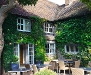
Angel Inn
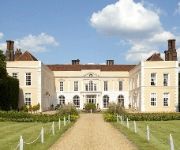
Hintlesham Hall
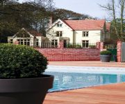
MAISON TALBOOTH
Holiday Inn Express COLCHESTER
Videos from this area
These are videos related to the place based on their proximity to this place.
Paintball UK: Gunsmoke Paintball: 2012 August
Hello! Welcome to our channel and also out first video! We're a mixture of friends and family who love paintball! We've been playing for many many years! Although we aren't an official...
Celotex Corporate Video
A Celotex corporate video showcasing the manufacturing and operational facilities as well as the added features and benefits of using Celotex insulation.
Celotex timelapse
A time-lapse video showing the construction of the new Celotex Innovation and Distribution Centre.
'The God Question' by Graham Lancaster - 17th August 2014 PM
Sunday sermon from Hadleigh Baptist Church in Suffolk.
game maker tutorial: drag and drop objects
This just shows how I found out how to make drag and drop objects. There is probably a better, easier way, so if you want you can post a video response. the songs were The importance of being...
Japan Visit, with OMF - Tom Messenger
Tom Messenger speaking about his potential visit to Japan this summer (2014). He is hoping to go with OMF International, a Christian mission agency.
'Between the Devil & the Deep Blue Sea' (Exodus 14 & 15) by Pastor Chris Todd - 7th June 2014 PM
A Sunday service from Hadleigh Baptist Church in Suffolk.
Videos provided by Youtube are under the copyright of their owners.
Attractions and noteworthy things
Distances are based on the centre of the city/town and sightseeing location. This list contains brief abstracts about monuments, holiday activities, national parcs, museums, organisations and more from the area as well as interesting facts about the region itself. Where available, you'll find the corresponding homepage. Otherwise the related wikipedia article.
Babergh
Babergh is a local government district in Suffolk, England. Its council headquarters is based in Hadleigh, whilst its largest town is Sudbury. The district was formed on 1 April 1974 by the merger of the Borough of Sudbury, Hadleigh urban district, Cosford Rural District, Melford Rural District and Samford Rural District. It is one of the few English second tier authorities that has never had one party or coalition of parties in control.
Hadleigh United F.C
Hadleigh United F.C. are an English football club based in Hadleigh, Suffolk. The club are currently members of the Eastern Counties League Premier Division, and play at the Millfield.
East Anglian School of Painting and Drawing
The East Anglian School of Painting and Drawing was an art learning environment established by Cedric Morris and Arthur Lett-Haines in East Anglia in 1937. It was run on very idiosyncratic lines based upon the "free rein" approach that was then current in French academies. It had a great influence on many Suffolk artists and made an important contribution to art teaching in the east of England for forty years.
Raydon Wood railway station
Raydon Wood railway station was a station in Suffolk, on a short branch line from Bentley Junction to Hadleigh. There was a goods shed on a passing loop which included a small siding on the south side of the station at the Bentley end. Together with Capel it was extensively used for handling supplies in World War II for a nearby United States Army Air Forces base, later known as RAF Raydon.


