Safety Score: 3,0 of 5.0 based on data from 9 authorites. Meaning we advice caution when travelling to United Kingdom.
Travel warnings are updated daily. Source: Travel Warning United Kingdom. Last Update: 2024-04-29 08:03:39
Delve into Elmswell
Elmswell in Suffolk (England) with it's 3,950 habitants is a town located in United Kingdom about 67 mi (or 108 km) north-east of London, the country's capital town.
Time in Elmswell is now 10:19 PM (Monday). The local timezone is named Europe / London with an UTC offset of one hour. We know of 8 airports closer to Elmswell, of which 5 are larger airports. The closest airport in United Kingdom is RAF Honington in a distance of 9 mi (or 15 km), North-West. Besides the airports, there are other travel options available (check left side).
There are several Unesco world heritage sites nearby. The closest heritage site in United Kingdom is Royal Botanic Gardens, Kew in a distance of 58 mi (or 94 km), South-West. Also, if you like the game of golf, there are some options within driving distance. We saw 1 points of interest near this location. In need of a room? We compiled a list of available hotels close to the map centre further down the page.
Since you are here already, you might want to pay a visit to some of the following locations: Snetterton, Shropham, Ipswich, Tiptree and Norwich. To further explore this place, just scroll down and browse the available info.
Local weather forecast
Todays Local Weather Conditions & Forecast: 15°C / 58 °F
| Morning Temperature | 4°C / 39 °F |
| Evening Temperature | 13°C / 55 °F |
| Night Temperature | 7°C / 45 °F |
| Chance of rainfall | 0% |
| Air Humidity | 61% |
| Air Pressure | 1015 hPa |
| Wind Speed | Fresh Breeze with 13 km/h (8 mph) from North |
| Cloud Conditions | Scattered clouds, covering 40% of sky |
| General Conditions | Scattered clouds |
Tuesday, 30th of April 2024
12°C (54 °F)
11°C (51 °F)
Light rain, moderate breeze, overcast clouds.
Wednesday, 1st of May 2024
16°C (62 °F)
10°C (49 °F)
Light rain, moderate breeze, overcast clouds.
Thursday, 2nd of May 2024
16°C (61 °F)
12°C (53 °F)
Light rain, moderate breeze, overcast clouds.
Hotels and Places to Stay
Ixworth House
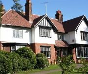
Drinkstone Park Bed & Breakfast and Gardens
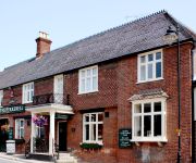
The Pykkerell Inn
TRAVELODGE IPSWICH STOWMARKET
Videos from this area
These are videos related to the place based on their proximity to this place.
Beyton Parish Council call the police and still try to resist filming
Beyton Parish Council still do not want to allow the public to film their meetings. They felt it necessary to call the police. Go to www.beytongeese.com for more information. Please forward...
Smith Family Day Out At Little Orchard Railway
Smith Family Day Out At Little Orchard Railway 16/05/2009.
Lister CD Diesel Engine
Lister CD diesel engine filmed at the 2009 Woolpit Steam Rally. The Woolpit Steam Rally has a good number of Stationary Engines and is a must for all local engine enthusiasts.
Tuffa Boots European Factory - cleaning soles
Tuffa Footwear Limited proudly manufacture all our leather boots in Europe. Watch the various processes on our boots including Tuffa Suffolk Boots and Tuffa Fjord Boots.
Trail Toilet (Part 1) - Trail Toilet Roll
This series discusses a topic seldom discussed publicly: how to go to the toilet when on the trail (I.E. the great outdoors) This video shows how to prepare toilet paper so that it can be quickly...
GSXR 750 day out
Quick run through with my 720p W150 bullet cam mounted on fairing external mike under solo pod cover.
Cornering - Left-hand, right-hand, combinations and twisty roads
Cornering on sunny Suffolk roads on my Honda ST1300 Pan-European to show basic then flexible positioning for bends, all based on the available view and the limit/vanishing point plus any hazards....
Shooting in the garden Suffolk UK
Kirsten ! https://www.youtube.com/user/KirstenJoyWeiss Polenar ! https://www.youtube.com/user/PolenarTactical Srspower ! https://www.youtube.com/user/srspower English Shooting ...
The Art of setting Boulder Problems
New Bouldering sett - Ready The Cragg Climbing Wall - in Stowmarket Leisure Centre August 2014.
Videos provided by Youtube are under the copyright of their owners.
Attractions and noteworthy things
Distances are based on the centre of the city/town and sightseeing location. This list contains brief abstracts about monuments, holiday activities, national parcs, museums, organisations and more from the area as well as interesting facts about the region itself. Where available, you'll find the corresponding homepage. Otherwise the related wikipedia article.
Bury St Edmunds (UK Parliament constituency)
Bury St Edmunds is a county constituency located in Suffolk and centred on the town of Bury St Edmunds. It elects one Member of Parliament (MP) to in the House of Commons of the Parliament of the United Kingdom. It has elected Conservative MPs for over a century, although Labour came close to gaining the seat in 1997.
Thedwastre Rural District
Thedwastre was a rural district in West Suffolk, England from 1894 to 1974. It was formed under the Local Government Act 1894, from the part of the Stow Rural Sanitary District which was in West Suffolk. It was named after the historic hundred of Thedwastre. The district was abolished in 1974, under the Local Government Act 1972, and went to form part of the Mid Suffolk district in Suffolk.
Elmswell railway station
Elmswell serves the village of Elmswell in Suffolk, England. The station, and all trains serving it, are operated by Greater Anglia. With the introduction of regular hourly services, passenger usage has increased by more than 100% from 2005 to date (see SRA figures right). According to the Official Handbook of Stations the following classes of traffic were being handled at this station in 1956: G, P, F, H, C and there was a 6 ton crane. Beer & Sons and St Edmundsbury Co-op had private sidings.
RAF Great Ashfield
RAF Great Ashfield was a World War II airfield in England. It is located 10 miles east of Bury St. Edmunds and two miles south of Great Ashfield village in Suffolk. Great Ashfield Airfield is still in private use although much reduced in size. It was originally a Royal Flying Corps grass landing strip on this site in World War I, and before the USAF arrived the RAF had been using it for training, during that period it was known as RAF Elmswell.


